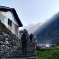
Annapurna Base Camp Trek is among the top trekking adventures in Nepal. It attracts adventure lovers worldwide who savor its picturesque landscapes and rich cultural heritage. This trekking experience enables you to see the extraordinary range of Annapurna more clearly while exposing you to life at the foothills of the Himalayas. Anyone on this trek should carry an “Annapurna Base Camp Trek Map” to ensure a well-directed and safe trek.
Importance of Having a Detailed Trek Map
- Navigation: A detailed trek map is your essential tool for navigating the complex pathways of the Annapurna Region. It marks trails, checkpoints, and distances, helping to prevent getting lost and ensuring you remain on the intended path.
- Safety: The map outlines essential details like hazardous areas, steep descents, and emergency exits. These elements can significantly increase your safety, particularly when facing bad weather or unforeseen diversions.
- Planning Stops: The map displays the locations of guesthouses, rest areas, and potential camping sites, enabling trekkers to plan their daily halts effectively. This planning is crucial for managing time and energy on the demanding trek.
- Cultural Engagement: A comprehensive trek map points out cultural sites such as temples, monasteries, and traditional villages. Exploring these places enriches your trek by deepening your understanding of local customs and heritage.
- Environmental Awareness: Utilizing a trek map allows you to recognize environmentally sensitive areas along your route, where you must follow specific guidelines to minimize ecological impact. It supports sustainable trekking practices.
- Emergency Preparedness: In emergencies, a detailed map will guide you to the closest assistance centers, contact points, and safer areas where you can seek help immediately.

Detailed Description of the Annapurna Base Camp Trek Map
A detailed map is essential for planning a successful and safe trek to Annapurna Base Camp. The Annapurna Base Camp Trek Map provides crucial insights into the terrain, helping trekkers navigate the complex network of trails. Below is a comprehensive breakdown of what this map offers, ensuring you are well-prepared for the adventure.
High-Resolution Images of the Annapurna Base Camp Trek Map
A clear, high-resolution Annapurna Base Camp Trek Map is your visual guide to the entire trek. It outlines the main paths, alternative routes, and significant landmarks. Studying these images lets you familiarize yourself with the trail’s layout before you begin. The map highlights trek sections, marking critical points such as base camps, teahouses, and rest stops. This visual tool lets you plan your trek daily, ensuring you know what to expect at each stage.
Step-by-Step Breakdown of the Main Routes and Alternative Paths
The Annapurna Base Camp Trek Route is one of the most iconic paths in the Himalayas, and the map details the primary route along with alternative paths. Here’s a breakdown to help you understand the layout:
- Starting Point (Nayapul): Most treks begin at Nayapul, and the map will guide you through the initial stages, passing through villages like Birethanti and Tikhedhunga.
- Ascend to Ghorepani: The trek continues with a climb to Ghorepani, one of the most scenic spots on the route. The map marks key checkpoints along this segment, ensuring you stay on track.
- Ghorepani to Poon Hill: An early morning hike to Poon Hill is a highlight, and the map outlines this detour clearly. This section is trendy for sunrise views.
- Descend to Tadapani: After Poon Hill, the route descends to Tadapani. The Annapurna Base Camp Route Map shows various trails leading to Tadapani, allowing flexibility in your trek.
- Trek to Chomrong: From Tadapani, the trek continues to Chomrong, a crucial junction. The map helps you navigate this area, marking important rest points and viewpoints.
- Chomrong to Bamboo and Dovan: As you head deeper into the Annapurna Sanctuary, the map guides you through Bamboo and Dovan, with detailed notes on the terrain and altitude changes.
- Machhapuchhre Base Camp (MBC): Before reaching Annapurna Base Camp, trekkers often stop at Machhapuchhre Base Camp. The map marks this area, helping you plan an overnight stay if needed.
- Final Ascent to Annapurna Base Camp: The last leg of the trek takes you to Annapurna Base Camp. The Annapurna Base Camp Route Map provides detailed information on this ascent, including potential hazards and the best routes.
- Alternative Paths: The map also shows alternative routes for those looking to explore more, such as the path through Jhinu Danda, known for its hot springs, and the less-traveled route through Ghandruk.


Key Features on the Annapurna Base Camp Trek Map
The Annapurna Base Camp Trek map is an invaluable tool for trekkers navigating one of Nepal’s most beautiful trekking routes. This detailed map not only directs you through paths but also highlights crucial features of the landscape. Understanding these key features will enhance your trekking experience and ensure you appreciate every aspect of your adventure. Here’s an in-depth look at the essential features displayed on the map.
Identification of Key Landmarks
- Major Peaks: The map highlights all significant peaks on the trek, including Annapurna South, Machhapuchhre (Fishtail), and Hiunchuli. Knowing these peaks helps trekkers orient themselves and gauge their progress.
- Rivers and Valleys: Streams and rivers, such as the Modi Khola, are clearly marked. The map also details the deep valleys that carve the terrain, providing a dramatic and picturesque scenic backdrop.
- Forests and Conservation Areas: The map identifies dense forest areas and the boundaries of the Annapurna Conservation Area, providing insights into the region’s biodiversity and protected zones.
Locations of Campsites, Teahouses, and Rest Points
- Campsites: For those preferring to camp, the map shows designated camping areas along the route where trekkers can set up tents safely.
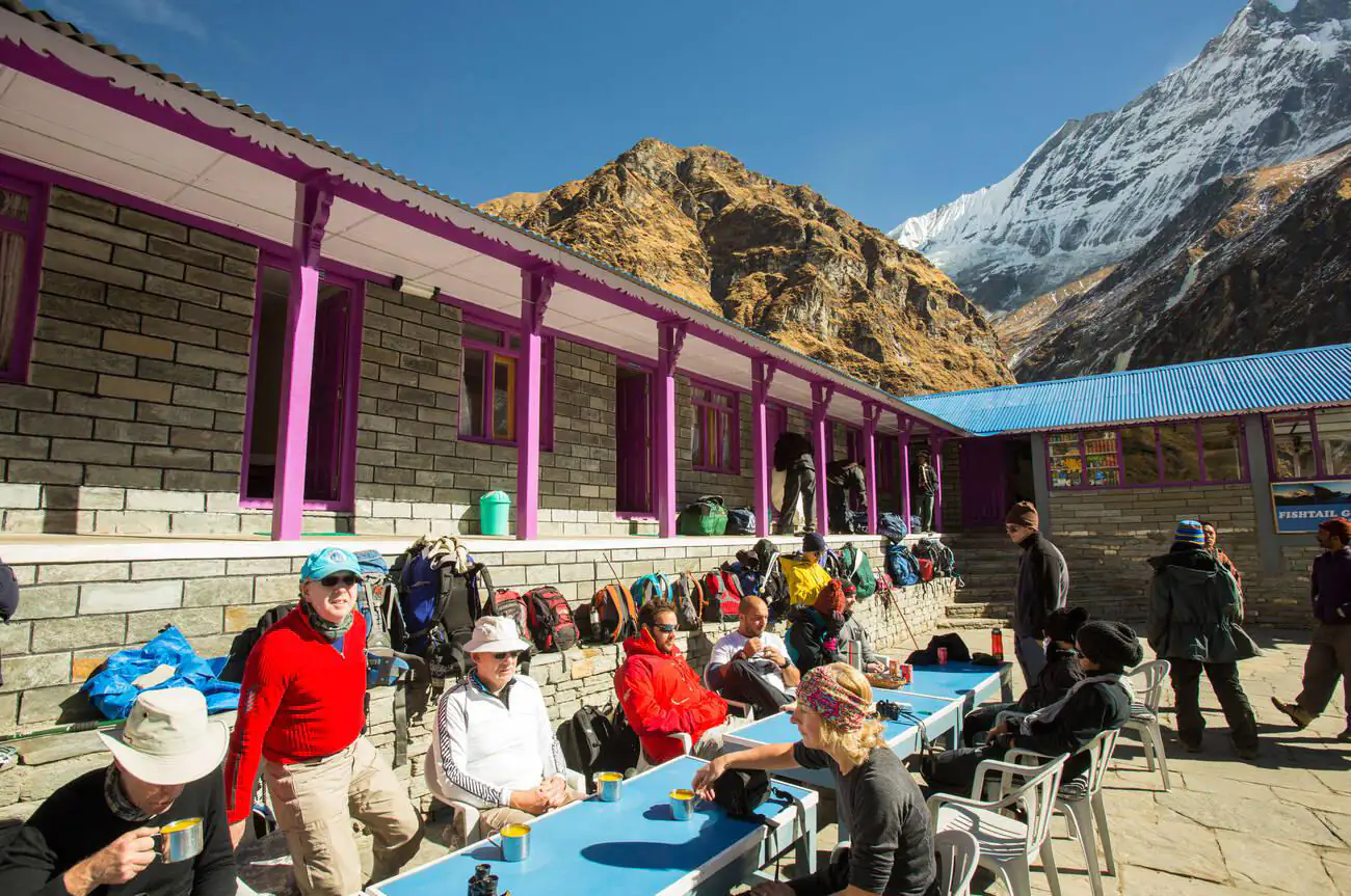
- Teahouses: The locations of teahouses are crucial for planning overnight stays. The map details these, helping trekkers decide how far they wish to trek each day.
- Rest Points: Strategic rest points, such as cafes and small local shops, are marked for trekkers to stop, refresh, and interact with locals.
Indication of Altitude Changes at Various Stages of the Trek
- Altitude Markers: The map displays altitude at various points along the trek, which is crucial for acclimatization planning. This feature helps trekkers manage altitude sickness and plan their ascents to adapt comfortably.
- Steep Sections: Areas with significant altitude changes over short distances are highlighted. This information is vital for preparing physically and mentally for challenging sections of the trek.
- Gradual vs. Steep Ascents: The map differentiates between gradual ascents and steep climbs, allowing trekkers to pace themselves, especially on more strenuous path segments.
Navigational Tools and Tips for the Annapurna Base Camp Trek
Navigating through the Annapurna Base Camp can be a thrilling yet challenging adventure. Equipped with the Annapurna Base Camp Trek Map and the right tools, you can enhance your trekking experience. This section provides essential tips and advice on utilizing various navigational aids effectively throughout your trek. Incorporating these strategies ensures you remain on the right path and enjoy the trek through one of Nepal’s most stunning trekking routes.
How to Read the Annapurna Base Camp Trek Map Effectively
- Understanding Symbols and Legends: Familiarize yourself with the symbols, scale, and legends used on the map. These indicate various types of terrain, paths, water bodies, and more, which are crucial for anticipating what lies ahead.
- Route Planning: Before each day’s trek, review the route you plan to take. Note the estimated distances between points and any significant landmarks you will pass, which will help you gauge your progress throughout the day.
- Cross-Referencing with Physical Landmarks: As you trek, compare your physical surroundings with what you see on the map. This practice helps you verify your current location and make necessary adjustments if you drift off course.
GPS Coordinates for Crucial Points
- Pre-loaded GPS Coordinates: If available, load the GPS coordinates of crucial points along the trek into your device before you start. These points can include campsites, divergence paths, and emergency exit routes.
- Real-Time Tracking: Use a GPS device to track your real-time location against the map. This tool is invaluable in areas where the trail might need to be more defined.
Mobile Apps and Devices That Support Navigation
- Recommended Apps: Install trekking apps designed for the Himalayas. Apps such as “Maps. me” and Gaia GPS provide offline maps, which can be crucial in areas lacking mobile network coverage.
- Using Smart Devices: Ensure your mobile phone or GPS device has a reliable protective case and extra power banks. Cold temperatures can quickly deplete battery life, making it essential to keep your devices warm and fully charged.
- Backup Paper Map: Despite technological advances, we advise carrying a physical copy of the Annapurna Base Camp Trek Map. Devices can fail due to weather or accidental damage, and a paper map provides a fail-safe.
Safety and Preparation for the Annapurna Base Camp Trek
Planning your trek to Annapurna Base Camp requires you to prioritize safety as much as your route. The Annapurna Base Camp Trek Map is essential, offering crucial details that prepare you to face various challenges during your trek.
Understanding Hazard Zones
- Avalanche-Prone Areas: The map explicitly identifies areas vulnerable to avalanches. Before you trek, especially during winter or early spring, familiarize yourself with these zones. Aim to traverse these areas in the early morning when temperatures remain low, and the snow is stable, reducing risk.
- Weather Changes: Rapid weather changes are typical in the Himalayas. The Annapurna Base Camp Trek Route map identifies areas at higher risk of sudden weather shifts. Monitor the weather forecast regularly, and be ready to alter your plans or find shelter if the weather turns bad.
Tips for Emergency Situations
- Evacuation Points: Familiarize yourself with the nearest evacuation points along the trek. The Annapurna Base Camp Route Map marks these crucial locations as vital in emergencies like medical issues or natural disasters.
- Emergency Contacts: You need to keep copies of emergency contacts with local authorities, your trekking agency, and medical centers in the area. Store this on your phone and have an extra hard copy.
- First Aid and Survival Gear: Ensure you carry a comprehensive first aid kit and understand basic first aid procedures. Also, pack essential survival items like a whistle, flashlight, extra food, and water.
- Travel Insurance: Secure travel insurance that covers high-altitude trekking and emergency evacuation. Verify that your policy provides comprehensive coverage throughout your trek.
- Local Guides: Employ a local guide who knows the Annapurna Base Camp Trek Route well. Their expertise in navigating the terrain, understanding weather patterns, and managing emergencies can significantly enhance your safety.

Trekker’s Resources on the Annapurna Base Camp Trek
Setting out on a trek to Annapurna Base Camp becomes more rewarding with access to essential resources. The Annapurna Base Camp Trek map provides crucial information about the facilities and services available along your trek. Here are the details you need to know:
Information Centers, Guide Hiring Spots, and Checkpoint Locations
- Information Centers: Located strategically along the Annapurna Base Camp Trek Route, these centers offer updates on trek conditions, weather forecasts, and potential hazards. They play a vital role in helping you adjust your trekking itinerary as needed.
- Guide Hiring Spots: The map indicates locations to hire knowledgeable local guides, especially recommended for first-time trekkers or those unfamiliar with the region. These guides possess extensive knowledge of the Annapurna Base Camp Route Map and can assist in navigating challenging parts of the trek.
- Checkpoint Locations: The trek includes several checkpoints that monitor permits and ensure trekkers’ safety. The Annapurna Base Camp Trek map marks these spots clearly, helping you prepare to show your permits and get the latest updates from the authorities.
Availability of Food, Water, and Medical Supplies
- Food: Teahouses and lodges along the trek offer a variety of meals and snacks. The Annapurna Base Camp Route map identifies these locations, enabling you to plan where to stop for food. These establishments typically serve traditional Nepali cuisine and some international options, catering to diverse palates.
- Water: Clean drinking water is crucial. The map shows reliable water points, such as natural springs and bottled water vendors. You should carry water purification tablets or a portable filter as it may only sometimes be safe to drink directly from natural sources.
- Medical Supplies: You can find basic medical supplies at certain teahouses and shops along the route. The Annapurna Base Camp Trek Map indicates where these are available, allowing you to replenish first aid essentials like bandages, antiseptics, and altitude sickness medicine. Nonetheless, packing your first aid kit is advised for emergencies.
Cultural Sites and Attractions
The Annapurna Base Camp trek offers more than breathtaking scenery; it provides a deep dive into the region’s rich cultural heritage. The Annapurna Base Camp Trek map details various culturally significant sites that enrich your trekking experience.
Culturally Significant Sites Along the Trek
- Temples and Monasteries: These sacred sites, marked on the map, are pivotal to the local communities. They offer a glimpse into the region’s spiritual practices, and visiting them connects you with the local culture and traditions.
- Sacred Mountains: Not only are the Annapurna and Machhapuchhre peaks visually spectacular, but they also hold great spiritual significance. The Annapurna Base Camp Route Map notes these mountains, highlighting their sacred status to the local communities.
Insights into Local Villages and Their Cultural Importance
- Ghandruk Village: The map highlights Ghandruk, which is known for its rich Gurung culture. Planning a stop here allows you to soak in the local hospitality, enjoy traditional dances, and admire the unique architectural styles.
- Chomrong Village: This village is a critical gateway to the Annapurna Sanctuary and a crucial feature on the map. Visiting Chomrong offers a window into the everyday lives of the locals, providing insights into their customs and agricultural practices.
Capturing the Beauty: Photography and Scenic Spots on the Annapurna Base Camp Trek
Setting out on the Annapurna Base Camp trek offers more than just a hiking adventure; it’s a photographer’s paradise. The Annapurna Base Camp Trek Map highlights several spots where you can capture the majestic beauty of the Himalayas. Here’s a guide to making the most of these photographic opportunities.
Recommended Spots for the Best Photography
- Poon Hill: Renowned for its panoramic sunrise views over the Annapurna and Dhaulagiri ranges, Poon Hill is a must-visit spot for photographers. The Annapurna Base Camp Trek Route leads you here early in the trek, providing an unforgettable opportunity to capture the golden hues of dawn breaking over the snowy peaks.
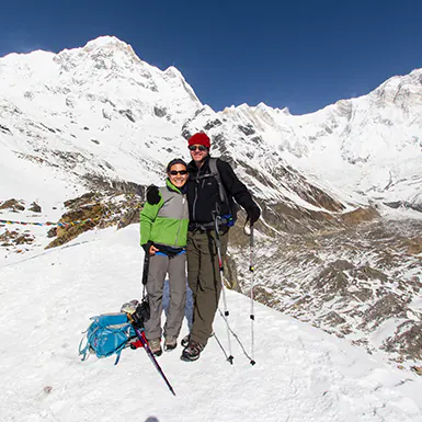
- Annapurna Base Camp: The trek’s culmination offers dramatic views of the Annapurna massif. The base camp area, marked on the Annapurna Base Camp Route Map, allows for spectacular shots of the surrounding glaciers and peaks.
- Machhapuchhre Base Camp: Another excellent location for photographers is the Machhapuchhre Base Camp. This spot offers close-up views of the fishtail-shaped Machhapuchhre peak, a sacred mountain that is beautifully symmetric and highly photogenic.
Scenic Viewpoints Marked on the Map
The map also marks lesser-known but equally stunning viewpoints:
- Jhinu Danda: It offers lush landscapes and is famous for its hot springs, which are the perfect spot for relaxing photos.
- Deurali: Higher up along the trail, Deurali presents broad vistas of the valley below, ideal for wide-angle shots.

Staying Updated: Recent Changes and Updates on the Annapurna Base Camp Trek
The trekking route to Annapurna Base Camp is dynamic, with occasional changes that can affect your travel plans. Staying informed about these updates is crucial for a safe and enjoyable trek.
Recent Changes to the Trek Route or New Facilities
- New Teahouses: Recent expansions have introduced new teahouses along sections of the trail, particularly between Chomrong and Dovan. These facilities provide additional comfort and options for trekkers needing rest or refreshments.
- Route Alterations: Landslides and natural wear have led to minor alterations in the trail, especially around Sinuwa. Updates to the Annapurna Base Camp Trek Map reflect these changes, ensuring trekkers follow the safest and most scenic paths.
Updates on Trail Conditions or Construction
- Trail Maintenance: Ongoing maintenance work, particularly in the pre-monsoon season, can temporarily disrupt the usual trek routes. The latest versions of the trek map typically note such updates.
- Weather-related Advisories: Seasonal weather changes can significantly impact trail conditions. Updated maps and local guide advisories provide crucial information on what to expect and how to prepare for current trek conditions.
Conclusion: Maximizing Your Annapurna Base Camp Trek Experience
Successfully navigating the Annapurna Base Camp requires more than just stamina and determination; it requires reliable guidance. The “Annapurna Base Camp Trek Map” is indispensable for anyone planning this iconic trek. Integrating this detailed map into your preparations ensures a well-informed and secure trek through one of the world’s most breathtaking landscapes.
The Importance of Using the Annapurna Base Camp Trek Map
The Annapurna Base Camp Trek Map is not merely a navigational tool; your companion guides you through varying terrains, ensuring you stay within the safest and most scenic paths. This map provides:
- Detailed Routes: The map shows the main paths and alternative routes, helping you plan daily itineraries effectively.
- Landmark Highlights: Indicating essential landmarks, water sources, and rest stops.
- Safety Features: Outlining high-risk areas, such as avalanche-prone zones and sudden weather change hotspots.
Encouragement to Respect Local Guidelines and Environmental Practices
While the Annapurna Base Camp Trek Map helps with physical navigation, it also fosters respect for the local environment and communities. As trekkers, it is our responsibility to:
- Follow Local Guidelines: Adhere to the rules set by local authorities to preserve the integrity of the trail and its natural surroundings.
- Practice Environmental Stewardship: Follow Leave No Trace to protect the environment.
- Support Local Economies: Engage with local businesses and services, which will enrich your cultural experience and contribute to the economic sustainability of the communities along the trek.
[contact-form-7 id=”bec8616″ title=”Inquiry From – Blog”]