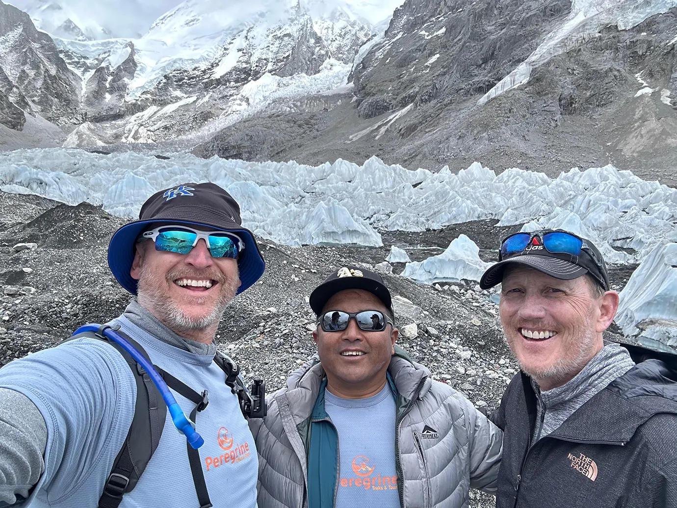
Based on 9 reviews

Gokyo Cho La Pass Trek
Explore Mount Everest and Gokyo Lakes with Sherpa Guide
Duration
17 Days
Meals
- 14 Dinners
- 13 Lunches
- 16 Breakfasts
Accommodation
- 03 nights hotel
- 13 nights eco-lodge
Activities
- Trek to EBC & Gokyo
- Scenic Flight
- Sightseeing
SAVE
US$ 410Price Starts From
US$ 2050
Overview of Gokyo Cho La Pass Trek
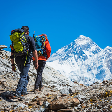
The Gokyo Cho La Pass Trek covers approximately 160 kilometers across 17 days through the Khumbu Valley. It is the most complete route through the Everest region — the only standard itinerary that combines the turquoise Gokyo Lakes, a sunrise summit of Gokyo Ri (5,357m), a glacier crossing of Cho La Pass (5,368m), Everest Base Camp (5,364m), and the Kala Patthar sunrise viewpoint (5,545m) in a single continuous circuit. Also known as the Everest Circuit Trek, this route ascends through the quieter Gokyo Valley and descends via the classic EBC trail — or vice versa — without retracing the middle section.
The trek begins with a flight to Lukla and follows the Dudh Koshi River to Namche Bazaar. From there, the trail diverges from the standard EBC route. Instead of heading to Tengboche, you turn left at Sanasa and climb through the Gokyo Valley — a quieter, less-trafficked corridor where yak caravans outnumber trekkers and wildlife sightings are more common. You pass through Dole, Machhermo, and along the edge of the Ngozumpa Glacier — the longest glacier in the Himalayas at 36 kilometers — before reaching Gokyo village on the shore of the third lake.
From the summit of Gokyo Ri, you see four of the world’s five highest mountains in one panorama: Everest (8,849m), Lhotse (8,516m), Makalu (8,485m), and Cho Oyu (8,188m). The Gokyo Lakes — a Ramsar Wetland site and the highest freshwater lake system in the world — stretch out below in shades of turquoise that shift with the light. No viewpoint on the standard EBC route offers this combination.
After Gokyo, you cross the Cho La Pass (5,368m), the technical highlight of the trek. This glacier crossing requires crampons, an experienced guide, and clear weather. The pass connects the Gokyo Valley to the Khumbu Valley, bringing you to Dzongla and then Lobuche. From here, the route joins the classic EBC trail to Gorakshep, Everest Base Camp, and the pre-dawn climb of Kala Patthar — the closest non-technical view of Everest’s summit pyramid.
This is the trek for experienced hikers who want everything the Khumbu has to offer in one journey. It is harder and longer than the standard EBC Trek, but it rewards the effort with landscapes, lakes, and perspectives that the main Everest trail simply cannot match.
Quick Facts
- Duration: 17 days (Kathmandu to Kathmandu), 13 trekking days + 2 summit/acclimatization days + 1 pass crossing day
- Trip style: Private departure — you choose your start date
- Total trekking distance: Approximately 160 km
- Highest point: Kala Patthar at 5,545m (18,192 ft)
- Key passes and summits: Cho La Pass (5,368m), Gokyo Ri (5,357m), Kala Patthar (5,545m)
- Difficulty: Challenging — requires good fitness, altitude experience recommended, crampons needed for Cho La
- Acclimatization days: 1 dedicated day in Namche Bazaar (additional acclimatization built into the gradual Gokyo Valley ascent)
- Best seasons: Spring (March–May) and Autumn (September–November)
- Price: US$ 2,050 per person (includes all permits, meals, accommodation, flights, and equipment loans)
Every booking includes airport transfers, accommodation at The Everest Hotel in Kathmandu with breakfast, the Kathmandu–Lukla flight, all Sagarmatha National Park and Khumbu Rural Municipality permits, TIMS documentation, three meals daily on the trek, an experienced guide and porters at a 2:1 ratio, loaner down jacket and sleeping bag, a comprehensive first-aid kit with pulse oximeter, crampon rental if needed for Cho La Pass, a Peregrine duffle bag, trekking map, t-shirt, and a completion certificate. A farewell dinner in Kathmandu is included on your final evening.
Gokyo Cho La Pass Trek Highlights
- Trek 160 km through the Khumbu Valley — the most complete Everest region route combining Gokyo Lakes, Cho La Pass, and Everest Base Camp in a single circuit
- Summit Gokyo Ri (5,357m) at sunrise and see four of the world’s five highest peaks in one panorama — Everest, Lhotse, Makalu, and Cho Oyu
- Cross Cho La Pass (5,368m), a glacier crossing requiring crampons and guided passage — the technical highlight of the trek
- Reach Everest Base Camp (5,364m) and climb Kala Patthar (5,545m) for the definitive sunrise view of Everest’s summit
- Walk alongside the Ngozumpa Glacier (36 km), the longest glacier in the Himalayas, and visit the turquoise Gokyo Lakes — the highest freshwater lake system in the world
- Trek through Sagarmatha National Park and experience Sherpa culture in traditional villages, monasteries, and centuries-old gompas along both the Gokyo and EBC trails
- Private departure on your chosen date with an experienced guide, porters, all permits, equipment loans, and meals included
Detail Itinerary of Gokyo Cho La Pass Trek
Day 01: Arrival in Kathmandu (1,400m)
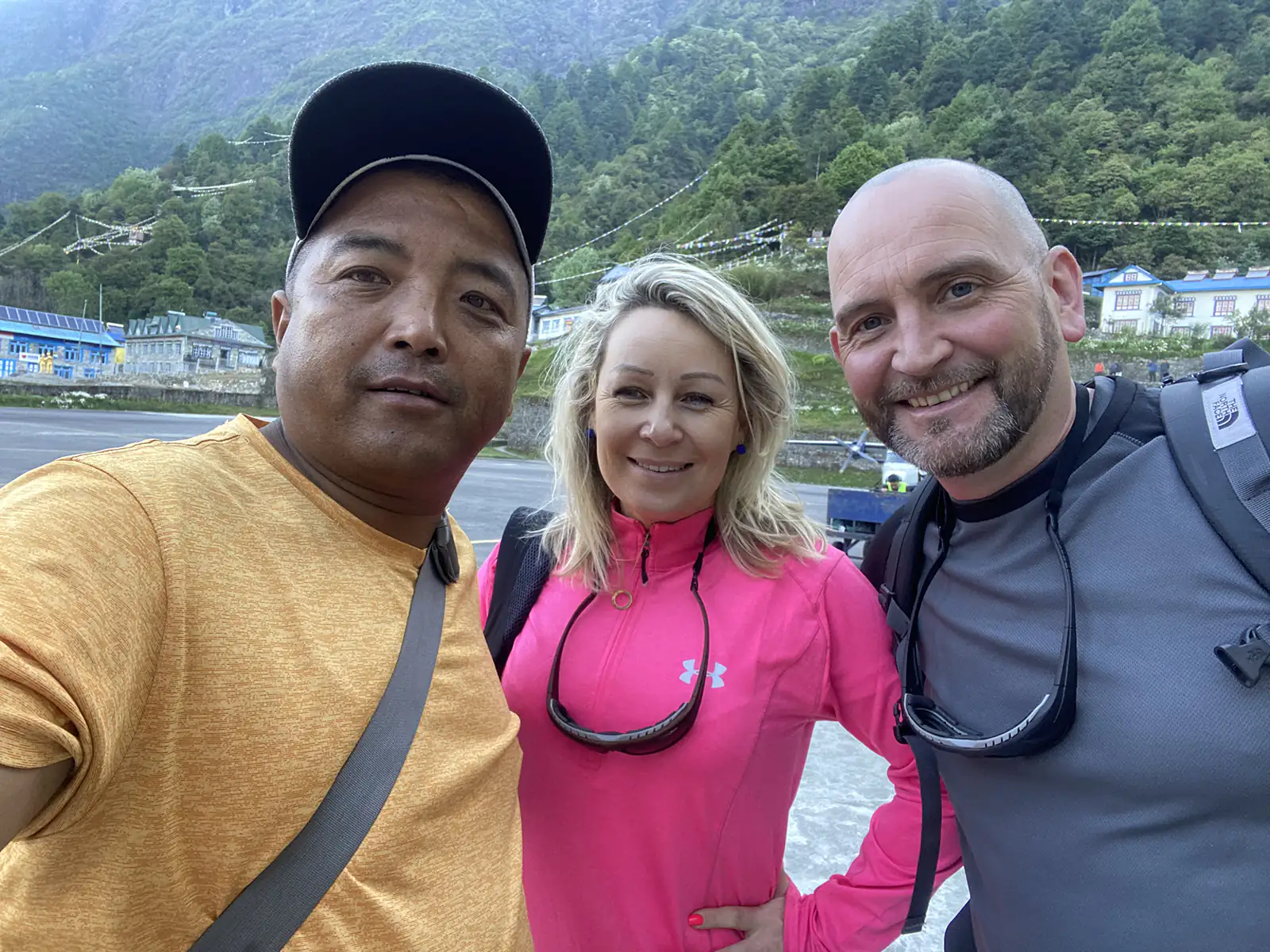
When you land at Tribhuvan International Airport, a Peregrine Treks representative greets you after customs. They escort you to a waiting vehicle.
We transfer you to The Everest Hotel, a 5-star property in Kathmandu with sweeping views of the Kathmandu Valley. Prefer a different hotel? Alternatives are available on request.
In the evening, we hold a briefing session at the hotel. Your lead guide, a certified Khumbu-born guide with extensive Everest region experience, introduces himself and walks you through each day of the itinerary. He checks your gear thoroughly — for this trek, he specifically confirms you have crampons and gaiters, or arranges rental immediately if you do not.
Please submit your travel insurance details tonight. This is mandatory. Your policy must cover helicopter evacuation up to 6,000 meters — essential for the Cho La Pass and high Gokyo sections.
If you arrive early, our team can arrange a half-day or full-day sightseeing tour of Kathmandu’s UNESCO World Heritage Sites (Durbar Square, Swayambhunath, Boudhanath, or Pashupatinath) at additional cost. Let us know your arrival time in advance.
We recommend arriving a day early if you are flying from Europe or the Americas. This gives your body time to recover before the trek starts.
Tonight is your last chance to purchase or rent missing trekking gear. Thamel district, a 10-minute drive from the hotel, has dozens of gear shops open until 9 PM.
Quick Facts:
- Altitude: 1,400m / 4,593 ft
- Meals: Not included (dinner available at the hotel)
- Accommodation: The Everest Hotel, Kathmandu (5-star)
Day 02: Fly to Lukla, trek to Phakding (2,610m)
You flew from Kathmandu to Lukla this morning. The scenic flight takes 35 to 45 minutes. Snowy peaks fill your window.
Important flight note: Flights to Lukla are weather-dependent. During peak season (October–November), your flight may depart from Ramechhap (Manthali) instead of Kathmandu. This requires a 4-hour drive in the early morning. We handle all logistics and confirm your departure point the evening before.
You land at Lukla (2,860m), a hillside airstrip carved into the mountains. Here, you meet your porters and assistant guide. They have already organized your duffel bags. You only carry a light daypack.
The trek starts gently. After leaving Lukla, you pass through Cheplung village. From here, you see the sacred peak of Khumbila (5,761m). This mountain is never climbed out of respect for local beliefs.
The trail follows the Dudh Koshi River. You cross small suspension bridges and walk through quiet pine forests. The sound of the river keeps you company.
When you reach Phakding (2,610m), a clear view of Kusum Kanguru peak greets you. The village has many comfortable teahouse lodges.
This first day is short and easy. The trail is mostly downhill with a few short ascents. Use this time to find your trekking rhythm and test your gear.
At this altitude, the oxygen level drops to about 74% of what you breathe at sea level. You will notice slightly deeper breathing during short climbs. This is normal — your body is adjusting.
Free WiFi and free device charging are available in Phakding lodges. It is a good moment to send your last messages home before connectivity becomes limited.
Quick Facts:
- Starting altitude: 2,860m / 9,383 ft (Lukla)
- Ending altitude: 2,610m / 8,563 ft (Phakding)
- Oxygen level: ~74% of sea level
- Distance: 7.5 km / 4.7 miles
- Walking time: 3–4 hours
- Terrain: Mostly downhill, river valley trail
- Meals: Breakfast, Lunch, Dinner
- Accommodation: Teahouse lodge
Day 03: Trek to Namche Bazaar (3,440m)
Today is the hardest day of the first half. You walk 5 to 6 hours, with a steep uphill push in the final 2 hours to Namche Bazaar.
You leave Phakding and soon cross a high suspension bridge over the icy Dudh Koshi River. The trail then climbs through pine forests and open ridges. You get splendid views of Mt. Nupla (5,885m) and Kongde Ri (6,093m).
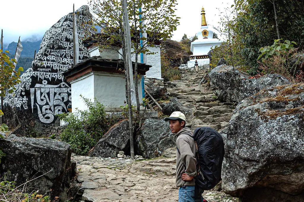
Along the way, you see Mani stones carved with the sacred mantra Om Mani Padme Hum. These stones remind you that you walk through sacred Sherpa land.
At a bend in the trail, the imposing Mt. Thamserku (6,623m) appears ahead. The view motivates you to keep moving.
You enter Sagarmatha National Park at Monjo. Your guide handles the permit registration. Keep your passport easily accessible for the checkpoint.
After Monjo, the valley narrows. You cross the Bhote Koshi River and begin the final steep switchback climb to Namche. The trail gains approximately 600 meters in 3 kilometers. This is the first real physical test of the trek.
Walk slowly on this climb. Drink at least 3 liters of water today. If you feel a headache starting, tell your guide immediately.
When you crest the ridge, Namche Bazaar suddenly unfolds. Colorful buildings form an amphitheater carved into the mountainside. The effort feels worth it.
If the sky is clear, you might see Mt. Everest for the first time from a viewpoint on the trail. Namche is the Sherpa capital and the region’s largest trading hub. You spend two nights here — tonight and tomorrow’s acclimatization day — to let your body adjust before heading to Phortse Thanga.
Free WiFi and charging are available in Namche lodges. This is the last settlement with reliable internet. Beyond here, WiFi costs US$ 5–7 per day at lodges.
Namche has the last ATMs on the trail. Withdraw enough cash here for extras like hot showers, charging, and drinks. Lodges higher up accept only cash.
Quick Facts:
- Starting altitude: 2,610m / 8,563 ft
- Ending altitude: 3,440m / 11,286 ft
- Oxygen level: ~70% of sea level
- Elevation gain: +830m
- Distance: 11 km / 6.8 miles
- Walking time: 5–6 hours
- Terrain: Forest trail, river crossings, steep final ascent
- Meals: Breakfast, Lunch, Dinner
- Accommodation: Teahouse lodge
Day 04: Acclimatization day in Namche Bazaar (3,440m)
This is not a rest day. Your body is adjusting to breathing at 70% of sea‑level oxygen. To prepare for the higher altitudes ahead, you need to “climb high and sleep low” — gain elevation during the day, then return to Namche to sleep.
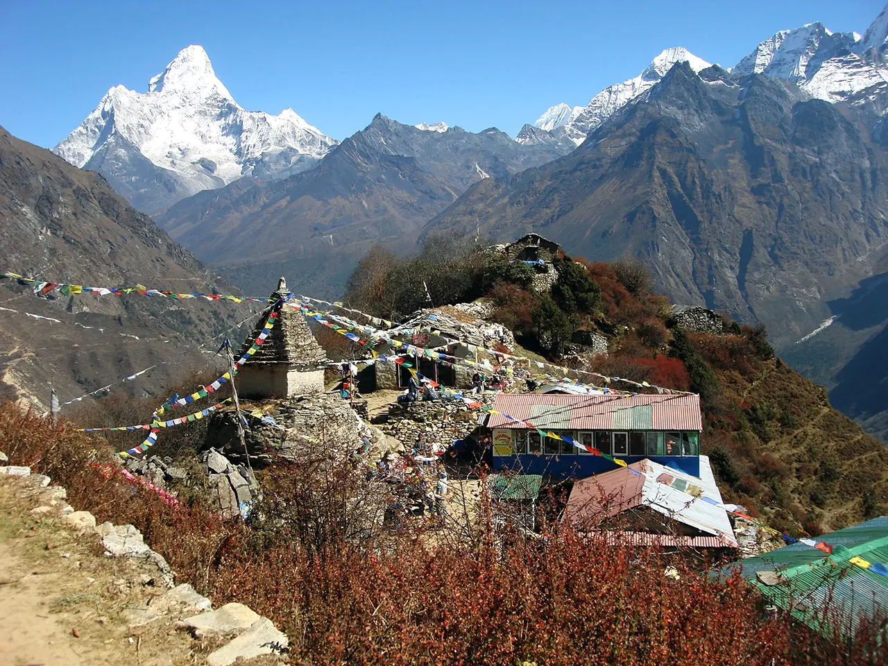
Your main acclimatization hike takes you to Syangboche (3,880m) and Khumjung Village. The round trip takes 3–4 hours. You ascend 440 meters above your sleeping altitude. Spending a couple of hours at this height trains your red blood cells to carry oxygen more efficiently.

The trail passes the Khumjung School, founded by Edmund Hillary in 1961, and offers direct views of Everest, Lhotse, Ama Dablam, and Thamserku. For a shorter walk, you can visit the Hotel Everest View, the world’s highest‑altitude hotel, and enjoy tea with a mountain panorama.
If you prefer a longer, more challenging hike, you can ask your guide about walking to Thame village. However, the round trip takes 7–8 hours — too long for a standard acclimatization day. Most trekkers choose the Syangboche/Khumjung hike.
Your guide checks your oxygen saturation (SpO₂) this evening with a pulse oximeter. A normal reading at this altitude is 88–92%. Readings below 85% may require a slower pace the next day. This check, together with how you feel, helps your guide make the right call.
Tomorrow, the trail diverges. Instead of continuing toward Tengboche on the standard EBC route, you turn left at Sanasa and follow a quieter path into the Gokyo Valley. From this point, you walk a less‑crowded trail with fewer lodges and a more remote feel. Your guide will brief you tonight on what to expect.
Free WiFi and charging are available in Namche. This is the last settlement with reliable internet.
Quick Facts:
- Sleeping altitude: 3,440m / 11,286 ft
- Acclimatization hike altitude: 3,880m / 12,730 ft (Syangboche)
- Oxygen level: ~67–70% of sea level
- Walking time: 3–4 hours (acclimatization hike)
- Meals: Breakfast, Lunch, Dinner
- Accommodation: Teahouse lodge
Day 05: Trek to Phortse Thanga (3,680m)
Today, the Gokyo Valley trail separates from the busy Everest Base Camp route. You leave Namche and climb gradually through rhododendron and birch forest to Kyangjuma. At the Sanasa junction, you turn left instead of continuing toward Tengboche. Instantly, the trail becomes quieter — fewer trekkers, fewer lodges, and a deeper sense of solitude.
The path traverses the hillside. The forest remains lush, and in spring, red, pink, and white rhododendrons carpet the trail. After a steady walk, you reach Mongla Danda. From this ridge, Ama Dablam fills the frame directly ahead — one of the finest views of this iconic peak you will have on the entire trek.
The descent from Mongla Danda to Phortse Thanga is steep. Take it slowly, use your trekking poles, and watch your footing on the dusty switchbacks. The trail drops to the confluence of the Dudh Koshi and Imja Khola rivers.
Phortse Thanga is a small, peaceful settlement right by the water. It feels far from the main trekking highway. You will find basic but welcoming teahouse lodges. Some itineraries pass through Phortse Village (3,840m), a traditional Sherpa farming village perched on the opposite hillside, largely untouched by tourism. If you would like to visit, speak to your guide — it adds a short detour and a strong cultural highlight.
The day’s walking is relatively easy — a gentle traverse followed by one steep descent. It serves as a perfect transition after your acclimatization day, waking up the legs without exhausting you.
Mobile signal (NTC) may work intermittently. WiFi is unlikely in Phortse Thanga. Charging may be offered for US$ 4–5 if the lodge has solar power. Nighttime temperatures drop to around –2°C to –5°C.
Quick Facts:
- Starting altitude: 3,440m / 11,286 ft
- Ending altitude: 3,680m / 12,073 ft
- Oxygen level: ~68% of sea level
- Elevation gain: +240m net (with descent sections)
- Distance: 8 km / 5 miles
- Walking time: 4–5 hours
- Terrain: Forest traverse, steep descent to river valley
- Meals: Breakfast, Lunch, Dinner
- Accommodation: Teahouse lodge
Day 06: Trek to Dole (4,090m)
The short distance on paper hides the effort. Today’s climb is one of the steepest sustained ascents on the Gokyo side of the trek. You gain over 400 meters in just 5 kilometers, leaving the river valley behind and entering a wilder, higher landscape.
The trail climbs steeply from Phortse Thanga through birch and rhododendron forest. The trees are often draped in old man’s beard lichen — a sign of clean air. You may see yak caravans hauling supplies to the higher lodges. Always pass yaks on the uphill side to avoid being pushed off the trail.
As you gain altitude, the forest begins to thin, giving way to alpine scrub and open meadows. Long‑range views open up to the north. On a clear day, you catch your first sight of Cho Oyu (8,188m), the world’s 6th highest mountain, which guards the Tibetan border.
You crossed 4,000 meters today. Above this altitude, your body absorbs oxygen much less efficiently. Walk 20–30% slower than you did below Namche. Breathe deeply and deliberately. Drink 3–4 liters of water. Eat even if you have little appetite.
The area between Phortse Thanga and Dole is one of the best on the trek for wildlife sightings. Keep your eyes open for Himalayan tahr, musk deer, and the brilliantly colored Himalayan monal — Nepal’s national bird.
Dole is a tiny settlement with just a handful of basic lodges. Facilities are simple. Nighttime temperatures drop to –5°C to –8°C. No reliable mobile signal or WiFi is available. Charging may be possible for US$ 4–5. Bring a power bank and a good book — evenings here are quiet.
Quick Facts:
- Starting altitude: 3,680m / 12,073 ft
- Ending altitude: 4,090m / 13,415 ft
- Oxygen level: ~65% of sea level
- Elevation gain: +410m
- Distance: 5 km / 3.1 miles
- Walking time: 3–4 hours
- Terrain: Steep forest climb, alpine meadow
- Meals: Breakfast, Lunch, Dinner
- Accommodation: Teahouse lodge
Day 07: Trek to Machhermo (4,410m)
The trail continues up the Gokyo Valley. You climb through juniper scrub on a rocky path with sections of steep switchbacks. The vegetation is sparse now, and the air feels thinner with every step.
Machhermo is a significant stop on this route, and not just for its views. This is the location of the Machhermo Rescue Post, established after altitude-related deaths in the early days of Khumbu trekking. The Himalayan Rescue Association (HRA) has historically operated an aid post here during the trekking season. Your guide may check whether the HRA post is currently staffed. Its presence is a reminder that altitude sickness is real, and you must stay vigilant about how you feel.
From the village, you get clear views of Thamserku, Kangtega, and the beginning of the Ngozumpa Glacier to the north.
You are now above 4,400 meters. From this point, even short uphill sections feel significantly harder. Take your time with every step. Sleep may feel broken tonight — this is a normal altitude response, not a sign of illness. Do not panic if you wake up frequently or have vivid dreams. Your body is working hard to adapt.
Your guide measures your oxygen saturation (SpO₂) this evening using a pulse oximeter. This is a critical checkpoint. Tomorrow you climb to 4,750 meters at Gokyo. If your SpO₂ dips below 80%, your guide may recommend an extra acclimatization day here at Machhermo. Listen to your guide’s advice. It could be the decision that keeps you safe.
Drink 3–4 liters of water today, even if you are tired of cold water. Staying hydrated helps your body adjust.
No reliable mobile signal or WiFi is available. Charging may be possible for US$ 4–5 if the lodge has enough solar power. Nighttime temperatures drop to –8°C to –12°C. Wear your thermals to bed and keep your water bottle in your sleeping bag to stop it from freezing.
Quick Facts:
- Starting altitude: 4,090m / 13,415 ft
- Ending altitude: 4,410m / 14,468 ft
- Oxygen level: ~62% of sea level
- Elevation gain: +320m
- Distance: 5 km / 3.1 miles
- Walking time: 3–4 hours
- Terrain: Rocky trail, juniper scrub, steep sections
- Meals: Breakfast, Lunch, Dinner
- Accommodation: Teahouse lodge
Day 08: Trek to Gokyo (4,750m)
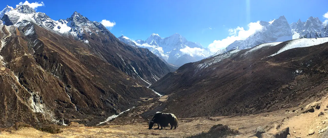
Today is longer and more demanding than the last few days. You leave Machhermo and climb past the tongue of the Ngozumpa Glacier — the longest glacier in the Himalayas, stretching 36 kilometers from the slopes of Cho Oyu.
The trail takes you past the first and second Gokyo Lakes: Longponga and Taujung. Their waters are a startling turquoise-blue in autumn, the color coming from glacial minerals suspended in the water. They may be partially frozen in spring and fully frozen in winter. Each one is a stunning sight that stops you in your tracks.
Cho Oyu (8,188m) dominates the northern skyline for much of the day. To its right, you see Gyachung Kang (7,952m). The scale of these mountains humbles you.
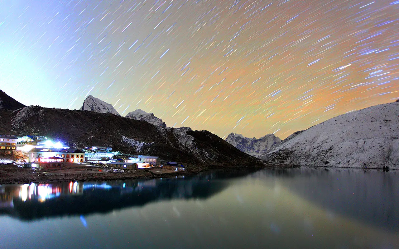
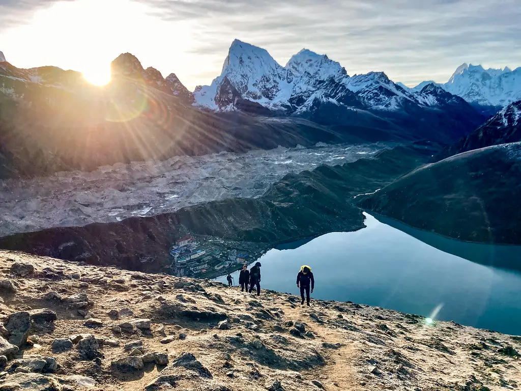
Gokyo village sits on the shore of the third lake, Dudh Pokhari — the largest of the Gokyo Lakes system. A handful of lodges cluster here, and the setting, backed by Cho Oyu and the peaks of the upper Khumbu, is unforgettable. The Gokyo Lakes are a designated Ramsar Wetland site, internationally recognized for their ecological importance.
You crossed 4,700 meters today. The oxygen level is 59% of sea level, the same as Dingboche on the EBC route, but you reached it on a longer, more remote trail. Every movement feels heavier. Walk slowly, arrive early, and rest. Let your body catch up.
Some lodges in Gokyo may offer WiFi for USD 7–10, but it is often unreliable. Do not count on a mobile signal. Charging costs USD 7–10, but it is often unreliable. Nighttime temperatures drop to –10°C to –15°C. Use your down jacket and wrap yourself in your sleeping bag even inside the lodge.
Quick Facts:
- Starting altitude: 4,410m / 14,468 ft
- Ending altitude: 4,750m / 15,584 ft
- Oxygen level: ~59% of sea level
- Elevation gain: +340m
- Distance: 8 km / 5 miles
- Walking time: 5–6 hours
- Terrain: Glacier moraine, lake shores, rocky trail
- Meals: Breakfast, Lunch, Dinner
- Accommodation: Teahouse lodge
Day 09: Hike Gokyo Ri (5,357m), explore fifth lake, trek to Thangna (4,700m)
You start before dawn for Gokyo Ri (5,357m). The climb from Gokyo takes 2–3 hours. The final section is steep and completely exposed to the wind. At the summit, oxygen is 54% of sea-level levels. Every breath feels thin.
The reward is the view. Four of the world’s five highest peaks are visible from this single point: Everest (8,849m), Lhotse (8,516m), Makalu (8,485m), and Cho Oyu (8,188m). Below you, the turquoise Gokyo Lakes chain stretches north. The Ngozumpa Glacier fills the valley floor. Many trekkers consider this the single best viewpoint in the entire Khumbu region.
You return to Gokyo for a well-deserved breakfast. Afterward, you have an optional hike to the fourth and fifth Gokyo Lakes. The fifth lake, Ngozumpa Tsho, is the highest and the least visited. The round trip takes about 2 hours. Few trekkers make it here, and the solitude, with Cho Oyu towering over the lake, is extraordinary. If you have the energy, go — it adds a layer of wild silence to your trek.
Whether you explore the fifth lake or rest in Gokyo, you later trek to Thangna (also called Dragnak), the base camp for tomorrow’s Cho La Pass crossing. The walk from Gokyo to Thangna takes 2–3 hours across the Ngozumpa Glacier’s lateral moraine. The lodge facilities here are very basic.
This evening, your guide briefs you in detail on the Cho La crossing: the early start, the glacier section, the equipment required (crampons, gaiters, trekking poles), the weather conditions he monitors, and the strict turnaround protocol. He answers every question. You go to bed knowing exactly what lies ahead.
This is a very long day — 7 to 8 hours of moving time. Manage your energy. Eat well. Tomorrow is the hardest and most technical day of the trek, and you need to arrive at Thangna rested.
Quick Facts:
- Gokyo Ri summit: 5,357m / 17,575 ft
- Ending altitude (Thangna): 4,700m / 15,420 ft
- Oxygen level: ~54% at Gokyo Ri, ~59% at Thangna
- Walking time: 7–8 hours total (Gokyo Ri + optional fifth lake + Thangna)
- Terrain: Steep summit climb, glacier moraine traverse
- Meals: Breakfast, Lunch, Dinner
- Accommodation: Teahouse lodge (basic)
Day 10: Cross Cho La Pass (5,368m), trek to Dzongla (4,830m)
You start before dawn, typically 4:00–5:00 AM. Cho La Pass (5,368m) is the technical crux of the entire trek. Unlike Kala Patthar, which is a steep hike, Cho La involves a glacier crossing, ice, and potentially loose rock. Your guide assesses conditions at the trailhead. If fresh snow has fallen overnight, if visibility is poor, or if ice conditions are unsafe, the guide may delay the start or cancel the crossing entirely. This decision is final and non-negotiable. Your safety comes first.
From Thangna, the trail enters a narrow rocky valley. The gradient steepens as you approach the pass. The final section crosses a small glacier — a stretch of approximately 200–300 meters. This is where crampons are required in most conditions. Your guide fits crampons for each trekker and checks that everyone is secure before you move onto the ice. Fixed ropes may be present depending on the season. Move carefully, one step at a time, and stay with the group.
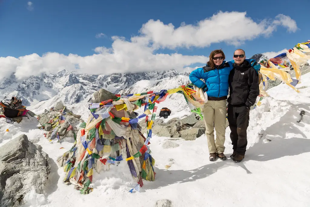
The top of Cho La is marked with prayer flags flapping in the thin air. At 5,368 meters, the oxygen is 53% of sea-level levels. You do not linger. The weather on the pass can turn suddenly. Take your photographs, breathe, and then begin the descent.
The western side of Cho La drops steeply through loose rock and scree. The descent is hard on your knees and demands full concentration. Use your trekking poles. The scree eventually gives way to a gentler path that leads into the Lobuche Valley. After a long, careful descent, you arrive at Dzongla (4,830m) in the late afternoon.
Lodges in Dzongla are basic. Expect cold rooms, shared facilities, and a limited menu. Rest, rehydrate, and eat. You have crossed the pass. You have earned this stop.
Cho La Pass — Important Safety Information
Cho La Pass is not a guaranteed crossing. Weather, snow conditions, and ice determine whether the pass is safe on any given day.
Your guide has full authority to cancel or delay the crossing. We do not send trekkers over Cho La in unsafe conditions.
Required equipment for the crossing: crampons (we provide loaners if you do not have your own), gaiters, trekking poles, warm gloves, a windproof layer, and a headlamp.
If the pass is closed due to conditions, we reroute via Phortse and Tengboche to rejoin the standard EBC trail at Pangboche or Dingboche. This adds 1–2 days to the itinerary but keeps you safe. We do not charge extra for safety reroutes.
Do not attempt to cross Cho La independently or ahead of your guide. Stay with the group at all times on the glacier section. Your guide’s instructions must be followed immediately and without argument.
Quick Facts:
- Starting altitude: 4,700m / 15,420 ft (Thangna)
- Cho La Pass: 5,368m / 17,611 ft
- Ending altitude: 4,830m / 15,850 ft (Dzongla)
- Oxygen level: ~53% at pass, ~58% at Dzongla
- Elevation gain: +668m (to pass), then –538m (descent)
- Distance: 8 km / 5 miles
- Walking time: 7–8 hours
- Terrain: Rocky valley, glacier crossing (crampons required), scree descent
- Meals: Breakfast, Lunch, Dinner
- Accommodation: Teahouse lodge (basic)
Day 11: Trek to Lobuche (4,940m)
After yesterday’s demanding Cho La crossing, today offers a shorter, more forgiving walk. The trail from Dzongla to Lobuche follows a gentle uphill traverse along the valley floor. Walking time is just 3 to 4 hours.
You rejoin the standard Everest Base Camp trail on this section. You will see other trekkers moving in both directions — the solitude of the Gokyo Valley gives way to the busier main route.
The path climbs gradually onto a moraine ridge. Cholatse and Tawache stand sentinel to your left and right. Ahead, Khumbutse and Lingtren appear, and the pyramid of Pumori grows larger with every step.
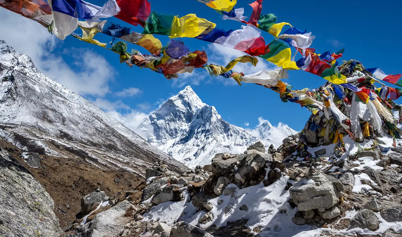
Between Dughla and Lobuche, you pass through the Thukla memorial site. Stone cairns and prayer flags honor climbers who died on Everest expeditions, including Scott Fischer (1996) and Babu Chiri Sherpa. This is a solemn and reflective stretch of trail. Take a quiet moment to pay your respects.
You arrive at Lobuche, a small, wind-exposed settlement. Lodge facilities are basic. Nighttime temperatures drop to –10°C to –15°C. Keep your water bottle inside your sleeping bag to prevent it from freezing overnight.
Even though the walking is short, do not underestimate the altitude. You are sleeping at 4,940 meters. Rest well tonight — tomorrow is the long push to Everest Base Camp.
No reliable mobile data is available. If the lodge has WiFi, it costs USD 6–7. Device charging costs US6–7.
Quick Facts:
- Starting altitude: 4,830m / 15,850 ft (Dzongla)
- Ending altitude: 4,940m / 16,207 ft (Lobuche)
- Oxygen level: ~56% of sea level
- Elevation gain: +110m
- Distance: 5 km / 3.1 miles
- Walking time: 3–4 hours
- Terrain: Valley traverse, moraine ridge, gradual climb
- Meals: Breakfast, Lunch, Dinner
- Accommodation: Teahouse lodge
Day 12: Trek to Gorakshep (5,170m) and Everest Base Camp (5,364m)
This is the longest and most demanding day of your trek. You walk 13 kilometers at altitudes between 4,940m and 5,364m, where oxygen levels drop to 53–54% of sea level. Start early, around 5:30–6:00 AM, to make the most of daylight hours.
From Lobuche, the trail climbs along the edge of the Khumbu Glacier. After about 3 hours, you reach Gorakshep (5,170m), a small settlement with a handful of basic lodges. This is the last overnight point before base camp. You leave your main packs here and carry only essentials for the final push to EBC.
The trail from Gorakshep to Everest Base Camp crosses the lateral moraine of the Khumbu Glacier. You walk through a landscape of gray rock, ice, and frozen meltwater pools. The path is not steep, but at this altitude, it is physically exhausting. Allow 2 to 2.5 hours each way.
Everest Base Camp is not a single fixed location. It is a sprawling area of rocks and ice at the foot of the Khumbu Icefall. During climbing season (April–May), you see colorful expedition tents, prayer flags, and the gear of summit-bound teams. Outside climbing season, the camp is empty, but the Icefall and the south face of Everest remain.
Standing at 5,364 meters with the Khumbu Icefall cracking and groaning above you — this is why you came. Take your photographs, but also stand still for a few minutes. Listen to the glacier. Feel the cold. This is the closest most people will ever stand to the summit of Everest.
Do not linger at EBC for more than 60–90 minutes. The return to Gorakshep takes 2 hours, and you need to arrive before dark. Your guide manages the timeline carefully.
Gorakshep lodges are basic. Expect cold rooms, shared facilities, and limited menu options. This is the highest overnight point on the trek. Celebrate quietly, drink warm fluids, and rest.
Quick Facts:
- Starting altitude: 4,940m / 16,207 ft
- Gorakshep: 5,170m / 16,962 ft
- EBC: 5,364m / 17,598 ft
- Oxygen level: 53–54% of sea level
- Elevation gain: +424m (to EBC)
- Distance: 13 km round trip
- Walking time: 7–8 hours total
- Terrain: Glacier moraine, rocky trail, high altitude
- Meals: Breakfast, Lunch, Dinner
- Accommodation: Teahouse lodge (basic)
Day 13: Kala Patthar sunrise (5,545m) and descent to Pheriche (4,240m)
You wake at 4:00–4:30 AM. It is dark and bitterly cold. You pull on your warmest layers, switch on your headlamp, and begin the final climb of the trek.
The hike to Kala Patthar takes 2–3 hours. The final 200 meters are steep and fully exposed to the wind. At 5,545 meters, the air contains only 52% of sea-level oxygen. Every few steps, you stop to catch your breath. This is physically the hardest climb of the entire journey.
Then the sun rises. The first light hits the summit pyramid of Everest, painting it gold. The entire Khumbu Glacier glows beneath you. The 360-degree panorama includes Everest, Nuptse, Changtse, Pumori, and Lingtren. This is the definitive Everest viewpoint — the photograph you have seen a thousand times was taken from where you are standing.

After 30–45 minutes at the top, you descend to Gorakshep for a well-earned breakfast. You pack your gear one final time, and then the long descent begins.
From Gorakshep, you retrace your steps through Lobuche and Dughla. The trail then drops steadily to Pheriche (4,240m). You lose approximately 1,300 meters of altitude over the course of the day. The descent is relentless and hard on your knees — use trekking poles and take the downhill slowly.
Pheriche feels different. The air is thicker, the temperature warmer, and the vegetation begins to return. You will likely sleep better here than you have in days. Pheriche also has a Himalayan Rescue Association (HRA) aid post. If you have any lingering altitude symptoms, this is the place to get checked.
This is a very long day — 7 to 8 hours of moving time. You started before dawn at an altitude of 5,100 meters, and you ended the day at 4,240 meters. It is a day of extremes. Be proud of what your body has done.
Quick Facts:
- Kala Patthar summit: 5,545m / 18,192 ft
- Ending altitude: 4,240m / 13,911 ft (Pheriche)
- Oxygen level: ~52% at Kala Patthar, ~61% at Pheriche
- Elevation loss: –1,305m (Kala Patthar to Pheriche)
- Distance: ~18 km
- Walking time: 7–8 hours
- Terrain: Steep summit climb, long moraine descent, river valley
- Meals: Breakfast, Lunch, Dinner
- Accommodation: Teahouse lodge
Day 14: Trek to Namche Bazaar (3,440m)
Today is a long descent back to the Sherpa capital. Pheriche to Namche is approximately 20 kilometers, and you walk for 6 to 7 hours through terrain you first crossed on the way up.
The change in altitude is noticeable immediately. Warmer air wraps around you, thicker vegetation appears, and birdsong returns. After days above 4,500 meters, every breath feels easier. Your body welcomes the oxygen.
You pass through Pangboche, and then either Tengboche or Deboche, depending on the trail your guide chooses. The rhododendron forests that were bare or just budding on your ascent may now be in full leaf or bloom, depending on the season.
The final stretch from Sanasa to Namche is a rollercoaster of short ups and downs. Take your time. Arriving in Namche feels like returning to civilization — hot showers, bakeries, good coffee, and free WiFi await.
Mobile signal returns reliably here. Namche has the last ATMs on the trail if you need more cash for the final days. Enjoy a well-deserved evening in comfort.
Quick Facts:
- Starting altitude: 4,240m / 13,911 ft (Pheriche)
- Ending altitude: 3,440m / 11,286 ft (Namche)
- Oxygen level: ~70% of sea level
- Elevation loss: –800m
- Distance: 20 km / 12.4 miles
- Walking time: 6–7 hours
- Terrain: River valley descent, forest trail, village paths
- Meals: Breakfast, Lunch, Dinner
- Accommodation: Teahouse lodge
Day 15: Trek to Lukla (2,860m)
Today, you retrace the familiar trail from Namche all the way to Lukla. It is a long downhill day through the same river valley you first walked two weeks ago — but now you descend with the memories of Gokyo, Cho La, Everest Base Camp, and Kala Patthar behind you.
The path drops through Monjo, where you exit Sagarmatha National Park. You cross the high suspension bridges over the Dudh Koshi, pass through Jorsale, and continue through the pine forests to Phakding. The vegetation grows thicker with every hour. Warm air settles on your skin, and the sound of the river grows louder.
From Phakding, the final stretch to Lukla involves a few short uphill sections — a reminder that the Khumbu always has one last incline to offer. The total walking time is 6 to 7 hours. Use your trekking poles on the descents to protect your knees.
Arrive in Lukla by mid-afternoon if possible. The airstrip town can get windy later in the day, and early arrival gives you time to rest and enjoy a relaxed final evening on the trail.
Tonight is the traditional time to gather with your guide and porters. Many groups share a farewell meal at the lodge, swap stories, and present tips to the team that supported them through the high passes. It is a quiet, warm, and well-earned celebration.
Quick Facts:
- Starting altitude: 3,440m / 11,286 ft
- Ending altitude: 2,860m / 9,383 ft (Lukla)
- Oxygen level: ~73% of sea level
- Elevation loss: –580m
- Distance: 18 km / 11.2 miles
- Walking time: 6–7 hours
- Terrain: Forest descent, river crossings, village trail
- Meals: Breakfast, Lunch, Dinner
- Accommodation: Teahouse lodge
Day 16: Fly to Kathmandu
You board a morning flight from Lukla to Kathmandu. The flight takes 30 to 40 minutes. As the plane lifts off the mountainside runway, the peaks you walked among recede into the distance. Terraced hills, river gorges, and the sprawl of the Kathmandu Valley soon fill the window.
Important flight note: Lukla flights depend entirely on the weather. Cancellations and delays are common in all seasons. Today’s buffer in the itinerary exists for this reason. If the morning flight is canceled, we attempt the afternoon slot or the next morning. In rare cases of extended cancellation, we can arrange a helicopter transfer at additional cost. Your guide handles all rebooking and communication.
Upon landing in Kathmandu, our vehicle transfers you to The Everest Hotel. The rest of the day is free. You can explore Thamel for souvenirs, book a massage or spa treatment to recover, or rest in the comfort of your room.

In the evening, we host a farewell dinner. This meal is included. Your guide presents your official Peregrine Gokyo Cho La Pass completion certificate. It is a moment to reflect on what you have achieved — the 5,368-meter pass, the turquoise lakes, the sunrise over Everest, and the long, quiet valleys in between.
Quick Facts:
- Flight: Lukla to Kathmandu, 30–40 minutes
- Meals: Breakfast, Farewell Dinner
- Accommodation: The Everest Hotel, Kathmandu
Day 17: Departure from Kathmandu
Your final morning starts with breakfast at The Everest Hotel. If your flight departs later in the day, you have a free window to pick up a few last souvenirs in Thamel.
Our representative picks you up from the hotel and drives you to Tribhuvan International Airport. Transfer time is approximately 30 minutes, depending on traffic. We recommend arriving at the airport at least two hours before your flight.
If your departure flight is in the afternoon or evening, we can arrange a half-day sightseeing tour of Pashupatinath, Boudhanath, or Patan Durbar Square at additional cost. Let us know in advance.
You arrived in Kathmandu 17 days ago. You crossed a 5,368-meter glacier pass, stood at the foot of Everest, watched the sunrise from Kala Patthar, and saw four of the world’s five highest mountains from the summit of Gokyo Ri. Not many people can say that.
Quick Facts:
- Altitude: 1,400m / 4,593 ft
- Meals: Breakfast
- Accommodation: N/A (departure day)
Customize this trip with help from our local travel specialist that matches your interests.
Includes & Excludes
What is included?
- Airport pickups and drops in a private vehicle
- The Everest Hotel in Kathmandu with breakfast
- Room in the best available lodge and all meals (Breakfast, Lunch, and Dinner) during the Gokyo Cho La Pass Trek
- Full-day Kathmandu Valley guided sightseeing in a private vehicle
- All entrance fees during sightseeing
- Kathmandu – Lukla – Kathmandu Flight ticket
- An experienced English or other Language speaking guide and one assistant guide for more than five trekkers
- One porter for two trekkers
- Guide, porter, and required staff salaries, insurance, accommodation, food, and airfares.
- Down jacket and sleeping bag (to be returned after trip completion)
- The trekking bag/duffel bag, t-shirt, achievement certificate, and trekking map are yours to take
- Gokyo Cho La Pass Trek Permit and TIMS
- First Aid Medical Kit or standard-essential medicine
- Seasonal fruits during the trek
- Farewell dinner
- All applicable government and local taxes
What is excluded?
- International airfare and visa fee
- Hotel accommodation, Lunch, and Dinner in Kathmandu because of an early arrival in Nepal or a late departure from Nepal before returning from the Gokyo Cho La Pass Trekking
- Personal Expenses like bar bills, telephone bills, laundry, etc
- Tipping for trekking crew members and the driver
Departure Dates
We also operate Private Trips.
Good To Know
Nepal uses the Nepali Rupee (NPR). US dollars are accepted for trekking-related payments. Namche Bazaar has the last ATMs. Withdraw enough cash in Namche for the remaining 12 days of personal expenses. Lodges above Namche accept only cash. Gokyo Valley lodges tend to charge higher prices than the main EBC trail due to more remote supply logistics.
We accept payments in USD, GBP, EUR, AUD, and CAD. Bank transfers avoid the 4% credit card processing fee.
Nepal uses 230V electricity at 50Hz. Power outlets are Type C, D, and M. Bring a universal adapter. Most modern phone and laptop chargers are dual voltage (100–240V).
No vaccinations are legally required for entry into Nepal. We recommend consulting your doctor about Hepatitis A, Typhoid, and Tetanus. Bring prescription medications in their original packaging, along with a doctor’s letter.
Most nationalities obtain a visa on arrival at Tribhuvan International Airport. Fees: US$ 30 for 15 days, US$ 50 for 30 days, US$ 125 for 90 days. Complete the online form at www.nepalimmigration.gov.np before your flight. Bring a passport photo and the exact visa fee in US dollars.
A minimum 30% deposit secures your Gokyo Cho La Pass Trek booking. The remaining balance is due 30 days before arrival. We accept bank transfers in USD, GBP, EUR, AUD, and CAD. Credit cards are accepted with a 4% processing fee.
Purchase a Nepali SIM card at Kathmandu Airport. Nepal Telecom (NTC) has the best coverage in Khumbu. Free WiFi is available in Phakding and Namche. From Phortse Thanga through the Gokyo Valley (Days 05–09), WiFi availability is limited and expensive (US$ 7–10 per day, where available). Mobile data (NTC) works in Lukla, Namche, and sporadically in Dole. There is no reliable mobile signal in Gokyo, on Cho La, or in Dzongla. Signal returns at Lobuche and Gorakshep (weak) and reliably again at Namche on the descent.
Free charging in Phakding and Namche. From Phortse Thanga onward, lodges charge US$ 4–5 per device. In the Gokyo Valley, charging availability can be inconsistent — some lodges have solar panels that fail in cloudy weather. Carry a power bank. Solar chargers are unreliable above 4,000 meters.
Carry a reusable bottle and water purification tablets or a portable filter. Boiled water is available at lodges. Bottled water costs US$ 2–5 per liter and rises sharply above Gokyo. Purifying your own water is cheaper and reduces plastic waste. Drink 3 to 4 liters per day above 3,500 meters.
The Gokyo Cho La Pass Trek passes through the homeland of the Sherpa people. You encounter Mani stones, prayer wheels, and prayer flags throughout both the Gokyo Valley and the EBC trail. Tengboche Monastery (visible from the trail on the return descent if rerouted via Tengboche) is the Khumbu’s most important spiritual site.
The route passes through Sagarmatha National Park, a UNESCO World Heritage Site. The Gokyo Valley side is quieter and less trafficked than the main EBC trail, and wildlife sightings are more likely — particularly Himalayan tahr, musk deer, and the Himalayan monal between Phortse Thanga and Dole. The Gokyo Lakes are a Ramsar Wetland site, recognized internationally for ecological significance.
Always walk to the left of Mani stones and prayer wheels (keeping them on your right). Remove shoes before entering monasteries. Ask before photographing people or religious sites.
Trip Information
Crossing Cho La Pass: Our Safety Protocol
Cho La Pass (5,368m) is the technical crux of the Gokyo Cho La Pass Trek. Unlike Kala Patthar or Gokyo Ri, which are steep hikes on rocky trails, Cho La involves crossing a glacier with ice, loose rock, and potential crevasses. This pass demands respect, preparation, and a guide who knows when to cross and when to turn back.
At Peregrine Treks, our motto is simple: safety over adventure. On the Cho La crossing, this principle is tested most directly.
How the Crossing Works
You start from Thangna (4,700m) before dawn, typically between 4:00 and 5:00 AM. The trail enters a narrow rocky valley that steepens as you approach the pass. The final section crosses a small glacier, approximately 200 to 300 meters of ice. Your guide fits crampons to every trekker before the glacier section and ensures each person is secure. Trekking poles are used for balance. The group stays together and moves at the pace of the slowest member.
At the summit (5,368m), prayer flags mark the top. You do not linger — weather changes rapidly on exposed passes above 5,000 meters. The descent on the western side drops steeply through loose scree and rock before leveling into the Dzongla valley.
When We Do Not Cross
Your guide assesses conditions at the Thangna trailhead before departure. The crossing is canceled or delayed if:
- Fresh snow has fallen overnight, covering the trail and making route-finding dangerous
- Visibility is poor due to cloud, fog, or active snowfall
- Ice conditions on the glacier are unstable
- High winds make the exposed pass unsafe
- Any trekker in the group is showing signs of altitude sickness that could worsen at 5,368m
This decision is the guide’s alone. We back it every time. A one-day delay at Thangna is inconvenient. A fall on ice at 5,300 meters is catastrophic. We choose the delay.
The Backup Route
If conditions close the Cho La for more than one day, we reroute the trek. The alternative follows the trail from Gokyo back through Phortse and Tengboche, then rejoins the standard EBC route at Pangboche or Dingboche. This adds 1 to 2 days to the itinerary but keeps you safe and still allows you to reach Everest Base Camp and Kala Patthar. We do not charge extra for the reroute. Your safety is not a premium add-on.
Equipment Required for Cho La
Your guide confirms the following gear is ready during the Day 01 briefing in Kathmandu and again during the evening briefing at Thangna on Day 09:
- Crampons (we provide loaners if you do not have your own)
- Gaiters to keep snow out of your boots
- Trekking poles for balance on ice and scree
- Warm wind-resistant gloves (not thin liner gloves — you need grip and warmth on ice)
- Windproof outer layer with hood
- Headlamp with fresh batteries (you start in darkness)
- Sunglasses with UV protection (snow glare on the glacier is intense)
Why This Matters
Many operators describe Cho La as “challenging but doable” and leave it at that. We go further because we have seen what happens when trekkers cross this pass underprepared or in bad conditions. A guided glacier crossing with crampons, clear conditions, and a trained team is a manageable adventure. The same crossing without preparation, in poor weather, or with an inexperienced guide is a genuine risk. We eliminate that risk by applying the same safety-over-adventure standard we hold on every Peregrine trek.
You are not crossing Cho La alone. You are crossing with a guide who has done it dozens of times, who carries the right equipment, and who will turn you around if the mountain says no.
Which Trek Is Right for You?
We operate three Everest region treks, each designed for a different schedule, fitness level, and experience goal. This comparison helps you choose.
| Feature | Everest Base Camp Trek | Cho La Pass | Gokyo Lakes |
|---|---|---|---|
| Duration | 15 days | 17 days | 13 days |
| Distance | 130 km | 160 km | 100 km |
| EBC Visit | Yes | Yes | No |
| Gokyo Lakes | No | Yes | Yes |
| Difficulty | Moderate | Hard | Moderate |
| Best For | First-time trekkers | Experienced trekkers | Scenic trekkers |
The Gokyo Cho La Pass Trek is the most complete route through the Everest region. It is the only itinerary that includes Gokyo Lakes, Gokyo Ri, Cho La Pass, Everest Base Camp, and Kala Patthar in a single continuous circuit. You see everything the Khumbu has to offer without retracing your steps through the middle section. The trade-off is duration (17 days) and difficulty (the Cho La glacier crossing requires crampons and good fitness).
Not sure which route fits your situation? Contact us with your available dates, fitness level, and priorities. We recommend the right trek for you.
Booking Flexibility and Cancellation
We operate the Gokyo Cho La Pass Trek as a private departure. You choose your start date, and we build the logistics around it.
How to Book
To confirm your trek, we require a 30% deposit of the total package cost. You can pay by bank transfer (no processing fee) or by credit card (Visa, MasterCard, American Express — a 4% processing fee applies). The remaining 70% is due 30 days before your arrival date in Kathmandu.
Cancellation Terms
- More than 120 days before arrival: full refund of deposit minus US$ 300 administrative fee
- 30 to 120 days before arrival: 70% refund of total payment
- 15 to 29 days before arrival: 50% refund of total payment
- Less than 15 days before arrival: no refund
Rebooking Option
If you cannot travel on your original date but want to reschedule, we will transfer your full payment to a new departure date at no extra charge — provided you notify us at least 30 days before the original arrival date. This transfer is valid for 12 months from the original booking date.
Weather and Cho La Pass Closure
If the Cho La Pass is closed due to weather or snow conditions during your trek, we will reroute via Phortse and Tengboche at no extra charge. The reroute adds 1 to 2 days but still reaches Everest Base Camp and Kala Patthar. If the Lukla flight is canceled due to weather, we will arrange an alternative departure from Ramechhap or charter a helicopter to Lukla (at an extra cost). We do not charge extra for weather-related delays that fall within the scope of our itinerary.
For events beyond anyone’s control — natural disasters, political unrest, pandemic-related border closures, or government-imposed travel restrictions — we offer a full credit toward a future trek within 18 months.
Travel Insurance Requirement
Travel insurance is mandatory. Your policy must cover emergency helicopter evacuation up to 6,000 meters. We verify your insurance details at the Day 01 briefing.
What to Budget for Extras
Your trek fee covers accommodation, meals, permits, flights, guides, porters, equipment loans, and the farewell dinner. Some personal expenses are not included.
| Item | Cost | Where Available |
|---|---|---|
| WiFi | US$ 5–10/day | From Phortse Thanga (free in Phakding & Namche) |
| Charging | US$ 4–5/charge | All lodges (free lower villages) |
| Hot Shower | US$ 3–5 | Below Machhermo (limited above) |
| Water (1L) | US$ 2–5 | All lodges (higher = more expensive) |
| Soft Drinks | US$ 3–5 | Most lodges |
| Beer | US$ 5–8 | Most lodges (avoid above 4,000m) |
| Electric Blanket | US$ 15–20/night | Selected lodges above Machhermo |
| Laundry | US$ 5–8 | Namche Bazaar only |
| Kathmandu Meals | US$ 15–25 | Arrival & return days |
Suggested Tips
Tipping is not mandatory on the Gokyo Cho La Pass Trek, but it is customary in Nepal and appreciated by the team that supports your 17-day journey.
- Lead trekking guide: US$ 300–500 total
- Assistant guide (if applicable): US$ 200–300 total
- Porters: US$ 150–250 total, per porter
- Drivers: US$ 5–10 per transfer
Tips can be given in US dollars, Nepali Rupees, or any major currency. Many trekkers pool tips and present them as a group at the farewell dinner in Kathmandu on Day 16.
Total Extra Budget
We suggest carrying US$ 400–600 in cash for personal expenses during the trek. The Gokyo Cho La Pass Trek is longer than the standard EBC route, and prices at Gokyo lodges are higher than on the main EBC trail due to more remote supply lines. Bring small-denomination bills. No ATMs exist beyond Namche Bazaar.
How to Prepare Physically
The Gokyo Cho La Pass Trek is rated challenging. It is harder than the standard Everest Base Camp Trek. You walk 5 to 7 hours per day across 17 days, summit two peaks above 5,300 meters (Gokyo Ri and Kala Patthar), and cross a glacier pass (Cho La) that requires crampons. The total trekking distance is approximately 160 kilometers with cumulative elevation gain exceeding 7,000 meters.
You do not need mountaineering experience. But you need sustained cardiovascular fitness, strong legs, and comfort with steep, uneven terrain. If you have never worn crampons, practice before you arrive — even 30 minutes on ice or a steep grassy slope with crampons strapped to your boots will help you feel confident on Cho La.
Start preparing at least 14 weeks before departure. This trek demands more preparation than a 12-day EBC itinerary because of its length and the Cho La crossing.
Weeks 1–4: Build Your Base
Walk, jog, or cycle for 30-45 minutes, 4 times per week. Add 2 leg strength sessions: squats, lunges, calf raises, and step-ups. Stretch for 10 minutes after every session. Use a stair machine if available — stair climbing is the closest gym exercise to trekking uphill.
Weeks 5–8: Increase Intensity
Extend your cardio to 45-60 minutes. Add hill walks with a 5-8 kg backpack. Do back-to-back training days at least once per week to simulate consecutive trekking days. Start including one longer weekend hike (3 to 4 hours) with elevation gain.
Weeks 9–12: Trek-Specific Training
Do 2 to 3 long hikes on weekends, each lasting 4 to 6 hours, with your actual trekking boots and daypack. Include at least two hikes with 800 to 1,000 meters of elevation gain. If possible, do one hike on rocky or uneven terrain to prepare for the Cho La descent. Practice walking in crampons if you have access to icy or steep grassy terrain.
Weeks 13–14: Peak and Taper
One final long hike in week 13. Light walks only in week 14. Rest before departure.
Fitness Benchmarks Before Departure
Before you leave for Nepal, you should be able to:
- Walk uphill for 6 hours carrying a 5 kg daypack without excessive fatigue
- Climb 1,000 meters of elevation gain in a single day hike
- Complete 3 consecutive days of 4-hour walks without significant soreness
- Wear crampons comfortably (even a brief practice session counts)
If you cannot meet these benchmarks, consider starting your preparation earlier. Alternatively, the 13-day Gokyo Lakes Trek follows the same route to Gokyo Ri but skips Cho La Pass and Everest Base Camp — it is rated moderate and requires less preparation.
Mental Preparation
This trek has two summit mornings (Gokyo Ri and Kala Patthar), one glacier crossing (Cho La), and several days above 4,700 meters where discomfort is normal. Sleep will be broken at high altitude. Your appetite will decrease. Simple tasks like packing your bag will leave you breathless above 5,000 meters. Knowing this in advance and accepting it as part of the experience makes the difference between a miserable day and a meaningful one. The trekkers who enjoy this route most are those who embrace the difficulty rather than fight it.
Best Time for the Gokyo Cho La Pass Trek
The Gokyo Cho La Pass Trek is more weather-sensitive than the standard EBC Trek because of the Cho La Pass glacier crossing. Fresh snow or ice on the pass can delay or close the crossing entirely. The best months offer clear skies, stable temperatures, and safe Cho La conditions.
Spring (March–May)
April and May are the best spring months. Temperatures are manageable, skies are clear, and the Cho La glacier is typically stable. March is colder with more snow on the pass — crossings are possible but require careful assessment. Rhododendron forests bloom from April, turning the lower trail sections between Namche and Phortse into corridors of red and pink flowers.
Autumn (September–November)
October is the best single month for the Gokyo Cho La Pass Trek. Post-monsoon skies are crystal clear, the Cho La glacier is firm and dry, and visibility from Gokyo Ri and Kala Patthar is at its best. November offers similar clarity with fewer trekkers and colder nights. Late September is possible, but monsoon weather may linger, and the Cho La can have residual snow.
Winter and Monsoon
Winter (December–February) closes the Cho La for most trekkers due to heavy snow on the glacier. Even if the pass is technically crossable, conditions are dangerous and unpredictable. Monsoon months (June–August) bring heavy rain below 4,000 meters and fresh snow on the pass. We do not recommend the Gokyo Cho La Pass Trek during winter or monsoon — the Cho La crossing is not safe in these conditions.
Our Altitude Sickness Response Protocol
Acute Mountain Sickness (AMS) is the primary health risk on the Gokyo Cho La Pass Trek. The route spends 10 consecutive days above 3,400 meters and reaches three points above 5,300 meters. Our itinerary, acclimatization schedule, and twice-daily SpO2 monitoring are designed to prevent AMS. If symptoms appear, we follow a clear protocol.
Mild Symptoms
Headache, nausea, poor sleep, mild dizziness, or loss of appetite.
Your guide conducts a symptom assessment and measures SpO2 levels. You rest at your current altitude and increase fluid intake. Medication is administered if appropriate — typically Diamox (acetazolamide) or paracetamol. SpO2 is rechecked every 2 hours. If symptoms do not improve within 12 hours, you descend to the previous night’s sleeping altitude.
Moderate Symptoms
Persistent vomiting, severe headache not relieved by medication, significant fatigue, loss of coordination, or difficulty walking in a straight line.
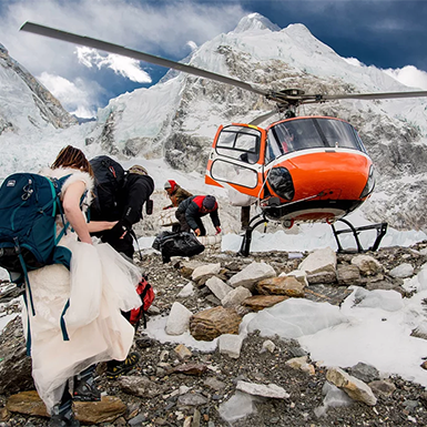
You descend immediately, at least 500 meters below your current altitude. The guide accompanies you. The rest of the group continues with the assistant guide or holds a position. SpO2 monitoring continues throughout the descent. Our Kathmandu office has been contacted, and the helicopter evacuation is on standby.
Severe Symptoms
Confusion, inability to walk without assistance, fluid in the lungs (crackling sound when breathing, persistent wet cough), blue lips or fingertips.
Emergency helicopter evacuation is activated immediately. The guide administers supplemental oxygen if available and keeps you warm and hydrated until the helicopter arrives. You are transported to a medical facility in Kathmandu — typically CIWEC Hospital or Grande International Hospital. Our team coordinates directly with your insurance provider.
Prevention Comes First
The Gokyo Valley route provides natural, gradual acclimatization. You ascend from 3,440m (Namche) to 4,750m (Gokyo) over four days, gaining roughly 300 meters per day — within recommended limits. The dedicated acclimatization day at Namche and the gradual ascent through Dole and Machhermo allow your body to adapt before the high-altitude days at Gokyo Ri, Cho La, and Kala Patthar.
Your guide has full authority to adjust the itinerary if he judges that any trekker needs more time to adapt — adding a rest day, slowing the pace, or holding at a lower altitude for an extra night. On the Gokyo Cho La Pass Trek, safety decisions are final.
Travel Insurance Requirements
Travel insurance is mandatory for the Gokyo Cho La Pass Trek. We verify your policy details during the Day 01 briefing in Kathmandu. If your coverage does not meet the minimum requirements, we will help you purchase an appropriate policy before the trek begins.
Minimum Coverage Required
- Emergency helicopter evacuation at altitudes up to 6,000 meters
- Coverage for high-altitude trekking above 5,000 meters (check your policy wording — some exclude activity above 3,000 or 4,000 meters)
- Coverage for glacier crossing and crampon use (some policies classify this as a “hazardous activity” requiring an additional rider)
- Medical treatment and hospitalization in Nepal
- Emergency repatriation to your home country
Recommended Additional Coverage
- Trip cancellation and interruption
- Trip delay (covers additional accommodation if the Lukla flight is canceled)
- Lost, stolen, or delayed baggage
- Personal liability
Important Note for Cho La
Some standard travel insurance policies cover “trekking” but exclude “glacier crossing” or “use of crampons.” The Cho La Pass crossing involves both. Contact your insurer before departure and confirm in writing that your specific trek — including the Cho La glacier crossing with crampons at 5,368 meters — is covered. If your insurer excludes this, upgrade your policy or purchase specialist adventure travel insurance.
Carry a printed copy of your insurance policy and your insurer’s 24-hour emergency number in your daypack. Store a digital copy on your phone.
Good to Know
Difficulty and Fitness Level
The Gokyo Cho La Pass Trek is rated challenging. It is harder than the standard Everest Base Camp Trek due to the Cho La glacier crossing, two summit mornings (Gokyo Ri and Kala Patthar), and a longer total duration of 17 days. You walk an average of 5 to 7 hours per day across varied terrain, including forest trails, rocky moraines, glacier edges, and a glacier crossing with crampons.
The most physically demanding days are Day 09 (Gokyo Ri summit and trek to Thangna), Day 10 (Cho La Pass crossing), Day 12 (Gorakshep and EBC), and Day 13 (Kala Patthar sunrise and descent to Pheriche). The altitude — not the terrain — is the primary challenge above Machhermo.
Previous high-altitude trekking experience is recommended but not mandatory. If you can hike for 6 hours with a daypack and climb 1,000 meters of elevation in a day, you are fit enough for this trek.
Packing List
The Gokyo Cho La Pass Trek requires the same base gear as the standard EBC Trek, plus additional items for the Cho La glacier crossing. Key items:
Clothing: Moisture-wicking base layers (2–3 sets), fleece mid layer, down jacket rated to –15°C, waterproof windproof outer shell with hood, waterproof trekking pants, trekking trousers (2 pairs), trekking shirts (3–4), warm beanie, sun hat, buff/neck gaiter, UV sunglasses, lightweight gloves for trekking, insulated gloves or mittens for summits and Cho La.
Footwear: Sturdy broken-in trekking boots with ankle support (must be compatible with strap-on crampons), comfortable lodge shoes, 5–7 pairs of warm trekking socks, gaiters.
Cho La specific gear: Crampons (we provide loaners if needed — confirm at Day 01 briefing), gaiters, trekking poles (essential for ice and scree descent).
Gear: 15–20 liter daypack with rain cover, 4-season sleeping bag rated to –10°C (we provide a loaner), sleeping bag liner, headlamp with extra batteries, portable power bank (10,000–20,000 mAh).
Health: Personal medications with a doctor’s letter; Diamox (consult your doctor); pain relievers; blister plasters; throat lozenges; water purification tablets or filter; sunscreen SPF 50; lip balm with SPF.
Documents: Passport with 6 months validity plus 2 copies, travel insurance policy (printed and digital), emergency contact information, and cash in small denominations.
What NOT to bring: Do not overpack. Your porter can carry up to 12 kg. Leave unnecessary items at the hotel in Kathmandu — they store luggage free during your trek.
For a complete item-by-item checklist with brand suggestions, see our full Nepal Trekking Gear List.
Contact Us
Have questions about the Gokyo Cho La Pass Trek? Contact us directly. There is no time barrier — call or message us anytime.
- Phone (USA): +1 315 388 6163
- Phone/WhatsApp/Viber/Telegram: +977 9851 052 413
- Email: sales@peregrinetreks.com
Our team responds within 24 hours. We are happy to customize this trek to match your schedule, fitness level, and preferences.
Frequently Asked Questions
The Gokyo Cho La Pass Trek is a 17-day trekking circuit through the Everest region that combines the Gokyo Lakes, a summit of Gokyo Ri (5,357m), a glacier crossing of Cho La Pass (5,368m), Everest Base Camp (5,364m), and a sunrise climb of Kala Patthar (5,545m). It is the most complete route through the Khumbu Valley — also known as the Everest Circuit Trek — and the only standard itinerary that includes all five major highlights in a single continuous loop.
Yes. The Gokyo Cho La Pass Trek is harder due to three factors: the Cho La Pass glacier crossing (which requires crampons and involves ice), two summit mornings instead of one (Gokyo Ri and Kala Patthar), and a longer total duration of 17 days versus 15 days for the standard EBC trek. Fitness requirements are higher, and previous high-altitude trekking experience is recommended.
Cho La Pass requires respect but is not dangerous when crossed with an experienced guide in good conditions. The glacier section is approximately 200 to 300 meters and requires crampons. Your guide assesses conditions before each crossing and will cancel or delay if snow, ice instability, poor visibility, or wind make the pass unsafe. Falls on ice, usually caused by poor equipment or rushing, are the primary risk. With crampons, trekking poles, and a controlled pace, the crossing is manageable for fit trekkers.
Yes. Crampons are required for the Cho La Pass crossing on Day 10. The glacier section is slippery and dangerous without traction. We provide loaner crampons at no extra charge if you do not have your own. Your guide checks crampon fit during the Day 01 briefing in Kathmandu and again at Thangna on the evening before the crossing.
If conditions make the Cho La crossing unsafe, we reroute the trek. The alternative follows the trail from Gokyo back through Phortse and Tengboche, then rejoins the EBC route at Pangboche or Dingboche. This adds 1 to 2 days but still reaches Everest Base Camp and Kala Patthar. We do not charge extra for the reroute. Your guide makes the final decision on whether to cross.
The Gokyo Cho La Pass Trek costs US$ 2,050 per person. This includes airport transfers, a hotel in Kathmandu with breakfast, the Lukla flight, three meals daily on the trek, guide and porters, all permits, equipment loans (down jacket, sleeping bag, crampons, duffle bag), farewell dinner, and a completion certificate. Personal expenses, travel insurance, Nepal visa, international flights, and tips are excluded. Budget US$ 400–600 in cash for extras.
Fit beginners can complete this trek, but it is rated challenging. Previous high-altitude trekking experience is recommended. If this is your first high-altitude trek, consider the standard Everest Base Camp Trek (15 days, moderate to challenging) or the Gokyo Lakes Trek (13 days, moderate) as an alternative. If you choose the Gokyo Cho La Pass Trek as your first Khumbu trek, commit to at least 14 weeks of physical preparation.
The trek takes 17 days from arrival in Kathmandu to departure from Kathmandu. This includes 13 trekking days, 1 acclimatization day in Namche Bazaar, 1 Cho La Pass crossing day, and 2 days in Kathmandu (arrival and departure). The Lukla flights add 2 travel days to the itinerary.
The best months are October, November, April, and May. October offers the best overall conditions — clear skies, stable Cho La glacier, and peak visibility from Gokyo Ri and Kala Patthar. November is colder but equally clear with fewer trekkers. April and May bring warmer temperatures and rhododendron blooms. March is possible, but snow on Cho La is more likely. We do not recommend June through August (monsoon) or December through February (heavy snow closes Cho La).
Early symptoms include headache, nausea, dizziness, loss of appetite, and difficulty sleeping. Inform your guide immediately if you experience any of these. Our guides carry pulse oximeters and monitor SpO2 twice daily from Namche onward. Mild symptoms are managed with rest, hydration, and medication. Severe symptoms — confusion, inability to walk straight, persistent vomiting, or difficulty breathing — require immediate descent or helicopter evacuation.
Yes. Travel insurance is mandatory. Your policy must cover emergency helicopter evacuation up to 6,000 meters, high-altitude trekking above 5,000 meters, and glacier crossing with crampons. Some standard policies exclude one or more of these activities — check your coverage and confirm with your insurer in writing before departure.
From the summit of Gokyo Ri (5,357m), you see four of the world’s five highest mountains in a single panorama: Everest (8,849m), Lhotse (8,516m), Makalu (8,485m), and Cho Oyu (8,188m). Below, the turquoise Gokyo Lakes stretch north along the valley floor. The Ngozumpa Glacier — the longest glacier in the Himalayas at 36 km — fills the valley between Gokyo Ri and Cho Oyu. It is one of the finest viewpoints in the entire Himalayan range.
The Gokyo Lakes are a system of six glacial lakes in the upper Khumbu Valley, ranging in elevation from 4,700m to 5,000m. They are the highest freshwater lake system in the world and are designated as a Ramsar Wetland site for their ecological significance. The turquoise color comes from glacial minerals. On this trek, you visit the first three lakes on the way to Gokyo village and can explore the fourth and fifth lakes as an optional hike on Day 09.
The Gokyo Cho La Pass Trek crosses one high pass (Cho La, 5,368m). The Everest Three Passes Trek crosses three passes (Kongma La, Cho La, and Renjo La) and takes 18 to 21 days. The Three Passes Trek is significantly harder and recommended only for experienced high-altitude trekkers. The Gokyo Cho La Pass Trek offers many of the same highlights — Gokyo, Cho La, EBC, and Kala Patthar — in a shorter, more accessible format.
Yes. We arrange additional hotel nights at The Everest Hotel or an alternative property. Many trekkers arrive 1 to 2 days early to recover from jet lag or explore Kathmandu. After the trek, extra days allow for sightseeing, shopping, spa recovery, or a day trip to Bhaktapur, Nagarkot, or Patan Durbar Square.
Yes. The Gokyo Cho La Pass Trek is commonly referred to as the Everest Circuit Trek because it completes a circuit through the Khumbu region — ascending via the Gokyo Valley and descending via the standard EBC trail (or vice versa) without retracing the middle section. It covers more ground and more highlights than any other standard Everest region itinerary.
Reviews on Gokyo Cho La Pass Trek
5.0
Highly recommended
Our second experience with this fantastic tour company was truly memorable. From the trek up Kala Pattar, over Cho La, to Gokyo and the ascent of Gokyo Ri with its astounding views, to the beautiful descent down Gokyo Valley – we had a wonderful time! We highly recommend their services and would be delighted to explore Nepal with them again in the future.

Madison Crooke
AustraliaAwesome Trek!
Thanks for the awesome hike, Peregrine! It was really fun and exciting! All the yummy breakfasts with fruit in the mountains and coffee at any altitude, plus the amazing views of nature – that was awesome!
Andrea T. Coleman
United StatesPrefession Team
We recently went on the Gokyo trek, and it was an awesome experience! Our guide was super professional and so helpful. The porter was really friendly and courteous. Every day we were treated to a different, stunning view. The trek was quite challenging, especially crossing Cho La Pass, but we would totally recommend Peregrine to anyone wanting to do it.
Sophie Green
WalesProfessional
I recently had the privilege of experiencing the Gokyo Cho La Pass trek with Peregrine Treks, and I must say, it was one of the most enjoyable trips I have ever taken! I was very impressed with the level of professionalism and expertise I encountered throughout the entire journey.
Paige Hilton
United KingdomGokyo Cho La Pass Trek with Peregrine
If you’re reading this review, it’s obvious that Peregrine Treks did an awesome job. No need to go overboard with praise – they’re already awesome!
Paige Potts
EnglandAwesome
I just went on a Gokyo Chola trek with Peregrine Treks in Nepal, and man; it was awesome! They totally deserve all the good stuff people are saying about them – really impressed.
Alyssa Crombie
AustraliaEasy communication and booking process
I had a blast doing the Kalapathar Gokyo and Chola pass trek with Peregrine treks. They go all out to make sure you’re always safe and comfortable. Pradip was super helpful – available on the phone at any time and super friendly and efficient throughout the entire trip.
Kiara Wentworth
AustraliaPeregrine is the best
I’ve been on three trips with Peregrine now, and each one has been awesome. They really know their stuff – reliable, professional, with lots of experience and safety as their top priority. They don’t miss a beat, taking care of every detail. I’ve seen other companies and guides in action, and I can honestly say Peregrine is the best.
Lea S. Schou
DenmarkRelated Packages
Destination
NepalDifficulty
ModerateGokyo Lakes Trek
US$ 1650
Destination
NepalDifficulty
ModerateEverest Base Camp Trek
US$ 1850
Destination
NepalDifficulty
Moderate to ChallengingEverest Base Camp Trek with Helicopter Return
US$ 2890