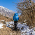
Langtang Valley, located in the heart of Nepal, is a premier destination for trekkers seeking stunning natural landscapes and rich cultural experiences. This region, known for its moderate trekking challenges, breathtaking views, and vibrant Tamang and Sherpa cultures, attracts many adventure lovers. The Langtang Valley Trek Map ensures a successful trek through this enchanting valley.
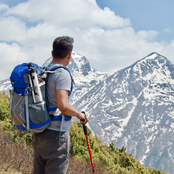
All adventurers intending to trek along Langtang should understand the Langtang Valley Trek Map. The map is thus an important tool for tracing your path, passing through essential places, acclimatizing to altitude changes, and planning daily distances. More knowledge of a gained map will be helpful, enhancing safety and self-trust during trips.
Importance of Understanding the Trek Map for Preparation and Navigation
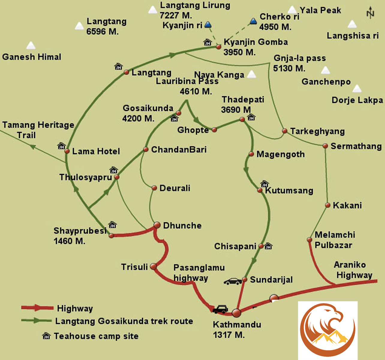
- Route Planning: The Langtang Valley Trek Map offers a comprehensive view of your trek from Syabrubesi to Kyanjin Gompa. Trekkers utilize this map for scheduling their daily hikes, selecting break places, and choosing night stays.
- Altitude Awareness: The map marks significant altitude points for preparing for acclimatization and preventing altitude sickness.
- Key Locations: The map marks critical spots such as Lama Hotel, Langtang Village, and Kyanjin Gompa. These locations provide opportunities for rest and cultural immersion.
- Terrain Information: The map details the trek’s varied terrain, showing areas that may be steep, rocky, or have river crossings. This information prepares trekkers for the physical challenges ahead.
- Distance Calculation: It enables trekkers to measure the precise distances between stops like Lama Hotel and Langtang Village, facilitating effective time management and preparation for each trek segment.

How the Map Helps in Planning, Understanding Altitude Changes, and Identifying Key Locations
- Planning Each Day: A detailed map helps trekkers efficiently plan each day’s travel, showing the distance between each stop and providing a realistic timeline for the trek.
- Altitude Changes: The map displays an elevation profile from Syabrubesi’s 1,500 meters up to 3,870 meters at Kyanjin Gompa, helping trekkers assess and prepare for the climb’s difficulty.
- Identifying Key Stops: The Langtang Valley Trek Map is essential for locating significant landmarks such as guesthouses, villages, monasteries, and scenic points. These marks help trekkers find resting spots and cultural sites to explore.

Overview of Langtang Valley Trek
Nestled in the northern reaches of Nepal and bordering Tibet, Langtang Valley offers one of the most accessible trekking experiences near Kathmandu. This stunning region captivates trekkers with its remarkable landscapes and rich cultural tapestry, combining challenging trails with enriching scenic rewards.
Geographic Location of Langtang Valley
Within Langtang National Park, Langtang Valley showcases a spectacular range of terrains, from verdant forests to sprawling alpine meadows. Trek routes wind through a scenic valley bordered by majestic peaks like Langtang Lirung and Dorje Lakpa. Its proximity to Kathmandu provides a unique opportunity for remote mountain adventures without the extended travel typically required for such experiences in Nepal.
Main Features of the Langtang Valley Trek
- Scenic Views: Trekking through Langtang Valley treats you to awe-inspiring vistas of snow-capped mountains, deep ravines, and glacier-fed rivers. The trek reveals cascading waterfalls, lush bamboo forests, and vast alpine meadows, all under the shadow of imposing peaks.
- Cultural Encounters: The route provides a window into the lives of the Tamang and Sherpa communities. As you pass through villages like Langtang and Kyanjin Gompa, the Langtang Valley Trek Map guides you to significant cultural sites featuring traditional homes, monasteries, and thriving yak pastures.
- Diverse Landscapes: The trek starts at Syabrubesi, at 1,500 meters, and climbs to Kyanjin Gompa, at 3,870 meters. This elevation change introduces a variety of ecosystems, from subtropical woodlands at lower levels to rugged high-altitude landscapes higher up. This diversity supports unique flora and fauna, such as red pandas and snow leopards, noted on the map at crucial points along the path.
Map Layout and Key Features
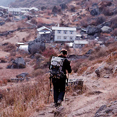
The Langtang Valley Trek Map outlines the complete trail, starting at Syabrubesi and concluding at Kyanjin Gompa. It marks essential waypoints such as Lama Hotel, Langtang Village, and Kyanjin Gompa. This clarity helps trekkers strategize their stops for rest and cultural immersion. The map further details accommodation options like guesthouses and monasteries along the trail.
- Key Landmarks: The map showcases essential cultural and natural sights, including traditional Sherpa and Tamang villages and monastic sites. Strategic viewpoints offer stunning vistas of the surrounding mountains.
- Natural Features: The map marks rivers, forests, and glaciers, aiding trekkers in staying aware of their environment. It also shows critical infrastructure, such as suspension bridges and water sources.
Visualizing the Trek Route
From its commencement in Syabrubesi, the Langtang Valley Trek Map illustrates the route’s progression through various notable points up to Kyanjin Gompa. The trek begins at 1,500 meters and ascends through dense forests to higher altitudinal points.
- From Start to Finish: The map meticulously traces the path from Syabrubesi to Kyanjin Gompa, providing insights into the daily travel segments. The trek is scenic, following the Langtang River and passing through verdant landscapes and rugged terrains.
- Route Milestones: The map divides the trek into manageable daily segments, indicating the distance between significant stops such as Syabrubesi to Lama Hotel and onwards to Langtang Village. This breakdown is crucial for effective trek planning.
Altitude Markers and Terrain Variations
Elevation markers on the map are essential for helping trekkers plan their acclimatization and assess the difficulty of various segments. The trek reaches its highest point at Kyanjin Gompa, at 3,870 meters.
- Terrain Changes: The map details the transitions in the landscape, from wooded areas to mountainous paths, helping trekkers prepare for upcoming challenges. This information is vital for selecting appropriate gear and establishing a comfortable pace.
- Awareness of Altitude: Altitude indicators on the map facilitate strategic planning for acclimatization breaks, which is crucial for mitigating altitude sickness risks. It highlights elevation changes that trekkers will encounter, aiding in their preparation for the physical demands of the trek.
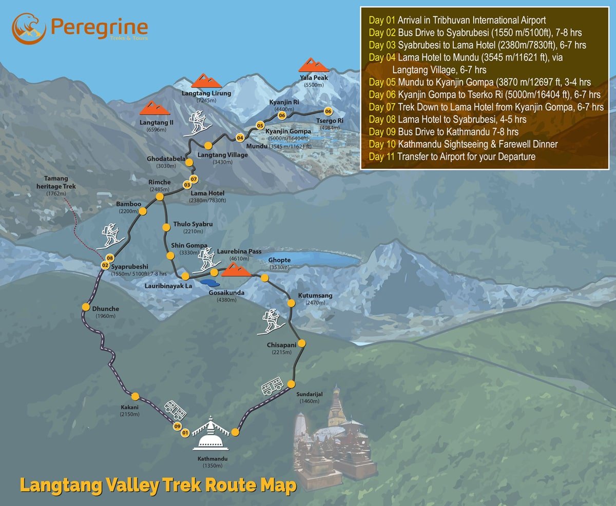
Langtang Valley Trek Itinerary
The Langtang Valley Trek itinerary is an 8-day adventure through one of Nepal’s most scenic regions. This trek provides stunning views, rich cultural experiences, and a route through traditional villages and natural landscapes.
Day 1: Drive from Kathmandu to Syabrubesi
- Distance: 122 km
- Travel Time: 7–8 hours
- Highlights: The trek begins with a drive from Kathmandu to Syabrubesi, a small town located at 1,550 meters. The drive takes you through hilly terrain with views of the Himalayan range. It’s a great start to the trek, offering the first glimpse of the countryside.
Day 2: Trek from Syabrubesi to Lama Hotel
- Trekking Distance: 11 km
- Walking Time: 5–6 hours
- Route Overview: The trek starts with a walk alongside the Langtang River, passing through forests and terraced farmlands. As you ascend to Lama Hotel at 2,380 meters, the trail becomes steeper.
- Key Landmarks: The trail passes through traditional Tamang villages and thick bamboo forests, where you might encounter wildlife, including red pandas.
Day 3: Lama Hotel to Langtang Village
- Trekking Distance: 14 km
- Walking Time: 6–7 hours
- Route Overview: This section of the Langtang Valley Trek route takes you further up the valley to Langtang Village, located at 3,430 meters. The path becomes more open, offering panoramic views of the surrounding peaks.
- Highlights: You’ll trek through rhododendron forests and reach Langtang Village. The 2015 earthquake caused significant damage, but locals have rebuilt the village. It’s a great spot to learn about local culture and enjoy the mountain vistas.
Day 4: Langtang Village to Kyanjin Gompa
- Trekking Distance: 6 km
- Walking Time: 4–5 hours
- Route Overview: The trek from Langtang Village to Kyanjin Gompa is relatively short, but it takes you to the trek’s highest point at 3,870 meters.
- Key Features: The Langtang Valley Trek map highlights Kyanjin Gompa as a significant cultural and scenic destination. The village offers views of Langtang Lirung and other surrounding peaks. Kyanjin Gompa is known for its ancient monasteries and yak pastures.
Day 5: Exploration Day at Kyanjin Gompa
- Optional Trek: Climb to Kyanjin Ri or Tserko Ri
- Altitude: Kyanjin Ri (4,773 meters), Tserko Ri (4,984 meters)
- Highlights: Spend a day exploring the surroundings of Kyanjin Gompa. You can take a short hike up to Kyanjin Ri or Tserko Ri for incredible panoramic views of the Langtang range, glaciers, and the valley below.
Day 6: Trek back to Lama Hotel
- Trekking Distance: 14 km
- Walking Time: 5–6 hours
- Route Overview: Retrace your steps as you trek downhill from Kyanjin Gompa to Lama Hotel. The descent is more accessible, allowing for a faster pace and more time to enjoy the surroundings.
- Key Landmarks: On your way back, you’ll revisit the scenic forests and villages, offering a different perspective on the Langtang Valley Trek route.
Day 7: Lama Hotel to Syabrubesi
- Trekking Distance: 11 km
- Walking Time: 5–6 hours
- Route Overview: The final day of trekking takes you back to Syabrubesi along the same route, with easier descents and gentle paths.
- Highlights: As you return, you’ll have time to reflect on the previous days’ stunning landscapes and cultural encounters.
Day 8: Drive back to Kathmandu
- Distance: 122 km
- Travel Time: 7–8 hours
- Highlights: A scenic drive back to Kathmandu marks the end of the trek. You’ll pass through the beautiful countryside and can reflect on your trek through Langtang Valley.
Practical Advice for the Langtang Valley Trek
- Total Trekking Distance: Approximately 70 km round-trip
- Maximum Elevation: 4,984 meters at Tserko Ri (optional climb)
- Best Time to Trek: Spring (March to May) and Autumn (September to November) are ideal for trekking because of clear skies and stable weather.
- Required Permits: Trekkers need a Langtang National Park entry permit and a TIMS (Trekkers’ Information Management System) card.
Langtang Valley Trek Route
The Langtang Valley Trek route takes trekkers through a spectacular landscape, starting from Syabrubesi and concluding at Kyanjin Gompa. This popular trail offers breathtaking views, cultural experiences, and a relatively moderate trekking challenge, making it suitable for seasoned and beginner trekkers.
Primary Route from Syabrubesi to Kyanjin Gompa
The Langtang Valley Trek Map outlines the primary trek route, beginning in Syabrubesi at 1,500 meters. From here, the trail takes you through a series of traditional villages, dense forests, and scenic viewpoints, leading to Kyanjin Gompa at 3,870 meters. Below is a breakdown of the critical points along the Langtang Valley Trek route.
Syabrubesi to Lama Hotel
The trek starts in Syabrubesi, a small town where trekkers can gather supplies and acclimatize before beginning the trek. From Syabrubesi, the trail follows the Langtang Khola River and ascends through oak and rhododendron forests. After about 5-6 hours of walking, you will reach Lama Hotel at 2,380 meters. Along the way, you can spot local wildlife, such as red pandas and monkeys.
Lama Hotel to Langtang Village
From Lama Hotel, the route continues upwards through forests and open meadows, gradually gaining altitude. After trekking for another 6-7 hours, you’ll reach Langtang Village at 3,430 meters. This village, known for its rich Tamang culture, was affected by the 2015 earthquake but has since been rebuilt. Langtang Village offers insight into local life and features stunning mountain views.
Langtang Village to Kyanjin Gompa
The final stretch from Langtang Village to Kyanjin Gompa is shorter, taking 3 to 4 hours. Kyanjin Gompa, situated at 3,870 meters, is a cultural and religious highlight of the trek. It is home to ancient monasteries and surrounded by stunning views of the Langtang range. The area is a great place to explore nearby landmarks and glaciers.
Kyanjin Ri
The climb to Kyanjin Ri (4,773 meters) offers a panoramic view over the Langtang Valley and nearby peaks for trekkers seeking additional elevation and views. The ascent is challenging but rewards trekkers with incredible views.
Possible Detours or Alternative Routes
Tserko Ri
One of the most popular side treks from Kyanjin Gompa is the ascent to Tserko Ri. This viewpoint, located at 4,984 meters, offers breathtaking panoramic views of the Langtang range, glaciers, and surrounding valleys. You can complete the trek to Tserko Ri in a day, making it ideal for those seeking a high-altitude trekking experience.
Tamang Heritage Trail
For those interested in exploring more of the region’s cultural aspects, the Tamang Heritage Trek offers an excellent detour or addition to the Langtang Valley Trek itinerary. This route explores the rich culture and traditions of the Tamang people, offering homestays in traditional villages. You can experience beautiful landscapes and learn about the local culture.
Langtang Valley Extension to Gosaikunda
Another alternative route for trekkers with extra time is to extend the trek toward Gosaikunda, a sacred lake in the Langtang National Park. This extension adds several days to the trek but takes you through even more diverse landscapes, including alpine lakes and higher-altitude passes.
Langtang Valley Trek Distance and Altitude Insights
Trekkers celebrate the Langtang Valley Trek for its stunning landscapes, moderate challenges, and rich cultural encounters. A solid grasp of the trek’s distance and elevation details is crucial for effective planning and acclimatization. This trek spans roughly 70 kilometers in a round trip and is manageable for those prepared for significant altitude changes.
Total Trekking Distance
The trek extends approximately 70 kilometers, starting and ending at Syabrubesi. The trek typically spans 7-8 days, depending on the itinerary and acclimatization periods. Although shorter than many other Nepalese treks, the elevation gain and diverse terrains necessitate a steady pace from trekkers.
Distance Breakdown:
- Syabrubesi to Lama Hotel: 11 km
- Lama Hotel to Langtang Village: 14 km
- Langtang Village to Kyanjin Gompa: 6 km
- Complete round trip: 70 km
Key Altitude Points
Elevation is a crucial aspect of the Langtang Valley Trek itinerary, which starts at a modest elevation and rises close to 4,000 meters. The adventure begins in Syabrubesi, located at 1,500 meters, and climbs to its apex at Kyanjin Gompa, at 3,870 meters.
- Syabrubesi (1,500 m): The adventure kicks off in Syabrubesi at 1,500 meters, where trekkers often spend their first night gearing up for the trek ahead.
- Lama Hotel (2,380 m): After a day’s trek, participants reach Lama Hotel at 2,380 meters. This stop is vital on the Langtang Valley Trek route for adjusting to the climbing altitude.
- Langtang Village (3,430 m): By day three, trekkers ascend to Langtang Village, perched at 3,430 meters. The altitude challenges physical stamina and emphasizes the need for proper acclimatization.
- Kyanjin Gompa (3,870 m): Situated at 3,870 meters, Kyanjin Gompa marks the trek’s highest point. Trekkers often allocate an additional day here to explore the surroundings and adapt to the altitude before the descent.
Navigating Altitude Changes with the Langtang Valley Trek Map
The Langtang Valley Trek Map is invaluable for trekkers monitoring elevation shifts and planning their trek. It underscores each significant elevation point along the path, assisting trekkers in recognizing where the significant altitude gains occur and when to take acclimatization breaks.
- Altitude Awareness: The map marks elevations at critical points such as Syabrubesi, Lama Hotel, Langtang Village, and Kyanjin Gompa. This feature helps trekkers anticipate the elevation gain throughout the trek and maintain a pace that mitigates the risk of altitude sickness.
- Acclimatization Strategy: The map illustrates potential acclimatization stops, particularly at Langtang Village and Kyanjin Gompa, and guides trekkers in scheduling necessary rest days to adjust to higher altitudes, thus reducing altitude-related health concerns.
- Elevation Gain Monitoring: Detailed altitude markers on the map offer insights into the trek’s varied ascents and more level stretches, preparing trekkers for the physical demands of each section. This preparation ensures a smoother and safer trekking experience.
Key Locations Marked on the Langtang Valley Trek Map
The Langtang Valley Trek Map outlines several important important locations for trekkers. These significant spots, such as Lama Hotel, Langtang Village, Kyanjin Gompa, and Kyanjin Ri, serve as essential rest points, cultural hubs, and scenic attractions. Understanding these points helps trekkers plan their route, acclimatize, and enjoy the trek.
Lama Hotel
- Elevation: 2,380 meters
- Importance: Lama Hotel is one of the first significant stops along the Langtang Valley Trek route. Located about 11 kilometers from Syabrubesi, it is a popular resting point after the first day of trekking. Trekkers stop here to recuperate from the initial ascent and adjust to the increasing altitude. Forests surround the area and offer trekkers a peaceful, relaxing environment.
Langtang Village
- Elevation: 3,430 meters
- Importance: Langtang Village is a cultural highlight on the Langtang Valley Trek Map. It is positioned at a higher altitude and is a critical acclimatization stop for trekkers. The 2015 earthquake severely impacted the village, but builders have reconstructed it. Visitors can interact with the local Tamang community and experience their traditional lifestyle. The views from Langtang Village, including nearby peaks and valleys, are breathtaking.
Kyanjin Gompa
- Elevation: 3,870 meters
- Importance: This combination makes it a cultural and scenic haven for trekkers on their final trek. Kyanjin Gompa is famous for its age-old monastery and yak pastures. Many trekkers stay another day to explore this tiny settlement, visit the old monastery, and appreciate the Langtang range viewed from a distance. Additionally, due to its height, hikers often use Kyanjin Gompa as a significant acclimatization point before they begin their way down again.
Kyanjin Ri
- Elevation: 4,773 meters
- Importance: Kyanjin Ri, a demanding climb, offers breathtaking views and is one of the highest points on the trek. The Langtang Valley Trek Map highlights this location as an optional side trek from Kyanjin Gompa. For trekkers looking to push their limits and experience incredible 360-degree views of the surrounding mountains and glaciers, Kyanjin Ri is a must. The climb is steep, but the view from the top makes it worth the effort.
Challenges and Terrain on the Langtang Valley Trek
The Langtang Valley Trek Map provides a clear picture of the diverse terrain trekkers will encounter along the Langtang Valley Trek route. The trek features a variety of landscapes, each presenting its own set of challenges. From dense forests to alpine meadows, the terrain is as diverse as it is stunning.
Forests: The trek begins with trails through thick oak, rhododendron, and bamboo forests. These sections are relatively shaded and offer excellent trekking conditions, but the paths can be slippery, especially after rainfall.
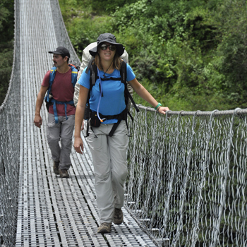
Rivers and Suspension Bridges: Several rivers run through the Langtang Valley Trek route, requiring trekkers to cross suspension bridges. These well-maintained bridges can be nerve-wracking for those unfamiliar with heights or swinging bridges. The Langtang Valley Trek Map marks all major river crossings, helping trekkers prepare for these sections.
Alpine Meadows: As trekkers ascend to higher altitudes, the landscape opens into beautiful alpine meadows. These grassy areas are often flat and provide a refreshing change from the steep, rocky paths below.
Potential Challenges Along the Route
While the Langtang Valley Trek is considered moderate in difficulty, there are several challenges that trekkers should prepare for:
- Steep Ascents: Some trek sections involve steep ascents, particularly the climb to Kyanjin Gompa and optional treks like Kyanjin Ri. These climbs can be exhausting, especially at higher altitudes with lower oxygen levels.
- Rocky Paths: Many parts of the Langtang Valley Trek route include rocky and uneven trails. These paths require careful navigation, particularly when wet or icy. Good trekking shoes with ankle support are essential for these sections.
- River Crossings: Though facilitated by suspension bridges, river crossings can be challenging after heavy rainfall or during the monsoon season. The map helps trekkers plan for these crossings, showing where and when they will encounter rivers.
Best Time to Trek Langtang Valley and Map Usage
The best seasons for trekking in Langtang Valley are spring and autumn. These seasons offer the most stable weather conditions and the best views, making the trek more enjoyable and safer.
- Spring (March to May): Spring is an ideal time for the Langtang trek, as the rhododendron forests bloom with vibrant colors. The temperature is mild, and the weather is relatively stable. The Langtang Valley Trek Map becomes especially useful for locating water sources and camping sites in warmer conditions.
- Autumn (September to November): Autumn provides crystal-clear skies and breathtaking views of the snow-capped peaks. The cooler temperatures make for comfortable trekking, and the weather is more predictable. The Langtang Valley Trek Map can help trekkers avoid any potential landslide areas that may have been affected by the monsoon season.
How the Map Helps with Hazards and Weather Conditions
The Langtang Valley Trek Map serves as a crucial tool for avoiding hazards like landslides or navigating through tricky weather conditions:
- Landslides: Some trek sections, notably lower areas, are prone to landslides after the monsoon season. The map marks these areas, helping trekkers avoid unstable terrain.
- Weather Changes: Sudden weather changes can occur at higher altitudes, particularly in the alpine meadows near Kyanjin Gompa. The map highlights rest stops and shelters where trekkers can take cover in case of sudden storms or snow.
Langtang Valley Trek Map Navigation Tips
The Langtang Valley Trek Map is an invaluable tool for trekkers, helping them navigate the challenging yet rewarding landscapes. Understanding how to read the map effectively will enhance your trek and ensure you remain on the correct path while managing altitude and terrain changes.
Reading the Map: Scale, Symbols, and Altitude Markers
- Understanding Scale: The Langtang Valley Trek Map scale helps trekkers gauge the distance between locations. For instance, if the map indicates 1 cm equals 1 km, you can estimate how far it is from Syabrubesi to Lama Hotel or between other critical points on the Langtang Valley Trek route.
- Symbols and Landmarks: Maps use symbols to represent various landmarks and features, such as villages, rivers, forests, and guesthouses. Recognizing these symbols ensures you can identify crucial spots like Langtang Village, suspension bridges, and rest areas. Ensure you familiarize yourself with the map legend so you can interpret these symbols accurately.
- Altitude Markers: Altitude markers are vital for tracking elevation changes, which are significant on the trek. The map shows elevation points for critical locations such as Kyanjin Gompa (3,870 meters) and Langtang Village (3,430 meters). These markers help you anticipate changes in altitude and prepare for acclimatization, a critical part of the Langtang Valley Trek itinerary.
Using the Map with GPS or Guides
While the Langtang Valley Trek Map provides an excellent overview of the route, using it with other tools like GPS or trekking guides can further improve your navigation.
- Combining Map with GPS: If you have a GPS device, you can use it alongside the map to track your exact position in real time. GPS is handy in less-defined areas or bad weather when visibility is low. Cross-referencing the GPS coordinates with the map lets you stay on the correct Langtang Valley Trek route without missing essential landmarks.
- Hiring a Guide: Though the map offers comprehensive details, local trekking guides can provide valuable insights into the trek. Guides are familiar with the terrain, seasonal changes, and detours. Using the map alongside a guide’s expertise ensures a smoother trek, especially in sections with rugged terrain or river crossings.
Conclusion
The Langtang Valley Trek Map is essential for navigating this stunning trek. It offers clear guidance on routes, distances, and altitude changes. The map highlights critical locations such as Lama Hotel, Langtang Village, and Kyanjin Gompa, ensuring trekkers are well-prepared for the trek’s challenges and rewards.
A reliable map is crucial for any successful trek. It helps you manage elevation, understand the Langtang Valley Trek Distance, and avoid potential hazards. Combining the map with GPS or a trekking guide guarantees you can make the most of your adventure in the Langtang Valley, enjoying its cultural richness and breathtaking views with confidence and safety.