Annapurna Circuit with Tilicho Lake Trek

An essential day for Tilicho Lake in Annapurna Circuit Trek

On day six, early in the morning, we left from Manang to Tilicho Lake. We reached Khangsar and had our breakfast. Then we started moving again and arrived at Shri Kharka and had our lunch there. The closer we get, the more visible and transparent the trial and equally seems more daring and challenging. The adventurous test to Tilicho Lake was full of ups and downs. The route was dangerous as some parts of the area were in a landslide zone but protected by an iron wire fence and stone. After walking for several hours reached Tilicho Base Camp. We took it as our day and rested in the base camp. We had our dinner and gathered near the Furnace, and many people were there. Then we went to the lodge and slept as we had our big day tomorrow — overnight in the Tlicho Base Camp.

On the seventh day, we left base camp at dawn (5 AM), and we were already tired before we reached our destination. There is a place called 21 Ghumti, which was the most challenging part of the trekking. On the way, we saw the Mountains very close to our vision. For instance, we were surrounded by mountains. The route was partially covered by snow. Finally, we reached Tilicho Lake, and we were all overwhelmed. The view was such that we were out of words; everyone started shouting joyfully. We took loads of pictures for the memory, and the view was mesmerizing.

We left quickly as it was windy and we couldn’t stay long. We returned to the base camp tired and joyful that we could reach the Lake. Afterward, we packed our bags and left. We stopped at Shri Kharka for lunch. From Shri Kharka, we moved again and arrived at Yak Kharka that day. That day was the toughest and most memorable. We stayed overnight in Yak Kharka.

On day eight, we had breakfast and moved on from Yak Kharka. We stopped at Fedi for tea and then for lunch in base camp, at the height of 4925 m. we stayed there for the night. We had to cross suspension bridges and Mountain cliffs to reach base camp. The trek from Yak Kharka to base camp wasn’t fair, but we kept it a short distance due to the high altitude. Everyone was tired, and we slept because we had a huge day to overcome tomorrow — overnight in High Camp.

[contact-form-7 id=”6913″ title=”Inquiry From – Blog”]

Mostly awaited day

On day nine, very early in the morning, before sunrise, we moved from basecamp. Today is our most challenging day. Therefore we prepared ourselves from the beginning. At the height of 5416m, we were walking and crossed Thorong La Pass. The moment we crossed the Pass, our heart was overwhelmed. Slowly by gathering ourselves, we continued our journey and reached Muktinath. We went to the hotel, kept our luggage, and freshened up. Hene, We visited the temple and took a bath. The water was cold. The Muktinath temple is a holy place with 108 tap water, and it’s believed that taking a shower in that 108 tap water takes away our sins. Afterward, we returned to the hotel and stayed there for the night.

On the tenth day at Muktinath, it was cold, though we were already at a lower elevation. In the morning, we had our breakfast and moved on. We took the bus from Muktinath to Jomsom. For further information, you can also trek this route without taking a bus. There is a small airport in Jomsom that flies to Pokhara. Then we had lunch in Jomsom and took some rest; after that, we took a bus to Tatopani.

On the way, we were welcomed by the beautiful ancient village of Marfa, the Kaligandaki River, hydro plants, and the excellent views of the mountains. After several hours of driving, we reached Tatopani; we checked in at the hotel and went to the hot spring. The hot spring was excellent at the bank of the Kaligandaki River. We had lunch at the hotel and took a rest for the day. You can directly go to Kathmandu or Pokhara from Tatopani to end the Annapurna Circuit with Tilicho Lake Trek, but we do not want to miss Ghorepani.


An optional trek to Ghorepani under Annapurna Circuit with Tilocho Lake Trek

On the eleventh day from Tatopani, we moved to Ghorepani. The hiking trail was excellent, and we had Nepali Dhedo at Durbindada. Then we carried on our trekking; after 6 hours of walking, we reached Ghorepani. We checked into the hotel and took a rest. We had dinner and stayed near the Furnace for a while. Then we went back to our room- Overnight in Ghorepani.


On day noon, we woke up and walked to see the sunrise at Pooh Hill, which is at a distance of 30 minutes of walk. The view of the sunrise was magnificent. We went to the view tower and had a panoramic view of the Mountain range. After seeing the morning, we returned to the hotel, had breakfast, and started walking to Ulleri. From there, we took a microbus to Pokhara, which can also be trekked. And we stayed in Pokhara for the night in the hotel. In the evening time, we went for a walk at the lakeside and enjoyed the nightlife of Pokhara.

On the thirteenth day, Pokhara, which is a sophisticated city, a luxurious hotel, and a massive facility enriched with natural beauty. Furthermore, loads of entertaining things to do, i.e., zip-flying, paragliding, kayaking, sky-diving, and many more. After enjoying the day in Pokhara, we returned to the capital city after the fight and checked into the hotel.

Nikesh Raj Shrestha

First Time Trekking in Nepal

A white-collar worker shares their experience of his first trekking with childhood buddies.

This is what is trekking is all about. It makes you think in so many different ways. Philosophically thinking, trekking is a great leveler. Regardless of who you are or what you have, you must carry your weight while climbing up the steps. Trekking treats everyone fairly if you can say that. You can’t hide behind money over here, for example. Walk and climb; you must.


▌ By Suraj Paudel

A plan was brewing some six months back. We, a group of five — all childhood friends from the same school, were busy hatching a plan for the Feb-March trekking. Our self-declared guide Bishnu, who, as we later found out, was as clueless about the route as the rest of us other than having the credentials of having seen it on the Google map, decided the route. Birethanti to Ghandruk. Three days of walking. One day to travel by car to Birenthanti and one day to return to Kathmandu. In total, five days.


Preparation time

We started preparing ourselves for the trekking. All of us began to request to leave and buy stuff like jackets, bags, trousers, shoes, etc. Madhukar agreed to take his car, although there was that constant threat of not making it available during the run-up to the last few days to the start of the trek. We were going anyway, if not by car then by tourist bus. Anup was relatively quiet during this period; he is Mr. Know All and Done It All, after all. The same qualities will make him run for his life toward the end of the trek.

Guys started walking days before the trekking started as practice, and the funny thing is Madhukar even injured himself while practicing walking! I also thought I would start walking to increase my stamina, only to push it for the next day until it couldn’t be sold any further. Yeah, you guessed it. I walked for a full zero days. During our trip to Daman, when we walked to Hrisheswor Mahadev temple, I got found to lack stamina. But I consoled myself by thinking I somehow had got better.


Day-1 Kathmandu to Birethanti

After a lot of confirmation from many of our friends, we were only four on the D-day. Hang on. Just as we were about to leave, we got a call from the fifth guy, Sunil, asking us where we were. He was waiting for us at the meeting point, a full one and a half hours later than we had agreed. What was he thinking? Well, we do know what he was thinking, and it will take at least two articles like this to summarize that. Madhukar arranged for his pick-up, and he was with us, ready and excited. We picked up Anup, and we were off to the Birethanti-Ghandruk Trek on the 5th of March.

Madhukar started driving us toward our destination. Things went as smoothly as we hoped for, barring a minor hiccup toward the end of the day. We knew we needed to travel toward Nayapul to take the dirt road to Birenthanti. It was dark and raining. We thought it was a good idea to ask a few people which way to take only for Mr. Know All to tell us not to waste our time on such things and drive until we reach a river. Simple. We did that only to see a huge ‘Welcome to Parbat District’ sign. Anup got quite a few stares. Not that it will stop him from being Mr. Know All in the future, but to take it positively, it added one more district to our ‘been there’ list.

We finally reached Birethanti after asking for directions from a few people. The torrential rain was making a mockery of our decision not to buy a raincoat despite spending thousands of rupees on other stuff. We parked the car in a local hotel to stay there for the next four nights and three days.


Day 2, 3 & 4-Trekking Days, Birethanti to Banthanti

Day 2 started with us trying to respond to our error by buying plastic sheets to work as makeshift raincoats. Breakfast, and then we were off. As directed by our guide, Bishnu, we decided Tikhedhunga (1525m) would be our first stop for lunch. So we started climbing. Easy route, not much of a stiff climb until we reached close to Tikhedhunga. Beautiful sceneries along the way, which we thoroughly enjoyed.

It was supposed to be our most challenging day of the trek as per Bishnu, and he once was so right. We sensed what was about to come once we reached closer to Tikhedhunga and had to climb up the steps for a short while. We had our lunch there, and the greatest entertainer in his mind, Sunil, decided it was time to entertain the guys and us with his s remix singing. He has a good voice, though; we were del; although not as much as he was. Or let’s say he was ‘freaked out’ to use his own words.

Next target, Ulleri. The very reason this was supposed to be our most challenging day and the dreaded climb up the steps. Whole 3200 of them and almost 90 degrees. We could see it coming as we left Tikhedhunga, and then we were there. At first, our attitude was what the fuss is all about. We do it friendly and relaxed. By the end, after taking a countless number of drinks became quite clear what the fuss was all about. Even the horses were struggling to climb that. I was left questioning my wisdom of inviting unnecessary trouble in my life as if there were not enough already.


Then we were there; at Ulleri (2070m). Yes! Tea time. Anup was busy taking pictures and telling us things that did not matter there, or anywhere for that matter. Madhukar was too tired even to contemplate what was going on. Bishnu had a massive grin on his face as if he was the first and only person to climb up the steps of Ulleri. Sunil was busy and at the pain in trying to make his two new Greek friends understand how he was a self-made man and how well settled he was. The rest of the time, he was busy telling us how that place is his ‘Sasurali’ as it was the place of Gurungs, the same ethnicity his wife belongs to. If only he could get even a little discount because of that.

But as Day 4 will tell us, myself and Anup should be the last persons to talk about getting discounts because of the self-declared relations. After having tea and hot momo at Ulleri, we decided to walk for a couple of hours more and stay at Banthanti. We were walking again. But the consolation lied in the fact that Ulleri was done and not much of wooden steps after that. We reached Banthanti and took the hot, took what we wanted to so badly, and got ourselves,s ready to play cards. We order a fried chicken as well for a starter. Four of us started playing cards, and Sunil was at his usual best, singing and entertaining.


Banthanti-Ghorepani (2775m)-–Poon Hill (3210m) – Deuraali (3000m)

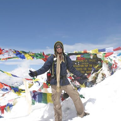
Day 3 was all about Poon Hill. It was about reaching there and viewing those beautiful mountains. If only things turned out as we thought. We arrived at Ghorepani without much hassle at noon, put our bags in the hotel, and decided to take the next stiff climb up the steps towards Poon Hill. Sunil’s knee was giving him problems, so he decided to miss the mountain view from Poon Hill and if only we had done the same. We had our lunch ordered for about an hour and a half later, and we were off to Poon Hill. Similar to Ulleri climb in design but not in length, this was another challenging part of the trip. The second most difficult after Ulleri, they said. By now, I had prepared my routine to climb these steps. I didn’t look up; I just looked and started taking step by step and thinking about some of the most useless things in the world. And it worked. After a few photographic sessions, we were at Poon Hill. It took us about 50 minutes to get there. During the whole trip, a couple of guys probably stopped more for taking photographs than walking. I will not take Anup’s and Bishnu’s name here. It is not fair. Poon Hill and not a mountain to be seen on any side as the weather was not good. Climbed 3210 meters for nothing. ‘Bad luck, we said. I came down thinking we should have come here in the morning. We had our lunch at Ghorepani.


Anup, Bishnu, and Sunil got into their musical mode after lunch. Singing and playing musical instruments happened nearby the fireside. It started raining a bit. Then more heavily. The initial plan by Bishnu was to stay at Ghorepani, but we had done so well so far, we thought we could easily walk for at least two more hours and make our last day of walking a bit easier. The rain subsided, and there was just a tiny drizzle going around. What do we do? Vote, of course. We live in a democratic country. It was tied at 2-2, Sunil and Anup voting in favor of walking further and Madhukar and Bishnu against it. My vote went for walking, although very conscious of the fact that there will be some real payback by the losers if it were to rain somewhere in the middle. It did not.

We reminded the losers about the ‘wise’ decision we took along the way. Before that, there was a small matter of climbing up the steps again after a couple of hundred meters from Ghorepani. Sunil counted it to be around 800 of them. But this was no Ulleri, and all five of us completed those steps without any break. Sunil and Anup both have excellent stamina. They were quick to climb that. By now, we were climbers! We reached Deuraali after walking for about two hours and decided to stay there. We were told there is a tower similar to Poon Hill called Gurung Hill, and we can see the mountains as clearly from there as we could from Poon Hill. According to locals, the altitude for both is the same. It was cold. Very cold. It was going to be the most challenging night of our trekking. No warm water to take a shower, and we could not even think about cold water.


We did enjoy our regular round of cards and fried chicken with it nearby the fireside. We also had our meal, although going away from hearth to the dining table was one challenging task due to the cold weather. It turned out to be the most challenging night for us. Only a single toilet inside the cottage and then the water did not come through the tap. The reason, it was so cold the water froze in the tank. Could not go to toilets outside as there were two dogs — dogs technically but tigers practically, such as their size — left freely outside the cottage for security. We had no option but to wait for the morning.


Deuraali-Banthanti (2800m)-Tadapani (2750m) – Ghadruk (2000m)

Day 4 and a fine morning it was. Bishnu and Sunil decided to climb up the Gurung Hill to see the mountains at around 5 am. Madhukar and I were looking at each other, and we decided Poon Hill was enough. But after a while, we came out in the cottage yard, and we could see those mountains. We again looked at each other, and this time made the wise decision of going up the hill. Anup is not a morning guy and loves to sleep all morning, but this time decided to join us. After climbing up the hill, we were at Gurung Hill. This was it. We could see all the mountains so clearly. You don’t get those kinds of views very often in your lifetime; I can vouch for that—finally, a reason to cheer at Deurali after all the hardships we had that night. We came down and continued our journey. This on paper was supposed to be the most accessible trek day. It was for three of us.
First, we decided to have breakfast at Banthanti, there are two places named Banthanti on either side of the Ghorepani and started walking down at around 7 am. Reached Banthanti, where our Mr. Know All guy, Anup, decided to ask the surname of the lady running the hotel. Her surname happened to be the same as Anup’s and mine, and in no time, there was this self-declared relationship of brothers and sisters by Anup. Result? She took us for cleaners. We ended up paying a lot more than what we believe we actually should have. Her logic? ‘Think it as a gift to your sister,” she said jokingly, and she even dared to complain about us complaining! So much for telling Sunil, he could not get a discount at his ‘Sasurali’ at the earlier Banthanti.


Tadapani next. We were scared by a lot of people that it is a stiff climb again for about 45 minutes, similar to Ulleri but less in terms of length. Yet this was no Ulleri. We climbed up to Tadapani very quickly, wondering whether those people got it wrong or we suddenly turned into brilliant climbers. We took lunch at noon. The next stop was Ghandruk, and it was all downhill from Tadapani. This is why we decided to have longer than usual lunch break and even had the time to play cards for a while. Madhukar, Bishnu, and I decided to climb down the hill for Ghandruk at around 2 pm, whereas Anup and Sunil decided the remaining part was too easy to be bothered about at that time and hence started mingling with their latest European friends. After a while, we reached a place that had two trails leading downwards. We decided to ask and then started taking the suggested path toward Ghandruk, although both led to Ghandruk. Anup and Sunil were nowhere to be seen.

We then met the European guys they were having fun with and asked them where our friends were, and they replied that they had left for Ghandruk before them. We got a little worried at this point but had no other option but to walk down. Then we got a call from our guys, saying they are in the middleware nowhere and had not seen a single person for almost an hour and a half. What happened, as we knew later, was Mr. Know All decided it wasn’t worthy enough to ask which trail to take when they came up to those earlier mentioned two trails and started walking through the path not in use anymore. They could see nothing other than jungles. They thought they were lost and ran for their lives for almost 20 minutes, fearing the worst. We asked a local boy, and he told us that the old trail leads to a bridge, and if they crossed that, they would join us in the new trail. Message relayed. Then it started to rain. It takes about 40 minutes to walk. We took out the plastic sheet we had purchased on Day 2 and made full use of it. It rained heavily just before we reached Ghandruk, but by then we could already see our lost friends and the hotel we were going to stay at. Similar routine. Hot shower, cards, and fried chicken. Mealtime and the time to hit the bed.


Ghandruk-Pokhara-Kathmandu

Day 5 was about getting to the car and driving to Pokhara and then to Kathmandu. First, we had a photo session with those fantastic mountains as a beautiful backdrop to even more beautiful Ghandruk village and then walked through Ghandruk village for about an hour to reach a bus park at the bottom of the village. Again there were two trails in the way, only for Anup to shout to a faraway woman asking for which trail to take. Lesson learned. We reached the bus stop, took the bus, and reached the hotel where our car was parked. The rest of the day was spent in Pokhara doing standard stuff that one does in the city centre and at about 9:30 pm, after playing cards and enjoying pizzas and other stuff courtesy of Sunil, we decided to drive back toward Kathmandu. I drove until Malkehu from where Anup took over for a couple of hours until we reached Kathmandu at 4:15 am. Madhukar, the Sahuji, just relaxed in the car this time.


My conclusion

Trekking can be frustrating at times. There will be days or at least times when you feel you will never do it again. Climbing up the Ulleri made some of us feel like that. When coming down from Ulleri, we did not know whether to feel happy because it gave us respite from climbing up or feel frustrated that we had to come down after climbing up with so much difficulty fully conscious of the fact that we will have to climb up again. Why can’t there be a straight line from the highest point we have reached used to be our question?

But then, this is what trekking is all about. It makes you think in so many different ways. Philosophically thinking, trekking is a great leveler. Regardless of who you are or what you have, it would help if you carried your weight while climbing up the steps. Trekking treats everyone fairly, if you can say that. You can’t hide behind money over here, for example. Walk and climb; you must. Practically speaking, from my own experience, I can say that trekking overall is a great experience. It allows you to be oblivious to the happenings around the world. In those three days of trekking, we did not worry about anything going on inside our country or outside of it. It did not matter whether or not there was a fuel shortage; it did not matter whether or not there were political protests, nor did it matter who was leading the Premier League or who was going to win the upcoming T20 World Cup. It did not matter what was happening around Europe or in the US presidential elections. For once, we did not have to worry about all those suffocating pollution here in Kathmandu. It feels even more special now, looking back.

We were in the lap of nature and were thoroughly enjoying it without any worry in the world other than when the next stiff climb is coming up. Another plan is brewing up again.

Pokhara and the Mountain Views

Prominent explorers, travel writers, and travel guide publications have placed Nepal’s second most popular destination, Pokhara, among some of the most beautiful places in the world. Swiss geologist Tony Hagen, who traveled 14,000 km across Nepal, including remote areas, on foot for over 12 years, wrote: “Nowhere in the world can the highest mountain reaching 8,000 meters level be admired from the tropical lowland without any intermediate mountain ranges. Pokhara and the Mountain Views is one of the most extraordinary and beautiful places.” Hagen contributed significantly to promoting Nepal to the outside world in the 1960s. Col Jimmy Roberts, founder of the trekking industry in Nepal in 1963, once told this scribe that “Pokhara is the most beautiful valley and a nice place to live.”

Pokhara, situated at an altitude of 827 meters, is a favored tourist destination among the three most visited places in the golden triangle — Kathmandu, Pokhara, and Chitwan. Pokhara is a gateway to some of the best trekking trails in the world, a center of adventure tourism, and a garden of seven lakes.

Buddhist monk Ekai Kawaguchi, the first Japanese visitor to Nepal who arrived in the country in 1899, wrote in “Three years in Tibet”: “I saw no scenery so enchanting as that which fascinates me in Pokhara in all my travels in the Himalayas.

Kawaguchi visited Tsharang, Tukuche, and Marpha in Mustang via Pokhara during his visit to Nepal.

Pokhara

Pokhara, which lies 200 km west of Kathmandu, attracts many domestic and foreign tourists yearly. Paragliding, ultra-light flight, mountain flight, rafting, kayaking, boating, fishing, mountain biking, and trekking are some of the tourism products the city has offered travelers for a long time. Besides Phewa Lake, the Lake Side area, Seti River, Devi’s Fall, caves, temples, and monuments, Pokhara is the only place in Nepal where you can enjoy the beautiful natural scenery and the world’s highest mountain range from Dhaulagiri in the west to Manaslu in the east.

As the valley is between the Greater Himalayas and Mahabharat range in the central region of Nepal, Pokhara has remained the most sought-after place for trekkers and mountaineers since the French mountaineer Maurice Herzog successfully reached the summit of Annapurna-I (8091 m) for the first time in 1950. Among the 14 highest mountains of the world above 8000 meters, eight lies in the Nepal Himalayas, and three of them — Annapurna, Dhaulagiri, and Manaslu can be viewed from Sarangkot in Pokhara.

Situated at an altitude of 1590 meters from sea level, Sarangkot sits on the ridge north of bewitching Phewa Lake. It is a popular hill station to watch the sunrise and breathtaking views of the western Himalayas of Nepal. The place offers perhaps the closest view of Mt Machhapuchhre (6997m), popularly known as the Fishtail, which looks like the Matterhorn of Switzerland. From Sarangkot, visitors can enjoy the natural beauty of Pokhara Valley and other adventure activities like paragliding, zipline, and bungee jumping, and a scenic view of World Peace Pagoda on the other side of the hill across the Fewa Lake.

Annapurna Range, which stretches for 55 kilometers in the Himalayas, is home to many tall peaks like Annapurna South (7219m), Annapurna I (8091m), Annapurna III (7555m), Annapurna IV (7525m) and Annapurna II (7937 m). Annapurna, translated from Sanskrit as ‘Goddess of Harvest’ and ‘rich in sustenance,’ opened a new vista in the mountaineering history of the world when members of a French expedition — Maurice Herzog and Louis Lachenal — climbed the mountain on June 3, 1950.

Besides tall peaks, the region is home to numerous trekking trails like Annapurna Circuit, Annapurna Sanctuary, Jomsom-Muktinath, Ghorepani-Poonhill, and Sikles, Mardi Himal, Upper Mustang, Manang, Dhaulagiri Circuit, Dolpa, and Dhorpatan. These trails attract thousands of trekkers every year. Nature lovers can view and experience spectacular mountains, the deepest gorge of the world in Kali Gandaki, Thorung La Pass (5416m), beautiful Gurung villages, unique cultural diversity of ethnic communities, Himalayan biodiversity, memorable homestays, and community-based tourism products, among others.

The number of trekkers in the Annapurna Circuit is increasing with every passing year despite road construction on many trails such as Nayapool-Ghandruk, Beni-Mustang, and Besisahar- Manang. One hundred twenty-nine thousand nine hundred trekkers visited the Annapurna region, 4439 in the Manaslu area, and 2,862 in the Mustang trek in 2013.

Machhapuchhre (6993m), with its Fishtail shaped silhouette, is another major attraction of the Annapurna region. It is also called the ‘Matterhorn’ of Nepal. Matterhorn (4478 m) is the most challenging climb and the most-photographed mountain in the world. Like Matterhorn, Machhapuchhre, which lies 28 kilometers north of Pokhara, is also one of the most photogenic mountains in the world with its twin-headed beautiful peaks. An unsuccessful attempt to climb Machhapuchhre was made in 1957 by a British team. Machhapuchhre is considered sacred by the locals and closed for mountaineers.

Annapurna Base Camp trek is one of the popular trekking trails that begin from Pokhara. The trail starts with a drive to Nayapool and progresses through Syaulibazar, Ghandruk, Tadapani, Chomrong, Bamboo, Machhapuchhre Base Camp (3700 m), and Annapurna Base Camp (4130m). It returns to Pokhara from Dhampus.

Machhapuchhre Model Trek is the recently developed trekking trail. It lies within the Annapurna Conservation Area (ACA) — the largest protected area of Nepal. Travel entrepreneurs have recently explored a new trekking route called ‘LOLUPERA,’ which links Lo Manthang of Mustang with Lumbini and Fewa Lake with Rara Lake. The trail is said to be crucial for developing and diversifying the tourism industry in the country’s western region.

Mount Dhaulagiri (8167m) – This is the seventh highest mountain in the world; it is a mound-shaped mountain seen from Pokhara. Dhaulagiri, also known as the ‘white mountain,’ is the most challenging and complex mountain in the western Himalayan range. There are five other mountains west of the main summit of Dhaulagiri. Their height ranges from 7,250m and 7,750m. They are jointly known as Dhaulagiri. The Dhaulagiri trekking trail starts from Beni and passes through Babiyachaur, Dharapani, Muri, Bagar, Dovan, Dhaulagiri Base Camp (4,650m), Dhampus Pass (5,250m), Yak Kharka, Marpha (2,665m), Jomsom and Pokhara.

Similarly, Manaslu (8163m), the eighth highest mountain in the world, is the other mountain peak that can be viewed from Pokhara. It lies 64 km east of Annapurna between the Gorkha and Manang districts of western Nepal. Since the first successful ascent of Manaslu Toshio Imanishi of Japan and Sherpa Sardar Gyaltsen Norbu of a Japanese expedition on May 9, 1956, many Japanese mountaineers have reached the summit. Of Manaslu, also known as ‘Mountain of the Soul.’ Manaslu Trek is perhaps the best way to enjoy the beauty of this unspoiled area.

The western region of Nepal has numerous tourist attractions due to its geographic and climatic variations to cultural diversity. Pokhara, a significant trekking hub and a gateway to the Annapurna region is a ‘must-visit place in Nepal for travelers from different parts of the planet. Though around 700,000 foreign tourists visit Pokhara annually, promoting the region to attract more tourists from traditional and new markets is necessary.

The planned promotion of Pokhara and the western Himalayas could attract thousands of globetrotters to visit ‘Paradise Pokhara,’ and it will lengthen the average stay and expenditure of the backpackers visiting Nepal. A visit to Nepal is incomplete without traveling Pokhara valley and adjoining areas, and ‘once is not enough to explore the natural beauty, cultural diversity, old traditional hospitality of the western region.

Mardi Himal Trek : A classic short trek in the Annapurna Region

First Day in Mardi Himal Base Camp Trek

The trek begins with a drive to Kande (1710m) from Pokhara. From Kande, it continues toward Australian Camp (2060 m) and Pothana before reaching Pitam Deurali – the first day’s destination. The first pit stop of the day, Australian Camp, offers a mesmerizing view of the dense forest below, picturesque Pokhara valley, Fewa Lake, and the adjacent hills in the south and the famous Annapurna Range to the north. The Camp is also a popular hiking destination because of its proximity to Pokhara.

It is popular among visitors because of the mesmerizing views it offers. Before reaching Pitam Deurali, the trek from the Australian Camp passes through Pothana. This small village has few houses, and visitors here can experience the homestay facilities that the village provides. From Pothana, the trail climbs through a dense forest. It takes three hours to reach Pitam Deurali from Pothana. The view of the sunrise from Pitam Deurali is something not to miss.

Second Day of the Trek

The destination for the second day is Mardi Viewpoint. Trekking on this day takes you to various places along the trail. The first place is Forest Camp (2600m), which can be reached after a trek of about five hours from Pitam Deurali, passing through a dense forest. The forest along the way gets so dense in some places that it looks completely dark. The view of sun rays piercing through the dense forest makes the trip even more soothing. Forest Camp can be an ideal place for lunch. The Camp is surrounded by dense jungle with few lodges and a volleyball ground.

After lunch and a brief rest, the trail leads to Low Camp. It takes around three hours to reach Low Camp from Forest Camp. Mountain ranges become visible again from Low Camp.  Mardi Himal and the famous Mt. Machapuchhre can be seen close by. After catching a beautiful view of the mountains, the trail continues further toward Viewpoint (2090 m). It is an ideal location for a night stop. There is only a lodge evenly. A lodge can accommodate more than twenty people at a time. Sceneries from the Viewpoint are fantastic. Annapurna and Machhapuchhre can be seen at close distance, and the view of the mountains in the clear night sky is mesmerizing. Like its name, Machapuchhre gives the view of a fishtail, and if the sky is clear, the mountains resemble shining pearls because of moonlight.

The Viewpoint also offers a mesmerizing view of the sunrise. The first rays of sunlight on the mountains bring out the golden shades of the mountain. Watching the change in colors of the mountain here can be equally eye-catching.

The third day

From here, the trek continues to Badal Danda (3100 m.). It takes about four hours to get there. The trek to Badal Danda offers breathtaking views of Ghandruk, Chhomrong, Landrung, and Ghorepani villages. We can see Modi Khola Valley leading up into the Annapurna Base Camp. From Badal Danda, the forests along the way are left behind, and the only things visible are the surrounding hills and rocky boulders. A walk of around two hours from Badal Danda will take us to High Camp (3550 m). During the walk, the dense forests transform into hills with mosses and lichens, tree ferns, and orchids. Dancing clouds, Pokhara valley at a far distance, and the view of the mountain ranges from here are equally rewarding.

The fourth day

The fourth day of the trek takes us to the Mardi View Point (4200 m) after an uphill walk of around two hours. The Viewpoint offers an astonishing view of the Mardi Himal and other adjoining peaks. From here, the trek continues toward the Mardi Himal Base Camp (4510m). The views along the trails are equally fantastic. Annapurna South and Machhapuchhre seem so close that they can be touched. The base camp offers a fantastic view of Mardi Himal and other peaks adjoining Mardi Himal. The day can be spent exploring the Mardi Himal Base Camp. As there are no lodging facilities, you will have to return. It takes three hours to reach the high Camp and another two hours to reach Badal Danda. The lodge’s availability and proper food are best for reaching Badal Danda on the day.

On the fifth day, the trek passes through the Viewpoint and Low Camp, following the newly built trail descending to Siding (1800 m). Siding is a beautiful village with excellent homestay facilities. You can spend a night here and experience local culture and hospitality, or take a two-hour drive to nearby Lwang village.

Lwang village also has a 150-meter waterfall, which is popular among canyoneers. Lwang is a Gurung settlement and is one of the few places in the area where you can see a tea garden. Almonds and coffee are also grown here. The village also provides a home stay facility, and you can experience local culture and hospitality.

It takes around two hours to reach Pokhara City from Lwang village. If you think trekking to the famous Annapurna region is too mainstream and want to get away from the crowded and commercialized place, trekking to the Mardi Base Camp can be a perfect alternative for the highly regarded Annapurna trek.

Tale of the first ascent of the world’s highest peak

Kanchha Sherpa, the last surviving member of the 1953 British Everest Expedition shares his memories of the successful ascent.

— By Rajiv Joshi

Well, George, we knocked the bastard off!

Sir Edmund Hillary told his friend George Lowe while returning from the first-ever ascent of Mt Everest in 1953. Though discovered as the highest peak on earth in the 1850s, Mt Everest was relatively unknown to many people. The successful summit, however, made Mt Everest famous worldwide.

Attempts to climb Mt Everest, however, had begun in the 1920s. Various expeditions were organized from the northern side as it was difficult to obtain a permit for foreigners from the Nepali side. When Nepal opened its borders to foreigners in the 1950s, expedition teams started attempting the mountain from the southern side. In 1950, a small group led by a British, Bill Tilman, undertook an exploration trip to Mount Everest.

The team developed a standard route to Everest via the south col. Next year, another British expedition led by Eric Shipton traveled to Nepal to survey a new route via the south face. The exploration teams at that time identified various routes from the Nepali side. But the only one they considered feasible was taking the route via the Khumbu Icefall, Western Cwm (a broad, flat, gently heaving glacial valley basin at the base of the Lhotse Face of Mt. Everest), traversing to the South Col.

In 1952, members of the Swiss expedition team made two attempts on Everest in spring and autumn. Two members of the spring team — Robert Lambert and Tenzing Norgay Sherpa — reached the record altitude of 8,510 m. on the southeast ridge. They had to retreat because of the unsettled weather conditions. A year later, Tenzing Norgay, now with the British expedition, and Sir Edmund Hillary reached the summit of Mt Everest.

Darjeeling, in 1952 with his friends at the age of 19 to search for some work, returned to the Everest region a year later as part of the British Everest Expeditions. “We headed straight to Tenzing’s house. As Tenzing knew my father, he allowed me to stay with him,” Sherpa shared at his home in Namche Bazaar some months ago. “I helped Tenzing with household chores.”

Before meeting Tenzing, Kanchha had no idea that Mt Everest, which locals knew as Chomolungma, was the highest mountain in the world. “I was happy to know that the highest mountain in the world is in our backyard and that foreigners were planning to climb it,” he added.

Tenzing, a Sirdar of the British expedition, included Kanchha in the team. “I was both surprised and happy,” he added.

It is tough to travel to Kathmandu these days. Tenzing and Kanchha, and eight other Sherpas walked to Kathmandu from Birgunj. They stayed in Kathmandu for two weeks. Kanchha first met Hillary in Bhaktapur.
“He was the first foreigner that I met. I had not seen any foreigners before that. I had only heard that they were red-haired and white-eyed. I was surprised to see that tall man (Hillary),” Kanchha shared.

After the equipment arrived, a jumbo team of 400 people, 15 expedition members from England and New Zealand, and 20 Sherpas and porters trekked to Namche via the Dolalghat-Risingo-Chitre route. “It took 16 days to reach Namche from Bhaktapur,” said Kanchha.

It was the ninth British expedition led by Col. John Hunt. The expedition was organized and financed by the Joint Himalayan Committee. The team comprised Britishers Charles Evans, George Band, Tom Bourdillon, Alfred Gregory, Wilfrid Noyce, Griffith Pugh, Tom Stobart, Michael Ward, Michael Westmacott, Charles Wylie; New Zealander Edmund Hillary, George Lowe, and Nepali Tenzing Norgay and Sherpa Annullu. James Morris, a correspondent of The Times newspaper, also accompanied the team.

“At that time, supplies were cheap, but money was scarce. The daily wage of Rs 8 (US$ o.7 cents) in silver coins was a big thing for us. We were also provided good gear, but it wouldn’t fit,” said Kanchha.
It took the team about a week to find the appropriate trail in the Khumbu Icefall. “Supplies were running out at the time we reached the Icefall. It was not as easy as it is today. Everything had to be built, even the bridges,” Kanchha shared.

The team fell ten trees in Namche Bazaar and carried the lumber to the Khumbu Icefall to build a wooden bridge over the crevasse. “It was the toughest part. We were terrified when crossing the bridge. But after crossing the bridge, the trail was easier,” he added.
Tenzing and Hillary got the opportunity to climb Everest only after the first choice pair, Bourdillon and Evans, returned unsuccessfully, said Kanchha. Tenzing and Hillary started on May 28 and reached the summit a day later, he added.

The record-making duo spent only about 15 minutes at the summit. Hillary took the iconic photo of Tenzing posing with his ice-ax. Additional photos were taken looking down the mountain as proof of the successful ascent.

Le trek au Haut Dolpo

Dolpo est une des destinations plus intéressantes pour le trek au Népal pour de nombreuses raisons. Avec une superficie de 7889 kilomètres carrés, il est le plus grand district du Népal, et pourtant l’un des plus faibles densités de population. Il est riche en nature, il contient le lac le plus profond du Népal, le lac Phoksundo , qui est aussi le lac plus profond du monde de la haute altitude. Dolpo est parmi quelques districts qui se trouvent derrière la chaine d’Himalaya, l’abri de la mousson il pleut très peu. Les paysages sont désertiques.

A cause du climat rustique et des hautes montagnes la région est une des régions plus sauvage au Népal et pourtant le paysages sont fascinants. Il y a peu de gens qui vivent ou voyagent dans cette région. Une grande partie de Dolpo est réservé demande une permission spécial pour pouvoir entrer qui favorise la préservation de la culture unique du Dolpo.


Le village Dho Tarap est une habitation à l’ altitude la plus élevée dans le monde. Le monastère Shey Gumba est le plus important monastère du Népal. Dolpo est riche en flore et la faune aussi. On peut observer des animaux sauvages. Mouton bleu , ghoral , et même des guépards , et de nombreuses autres espèces. Dans Haut Dolpo il y a des plantes médicinales qui sont rares comme Yarsagumba (une demi plante exotique, mi-animal qui est considéré comme un puissant aphrodisiaque) Jatamasi , Panchaunle , Chimailo , et bien d’autres . Chaque année, en mai et Juin, le parc national de Shey Phoksundo ouvre ses portes aux chercheurs d’ Yarsagumba .


Mars à Septembre est le bon moment pour faire du trekking dans cette région. Après Septembre, il commence à neiger, et le trekking est possible seulement avec un bon équipement. De Novembre il est déconseillé de faire le trek. Le meilleur moment est de Mars à Mai, car il peut pleuvoir en Juin et Juillet.


Les moyens de communication dans la région sont très difficiles à obtenir. Les téléphones satellites fonctionnent partout, mais ils sont coûteux. Les réseaux nationaux de communication ne fonctionnent pas bien ici. Le trek commence officiellement à partir de l’aéroport de Ranjha , un petit aéroport au-dessus de la ville de Juphal et se termine à Juphal.

Haut Dolpo Iitinéraire

Journée 1 Kathmandu-Nepalgunj

Conduite ou vol jusqu’à Nepalgunj.Hôtel


Journée 2 Juphal-Chhepka         

Trek jusqu’à Kagbeni environs 3 heures. Pause déjeuner à Kagbeni et on continue jusqu’à Chhekpa via Sangta. Lodge/Sous la tente


Journée 3 Chhepka-Chunuwar

Trek jusqu’à Rechi environs 4 heures passant par Dhane et Kiptarung. Après le déjeuner à Rechi on continue jusqu’à Chunuwar en suivant la rivière Phoksundo et la fôret dense. Nuit à Lodge/ Sous la tente


Journée 4 Chunuwar-Ringmo

Trek d’environs 2h30 jusqu’au tour d’observation d’où on peut profiter une vue spectaculaire de cascade de Phoksundo. Une montée pour apercevoir le lac. Une descente d’une heure jusqu’au village Ringmo. Nuit à Sous la tente


Journée 5 Ringmo-Ruktang

Trek jusqu’à Choklapuk. Le début d’haut Dolpo commence aujourd’hui.Le village Ringmo est la frontier entre Haut et Bas Dolpo.. Nous arrivons à Choklapuk en traversant les montagnes et forêt pendant 5 heures.Déjeuner à Choklapuk on continue jusqu’à Ruktang. Nuit à Sous la tente


Journée 6 Ruktang-Base Camp

Nous portons notre piqnique et continuons le trek jusqu’à campe de base en passant par plusieurs cascades qui se jettent dans la rivière.Nous traversons plusieurs fois la rivière. 6h pour arriver au campe de base. Nuit à Sous la tente


Journée 7 Base Camp- Shey Gompa

Nous portons la piquenique pour la journée et continuons vers Shey Gompa, le plus grand stupa du Népal. La journée cruciale car nous passons un col le plus haut du circuit.Piquenique en route. Environs 7 heures de trek jusqu’au Base Camp. Nuit à Sous la tente


Journée 8 Shey Gompa-Saldang

Trek jusqu’au petit village Namjung, 7 heures de trek. Déjeuner à Namjung et on continue jusqu’à Saldang, 4 heures de trek. Autre option s’arrêter à Namjung. Nuit à Sous la tente


Journée 9 Saldang-Rhakyo

Trek jusqu’à Namdo, un petit village sur le chemin. Deux heures pour arriver à Namdo.Déjeuner à NamdoOn continue jusqu’à Rhakyo,cinq heures de trek. Cette partie du trek est la route commercial entre Tibet et Nepal. On peut croiser des caravanes des yacks et mullets. Nuit à Sous la tente


Journée 10 Rhakyo-High Camp

Nous suivons la rivière par un gorge. 6 heures de trek jusqu’à High Camp en altitude de 4850m. Nuit à Sous la tente


Journée 11 High Camp-Dho Tarap

Trek jusqu’à Jengla Pass,le dernier col à passer pour le circuit.5 heures de trek jusqu’au village Takshi . Déjeuner au village et une heure de trek jusuq’à Dho Tarap. Nuit à Sous la tente


Journée 12 Dho Tarap-Tangum

Trek jusqu’àTangum en passant par Lang and Tol Tol,. Déjeuner à Lang. 8 heures de trek. Nuit à Sous la tente


Journée 13 Tangum-Lashikyap   

Le trek continue par une vallée étroite Laini Odar en passant par la forêt de pin continuons jusqu’à Lashikyap village.

7 heures de trek. Nuit à Sous la tente


Journée 14 Lashikyap-Dunai

Trek jusqu’à Dunai, le centre départemenatl de Dolpa en passant par plusieurs villages Tarakot, Tarabagar, Sahar Tara and Tuppo Tara en route. 7h30 de trek. Nuit à Sous la tente


Journée 15 Dunai-Juphal

La dernière étape du trek commence par une piste jusqu’à Kalagauda et continuons par un chantier jusqu’à Juphal. 4 heures de trek. Nuit à Lodge/Sous la tente

Events of Visit Nepal Year 2020: From Mustang Ice Climbing to Skydiving in Syangboche

The Nepal Government is working hard to make Visit Nepal 2020 a successful event. For this purpose, various strategies and programs have been set up at the ministry level. Although there are many tourist attractions in Nepal, they have not been widely promoted around the world. The government plans to identify Nepal as the best destination during the Visit Nepal Year 2020, especially for adventure tourism. Various programs have been set up for this. Here are the ten main promotional programs forwarded by the Nepal government:

Ice Climbing festival in Manang

The Ice Climbing Festival is being organized in Manang, and the world’s best ice climbers participate. According to the Secretariat of the Visit Nepal Year, this event is held on 2-4 February. It plans to promote the festival as a whole in South Asia. It is expected that ice climbing in the mountains during winter will help in promoting Nepal as a brand country for this event.

Ice Hockey Match at Gokyo Lake

The ice hockey competition will be held at Gokyo Lake in Solukhumbu. In winter, when the water in the lake freezes, it turns into a field. An ice hockey game is planned for the same ground.

This competition will be organized in February 2020. Gokyo Lake is situated at a height of 4750 meters.

The International Hockey team of Finland has finalized its plans to come to Nepal for an ice hockey event. The team will fly to Lukla Airport and trek to Gokyo Lake.

Also, an ice skating event will be organized on the same lake. Skaters from America are invited to this event. The government believes that this event will play a significant role in promoting offseason trekking.

Mustang Trail Race

A high-altitude race competition will be held in Mustang, a beautiful land known as the Desert of Nepal. There will be eight events in this competition. The competition will run from 1-4 April. This event is believed to be significant in exposing Mustang to the world and bringing out the hidden beauty.

Sustainable Summit 2020

A mega event is being organized in 2020 to protect the environment and promote sustainable tourism. The Climate Alliance of Himalayan Communities plans to bring Alpine Clubs, Land and National Park Managers, conservation area engineers, pedestrians, and tourism professionals to this event. This event will discuss preserving the resources of sustainable tourism in the Himalayan region. Foreign speakers are invited to the event. The event is scheduled to be held from the 1st to the 5th of June.

World Trails Network Conference

A conference on trekking trails around the world was held in Nepal. It invites entrepreneurs from all over the world to promote and preserve the trails in the event. Held on September 3-7, the program is believed to be crucial for promoting trekking in Nepal.

 Karnali Kayak Race

A kayak race will be held on the Karnali River, known as the best river in the world. A kayak is scheduled to go from Rakam, Dailekh, to Bardiya. 20 to 25 national and international teams will be participating in this race. Each team will have five kayakers. Various events and kayak races will be held during this time. This event will help promote tourism in the Far West region. This competition is organized to attract tourists through water tourism. The secretariat stated that the race would be held in October.

Hot Air Balloon Festival

The Hot Air Balloon Festival will be held at Gautam Buddha International Airport in Lumbini. The event is being prepared for October 2020. The event is being organized to deliver the message that the new international airport has been constructed in Lumbini to tourists worldwide. The world’s ten best Hot Air Ballooners are invited to Nepal, and they will jump from the balloon to the ground in this event. The government believes in promoting Buddha’s birthplace, Lumbini, and contributes to mass tourism.

Mountain biking in Kali Gandaki Corridor

The Kaligandaki corridor is now under intense construction. This national pride project road will connect Nepal from north to south. A Mountain bike event is being organized at Kagabeni- Marpha-Tatopani-Kaligandaki River Corridor in Kaligandaki Corridor. Participants will be able to jump off bicycles in the deepest gorge in the world in the event held in December 2020.

Golden Trail Series

The world-famous Solomon Golden Trail World Series will be held in the Annapurna area of Nepal. The event, which will be held on October 9, is named the ‘Annapurna Trail Marathon.’ The 42 km long marathon is the Grand Final of the Golden Trail World Series. The top 10 runners from six qualifying races worldwide will participate in the event.

Skydiving in Syangboche

Youths are preparing to dive from the sky above Mount Everest, carrying the banner of Visit Nepal Year 2020. The event is being held at Syangboche in Solukhumbu. According to the Secretariat of Visit Nepal Year 2020, Sky Dive is planned to be documented in the video and picture with the logo of the Visit Nepal Year 2020. Famous skydivers from different countries, including the US, have been invited to this event. This event will be in October 2020.

Please enable JavaScript in your browser to complete this form.

Ghalegaun: The quintessential Gurung hospitality

The snow-capped mountains glittered in the sunlight. It was an amazing experience. We could see many peaks like Machhapuchhre, Lamjung Himal, Buddha Himal, Annapurna and Manaslu, among others. We could also see the beautiful Ghanpokhara village, perched on the small hillock, in the horizon.


— By Bishnu Bhattarai

Ghalegaun was one of the destinations I prepared five years ago on my bucket list. But I had been failing to manage time to visit this beautiful Gurung village despite getting many opportunities. So when Zimba dai, the former president of Nepal Mountaineering Association (NMA), asked me to join him for a two-night, three-day visit to Ghalegaun in the last week of October, I happily accepted.


Zimba Zangbu Sherpa, who chairs Khumbi-Ila Samrakshan Pratisthan – a non-profit-based non-government organization, was leading a group of travel writers to Ghalegaun with two objectives. One was to promote Ghalegaun news reports and write-ups in different mass media, and the other was to cover the familiarization trip of homestay operators of Salyan VDC of Kaski to Ghalegaun. Khumbu-Ila Samrakshan Pratisthan organized the fam trip.


On a fine winter morning, we left Kathmandu in a luxurious van. We were sixteen altogether. Most of us knew each other from four or five new faces. The journey was pleasing. We chatted like friends covering issues ranging from political developments to new Bollywood releases. Narayan dai, the famous face of News24 TV, was cracking jokes now and then. He pulled the legs of everyone, sparing not even our driver.


We reached Besishahar – the headquarters of Lamjung – where mouthwatering Thakali daal-bhaat was waiting for us. After having our lunch, we boarded an India-made SUV reserved for us. Two friends volunteered to get on the rooftop because the SUV did not have good seats. We began the journey on a windy, graveled road. Homestay operators from Salyan followed us in another SUV. The road passed through beautiful villages, lush-green forests, and neatly arranged terraces. As the road was full of bumps, we swayed right to the left and left to right many times. Not to mention our heads hitting the roof of our vehicle.


It was nearly five in the evening when we reached Ghalegaun. Once we got off the vehicle, we were greeted by beautiful Gurung women draped in their traditional attire with garlands. The first view of Ghalegaun was mesmerizing. We could see neatly arranged houses with stone and tin roofs. Smoke was billowing from the houses, an apparent sign that locals were preparing dinner.


The Ghalegaun Homestay Management Committee officials escorted us to a community hall in the middle of the village. There they offered us a steaming cup of tea, makai bhatmas, the popular combo of pop-corns and soybean, and gundruk (fermented lettuce) pickle. After devoured the snacks, the officials divided us into three groups and handed us over to our respective host families.


The real homestay experience begins here. Our host was a pleasing lady in her early 30s. She showed us to our rooms. There were four beds with neatly arranged bed sheets and warm blankets. By the time we had changed, our host had already prepared hot tea for us. She asked us to meet other family members who were busy preparing meals. We assembled around the fireplace and introduced ourselves to other family members. Zimba dai and three other friends were in the neighboring house. He invited us for some drinks and local snacks. The dry lamb meat prepared by his host was simply fantastic.

Our host called us for dinner at around seven. Rice, lettuce curry, gundruk pickle, and radish slices were neatly arranged on a bronze plate. We were served lamb curry and lentils in bronze bowls. We were seated near the fireplace on a woolen mattress called Radhe. The meal was simple but tasted great as all the ingredients were locally produced.


After dinner, our host escorted us to the community hall, where local artists performed traditional dances like Ghatu, Krishna Charitra, and Jhankri. The Ghats dance, performed by two young Gurung girls, was fantastic. It was a completely new experience for us. The artists even invited visitors to join them. It was a memorable experience. By performing the traditional dances for visitors, the locals are earning a livelihood and preserving the art handed over to them by their forefathers.

Our host escorted us back to the house after the cultural programs were over. We retired to bed early so we could wake up early in the morning to view the sunrise.

It was already five when we woke up in the morning. Snow-white mountains were already greeting us when we assembled in the courtyard. We hastily walked toward the view tower because we did not want to miss the sunrise. The golden sunlight greeted us a few minutes after we reached the view tower. The snow-capped mountains glittered in the sunlight. It was a fantastic experience. We could see many peaks like Machhapuchhre, Lamjung Himal, Buddha Himal, Annapurna, and Manaslu, among others. On the horizon, we could also see the beautiful Ghanpokhara village, perched on the small hillock.


After watching the sunrise and mountains from the view tower, we traveled to the other hillock, which housed Bhedi Goth – a community sheep shed. There were more than 300 sheep and goats. The community had hired four shepherds to look after the flock. The shepherds bring goats to lower altitudes when it is challenging to live in the highland during winter. We were lucky to find Bhedi Goth in Ghalegaun. We, however, could not arrange a time to visit a small tea garden managed by the local people and the Uttar Kanya temple.

When we returned to our house, we were offered millet bread, eggs, beans, and tea for breakfast. After breakfast, our host bade farewell to us by offering us tika and garland. They then escorted us to the bus park, where most of our team members had arrived. We then held a small interaction with the homestay operators of Salyan VDC, where they shared their experience of Ghalegaun. At around 11, we left Ghalegaun in the same creaking SUV for Besishahar. After spending the night in Besishahar, we left for Kathmandu early the following day, bringing lots of sweet memories from Ghalegaun.

Walking the Annpurna Dhaulagiri Eco Trail

In the Annapurna Region, one can enjoy views of numerous peaks like Dhaulagiri, Machhapuchhre, Nilgiri, Annapurna South, and Twelve Peak, among others.


— Ras Dhan Rai

When you are in Nepal, you can see magnificent views of snow-capped mountains in whichever part of the country you are. Many people worldwide have one desire – to see snow-capped mountains in the Himalayas. Many places in Nepal offer magnificent views of mountains, rivers, deep valleys, and lush green forests, among others.


In the Annapurna Region, one can enjoy views of numerous peaks like Dhaulagiri, Machhapuchhre, Nilgiri, Annapurna South, and Twelve Peak, among others. Many trekking trails in the region begin from Pokhara. Apart from natural beauty, culture, tradition, and lifestyle, different ethnic groups like Magar, Gurung, and Thakali enthrall foreign trekkers.


Annapurna-Dhaulagiri Eco Trek is one of the popular trekking trails in the Annapurna Region. The trek begins from Baskharka village of Myagdi district. The place can be reached after a hike of about one kilometer from Galteshwar near Beni. After a walk of about one kilometer, you cross the Kali Gandaki River, and after a trek of about three-four hours, you reach Baskharka. At Baskharka, you spend the night with local families. You eat what your hosts eat. Most of the people in the village are into farming. Orange farming is a favored occupation here. The place offers beautiful views of mountains and beautiful sceneries.

Trekking on the second day takes you to Nagi. The trek can be completed in around six-seven hours. People in Nagi village are very hospitable. Their language, culture, and behavior will attract you. From the village, you can see various mountain peaks like Annapurna South, Dhaulagiri, and Twelve Peak. Though the village is primarily undeveloped, you can buy souvenirs like a bag, cap, socks, and gloves prepared by local women.

Mohare is our destination for the third day. We see different vegetations as the trial progresses. Many wildflowers in their full bloom greet you. You reach Mohare Danda after crossing Hampal Danda and this place, you can see the beautiful view of the sunrise. The area provides perhaps the most beautiful mountain views. Various peaks like Machhapuchhre, Dhaulagiri, Annapurna South, and Twelve Peak, among others, glitter in the morning sun. You can even see Pokhara Valley far in the horizon. All lodges in Mohare Danda have Wi-Fi facilities.


From Mohare, your trek progresses toward Tikot village, and it is a beautiful village of Magar people. We can see many old houses in Tikot. In the village, one can experience the culture, tradition, and lifestyle of the Magar people. You can see traditional Magar dances during major festivals like Dashain and Tihar. After reaching Kopra Danda (3,600 meters) on the seventh day of trekking. There are good hotels in Kopra Danda. The place offers magnificent views of different mountain peaks like Annapurna South, Twelve Peak, Nilgiri, and Dhaulagiri, as well as beautiful villages. From Tikot, you descend to Beni via Bayale from where you can catch buses to Pokhara.