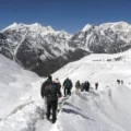
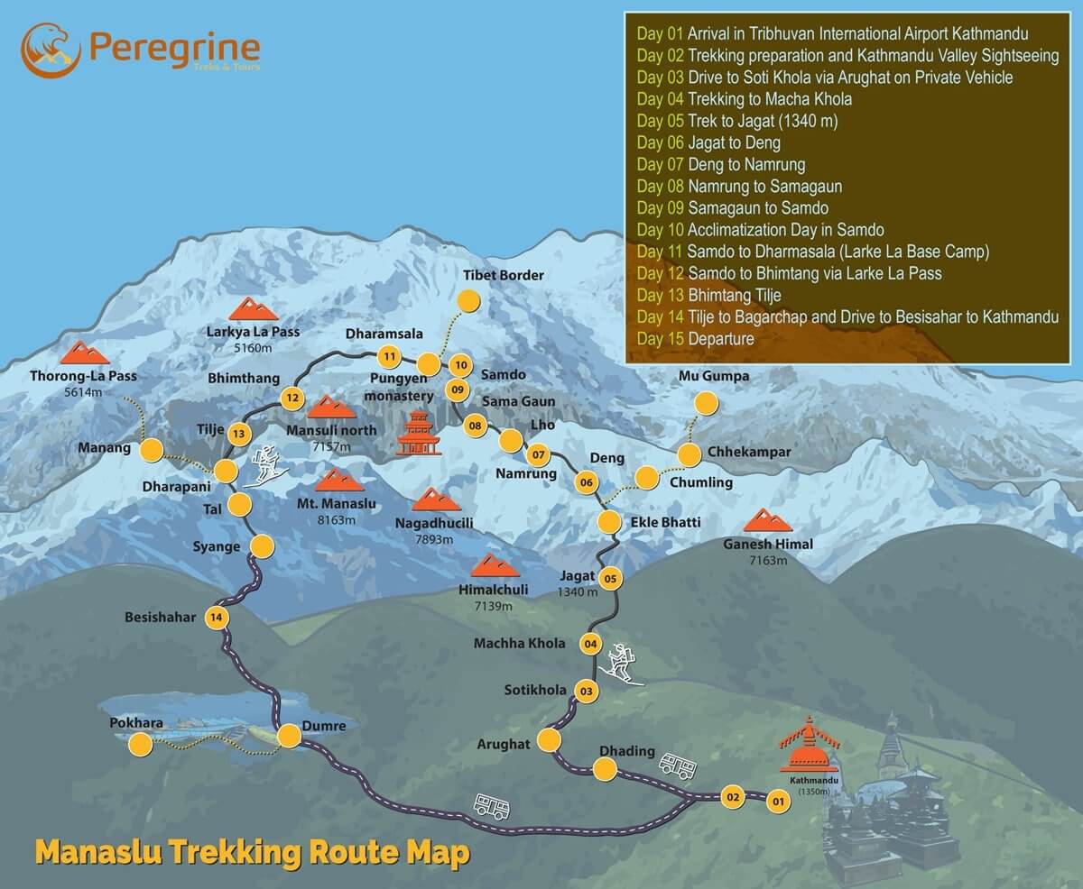
The Manaslu Circuit Trek is an adventure that will take you through the breathtaking beauty of the Himalayas. Famous for its untouched beauty and quiet trails, this trek introduces travelers to Nepal’s unique culture and natural beauty. The “Manaslu Circuit Trek Map” plays a vital role in smoothing this trek by providing valuable details to help you navigate the rugged terrain confidently.
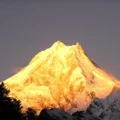
The excursion goes around Mount Manaslu, the eighth-highest summit on Earth, and provides different landscapes. Hikers walk through rich woods, pretty townships, stunning mountain ranges, and streams that get water from glaciers. Unlike the more active Annapurna Circuit or Everest Base Camp routes, this trekking route joins natural attractiveness with various cultural encounters, making it more unforgettable for less traveled visitors.
Why the Manaslu Circuit Trek Map is Essential
Route Planning
The map helps trekkers visualize the path from Soti Khola to Bimthang, ensuring better planning for each day’s hike. Using the map, trekkers can assess the Manaslu Circuit Trek distance and terrain of each segment of the trek, allowing them to determine how far they will hike daily.
Safety and Preparedness
Knowing where to find alternate routes or emergency exits is crucial in unexpected situations. The map highlights these critical points. The trek crosses several climate zones. A detailed map shows these changes, allowing trekkers to prepare for varied weather conditions.
Cultural Insights
A well-marked map helps trekkers locate villages and cultural landmarks, making it easier to connect with local communities. Knowing the location of monasteries, festivals, or traditional markets allows trekkers to incorporate cultural experiences into their schedules.
Navigation and Orientation
The map includes critical details like elevation, contours, and significant landmarks that help trekkers maintain their sense of direction throughout the trek. Modern maps can often be synced with GPS devices, making it easier for trekkers to navigate even when they can’t constantly refer to a physical map.
Accommodation Planning:
The map displays the locations of teahouses, allowing trekkers to plan where to stop for rest and accommodations along the route. It is essential to know where food, water, and basic medical supplies are available, and the map shows where trekkers can find these resources.

Detailed Overview of the Manaslu Circuit Trek Map
Having a dependable and detailed map is crucial to navigating the stunning yet difficult paths of the Manaslu Circuit Trek. For those who want to visit this quieter route around Mt. Manaslu, the eighth tallest mountain globally, there’s no better friend than the Manaslu Circuit Trek Map for trekkers within this area. This section will discuss how to properly utilize the map to plan your trek well and stay aware of the situation.
High-Resolution Map: A Must-Have for Every Trekker
A high-resolution map of the Manaslu Circuit Trek gives trekkers a clear, detailed view of the route, making it an essential resource. Here’s why:
Reviewing the map before setting it out helps you see the whole route, visualize essential segments, and organize your trip. Whether printed or digital, a high-resolution map keeps you oriented and keeps you on the path during the trek.
How to Access the Map:
Download the Manaslu Circuit Trek Map from a trustworthy source. It is essential to have a digital copy ready on your smartphone or tablet. Many digital maps come with zoom options that allow you to examine specific trek sections in greater detail, ensuring a smoother trek.
Key Features on the Map: Ensuring Confident Navigation
The Manaslu Circuit Trek Map shows the trekking route and highlights important features, significantly improving your trekking experience. Knowing how to interpret these key elements is vital for safe and enjoyable navigation.
- Landmarks: Major landmarks, such as the historic Larke La Pass and Birendra Lake, are marked, providing essential reference points and adding to the trek’s highlights.
- Campsites: The map indicates campsites, helping you plan your nightly rest stops and ensure there’s always a place to sleep.
- Altitude Markers: Altitude markers are essential for monitoring your ascent and preventing altitude sickness by helping you pace yourself properly.
- Villages: Villages are also marked on the map, allowing you to plan cultural stops and arrange for food, water, or other supplies during the trek.
How to Use the Map Features
- Plan Rest Stops: Utilize campsite and village locations to decide where to rest and resupply each day.
- Monitor altitude changes to manage your pace and avoid altitude sickness.
- Explore Key Landmarks: Use the landmarks on the map to enrich your trek by planning to visit scenic spots along the Manaslu Trek Route.
Segmented Description of the Manaslu Circuit Trek Route
There are several scenic trekking routes in Nepal, but none compares to the breathtaking views offered by the Manaslu Circuit Trek, which also has diverse cultures. The Manaslu Circuit Trek Map precisely illustrates the trekkers’ daily route so they can navigate it well. This guide helps you easily plan your trek by breaking down the distance covered each day, trekking duration, and daily altitude variations.
Day 1: Soti Khola to Machha Khola
- Distance: 14 km
- Trekking Time: 6–7 hours
- Altitude: 710m to 900m
The trek starts with a pleasant walk along the Budhi Gandaki River. The trail takes you through terraced farmlands and small local villages. The path undulates gently, with occasional ascents, making it a good warm-up for the days ahead.
Day 2: Machha Khola to Jagat
- Distance: 22 km
- Trekking Time: 6–7 hours
- Altitude: 900m to 1,340m
The trail becomes more challenging on the second day. As you trek through the rugged terrain, you’ll face steep climbs, cross shaky bridges, and pass through dense forests. You will arrive in Jagat, a checkpoint for the Manaslu Conservation Area.
Day 3: Jagat to Deng
- Distance: 19 km
- Trekking Time: 7 hours
- Altitude: 1,340m to 1,860m
This section of the trek passes through rocky paths and small villages. You will cross several rivers and ascend gradually. The trail offers spectacular views as you approach Deng, a small town surrounded by towering Himalayan peaks.
Day 4: Deng to Namrung
- Distance: 19 km
- Trekking Time: 6–7 hours
- Altitude: 1,860m to 2,660m
This day involves more ascents and offers scenic river crossings. The route winds through dense forests and climbs steadily, rewarding trekkers with panoramic views of the surrounding mountains as you approach Namrung.
Day 5: Namrung to Samagaon
- Distance: 17 km
- Trekking Time: 6–7 hours
- Altitude: 2,660m to 3,530m
The trek from Namrung to Samagaon takes you through alpine forests, past beautiful monasteries, and stunning landscapes. Upon reaching Samagaon, you will have a breathtaking view of Mount Manaslu. This day also provides cultural experiences as you interact with locals in the village.
Day 6: Acclimatization Day in Samagaon
- Trekking Time: 2–3 hours (optional hikes)
- Altitude: 3,530m
This day allows for rest and acclimatization. You can take short hikes to Birendra Lake or explore the nearby monasteries. Acclimatization is crucial at this altitude to avoid altitude sickness.
Day 7: Samagaon to Samdo
- Distance: 17 km
- Trekking Time: 4–5 hours
- Altitude: 3,530m to 3,860m
The trail to Samdo is relatively easy and offers expansive views of the Himalayan range. Samdo is a Tibetan village where you can enjoy the serene surroundings and experience the local culture.
Day 8: Samdo to Dharmasala (Larkya Phedi)
- Distance: 12 km
- Trekking Time: 3–4 hours
- Altitude: 3,860m to 4,460m
The trail to Dharmasala gets steeper as you climb toward the base camp of Larkya La Pass. The trek prepares you for the pass crossing, offering a gradual ascent to help with acclimatization.
Day 9: Dharmasala to Bimthang via Larkya La Pass
- Distance: 24 km
- Trekking Time: 7–9 hours
- Altitude: 4,460m to 5,160m (Larkya La Pass), descending to 3,720m
The day is indeed the most difficult of the whole trek. After pre-dawn, you reach Larkya La, the highest point on the Manaslu Trek Route. It presents a scenic view of the neighboring peaks. The lengthy hike to Bimthang is challenging but ultimately pays off.
Day 10: Bimthang to Tilije
- Distance: 18 km
- Trekking Time: 6–7 hours
- Altitude: 3,720m to 2,300m
After crossing the Larkya La Pass, the trail gradually descends through rhododendron forests. The easier terrain provides a welcome break from the previous days’ challenges.
Day 11: Tilije to Dharapani
- Distance: 8 km
- Trekking Time: 4–5 hours
- Altitude: 2,300m to 1,860m
The final day of trekking brings you down to Dharapani, a junction with the Annapurna Circuit. From here, you will drive to Besisahar, marking the end of your trek.
Highlights Along the Manaslu Circuit Trek
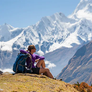
The Manaslu Circuit Trek is known for its breathtaking landscapes and rich cultural experiences, making it one of Nepal’s most rewarding treks. The Manaslu Circuit Trek Map helps trekkers navigate through stunning mountain ranges, serene valleys, and culturally significant locations. Along the Manaslu Trek Route, trekkers encounter significant peaks, scenic viewpoints, ancient monasteries, and diverse flora and fauna that enrich the experience. Here are the key highlights to expect along the way:
Significant Peaks and Scenic Viewpoints
- Mount Manaslu (8,163 meters): Mount Manaslu dominates the trek with its grandeur as the eighth-highest peak in the world. The view from Samagaon and the Larkya La Pass provides awe-inspiring panoramic views of this majestic mountain.
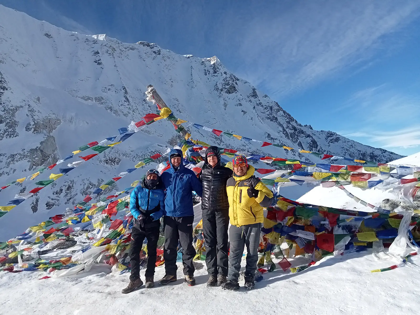
- Larkya La Pass (5,160 meters): One of the most thrilling trek parts, Larkya La Pass, offers stunning views of several peaks, including Himlung Himal, Cheo Himal, and Annapurna II. The pass is the highest point on the trek and a rewarding challenge for trekkers.
- Shyala Village Viewpoint: From Shyala Village, trekkers can enjoy spectacular views of Himalchuli, Ngadi Chuli, and the nearby glaciers. The viewpoint is a must-stop for capturing the breathtaking vistas of the surrounding Himalayan range.
- Birendra Lake: Near Samagaon, trekkers will find Birendra Lake, a glacial lake fed by the Manaslu Glacier. This pristine turquoise lake is a peaceful spot to take a break and enjoy the area’s natural beauty.
Cultural Sites and Villages
- Samagaon Monastery: Samagaon, one of the largest villages along the Manaslu Trek Route, is home to a traditional Tibetan Buddhist monastery. This cultural site is an essential spiritual hub for the locals and offers trekkers an opportunity to learn about Tibetan Buddhism and local customs.
- Pungyen Gompa: This remote monastery, perched high above Samagaon, offers cultural significance and incredible views of Mount Manaslu and surrounding peaks. It’s a great side hike for those interested in the spiritual aspect of the trek.
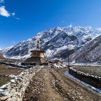
- Samdo Village: Located near the border with Tibet, Samdo is a small, traditional village that reflects Tibetan culture. Trekkers can interact with the local community and gain insights into their unique way of life, influenced by their proximity to Tibet.
- Namrung Village: An essential stop along the trek, Namrung offers trekkers a glimpse into the region’s architecture and traditions. The village is known for its stone houses and beautiful Buddhist prayer wheels that line the trail.
Biodiversity, Flora, and Fauna
- Rhododendron Forests: One of the highlights of trekking through the lower altitudes is passing through vibrant rhododendron forests. These flowers bloom in the spring, adding bursts of color to the otherwise rugged landscape.
- Unique Wildlife: The Manaslu Conservation Area is home to various rare species, including the Himalayan Tahr (a type of wild goat), Blue Sheep, and even the elusive Snow Leopard. Birdwatchers may also spot species such as the Himalayan Griffon and Golden Eagle along the route.
- Alpine Meadows: As you ascend higher, the landscape transitions into alpine meadows filled with medicinal herbs and flowering plants. These meadows provide grazing grounds for local livestock and create a serene trekking atmosphere.
Safety and Navigation Tips for the Manaslu Circuit Trek
When trekking the Manaslu Circuit, it’s crucial to prioritize safety and be well-prepared for the unpredictable conditions of the Himalayas. The Manaslu Circuit Trek Map is essential for navigating the trail effectively, ensuring trekkers stay on course while considering the weather and terrain. Here’s what to keep in mind:
Weather Conditions and Best Time to Trek
- Spring (March to May): Spring is one of the best times to trek the Manaslu Trek Route. The weather is usually stable, with clear skies and mild temperatures. During this time, the rhododendrons are in full bloom, adding vibrant colors to the trail.
- Autumn (September to November): Autumn is another ideal time for trekking, with clear skies and pleasant temperatures. The days are warm, but nights can get cold, especially at higher altitudes. It’s also the peak season, so expect more fellow trekkers on the trail.
- Monsoon (June to August): Trekking during the monsoon season can be dangerous due to slippery trails and frequent landslides. Heavy rainfall makes the paths muddy and treacherous, especially around the steep gorges of the Budhi Gandaki River.
- Winter (December to February): Winter trekking is possible, but temperatures drop drastically, especially at elevations like Larkya La Pass. The trail may be covered in snow, making it difficult to navigate. If trekking in winter, ensure you have adequate cold-weather gear.
Safety Tips for the Manaslu Circuit
- Altitude Sickness: The trek reaches heights over 5,000 meters at Larkya La Pass, so it’s essential to acclimatize correctly. Take rest days in places like Samagaon and Samdo to allow your body to adjust to the altitude.
- Hydration and Nutrition: Dehydration is common at high altitudes, so drinking plenty of water to stay hydrated is essential. Eat regularly to maintain energy levels, focusing on carbs and protein.
- Emergency Contacts: Keep the contact numbers of local trekking agencies and emergency services handy. Evacuation might be necessary for medical emergencies, so travel insurance is essential.
- Trekking with a Guide: The Manaslu region is restricted, and trekking without a licensed guide is prohibited. A guide will help with navigation and handle the paperwork for the necessary permits.
Using the Manaslu Circuit Trek Map and GPS
- Paper Maps: While trekking, always carry a physical Manaslu Circuit Trek Map in case electronic devices fail. The map will help you visualize critical landmarks, altitudes, and campsites.
- GPS Navigation: Modern GPS devices can help confirm your location, especially in foggy or low-visibility conditions. Before starting the trek, ensure you have the route preloaded on your GPS or smartphone app.
- Using the map Effectively: The map highlights significant points like villages, water sources, and altitudes. Use it to plan daily distances, assess difficulty levels, and monitor altitude gains and losses.
Accommodation and Amenities Along the Manaslu Circuit Trek
Along the Manaslu Trek Route, travelers will find a variety of accommodations, from basic tea houses to occasional camping options. The amenities and services in each village vary, so it’s essential to plan your trek based on food, water, and medical supplies availability.
Types of Accommodations
Tea Houses
- Tea houses are the most common accommodation along the Manaslu Trek Route. These lodges are essential, providing a bed, shared bathrooms, and meals. The rooms usually have simple furnishings, and trekkers must bring their sleeping bags for warmth, especially at higher altitudes.
- Cost: Prices increase as you ascend, with lower villages offering cheaper rates and higher altitudes being more expensive due to the remote location.
Camping
- While tea houses are available at almost every stop, some trekkers opt for camping, especially in more remote sections of the trail. Camping requires additional logistics, such as hiring porters to carry tents and cooking equipment.
Food and Water Availability
Meals
- Tea houses along the route provide basic meals, typically consisting of dal bhat (rice and lentils), noodles, and soups. The variety of food decreases at higher altitudes, where supplies become more limited. Meals in tea houses are usually simple but filling.
- Special Diets: Vegetarian options are available, but those with special dietary needs should bring snacks or supplements.
Water
- Trekkers can find water at tea houses, but purifying it before drinking is crucial. Use water purification tablets or a filtration system to avoid waterborne diseases. Bottled water is available at some stops but is expensive and contributes to plastic waste, so it’s better to use purification methods.
Medical Supplies and Facilities
- Basic Medical Care: Villages along the Manaslu Circuit Trek have limited medical facilities. Larger villages like Samagaon may have primary clinics, but more severe issues will require evacuation to Kathmandu. It’s essential to carry a well-stocked first-aid kit, including altitude sickness medication, bandages, and antiseptics.
- Access to Supplies: While food and water are available along the trail, other supplies like toiletries, batteries, and trekking gear are limited, especially at higher elevations. Trekkers should stock up in Kathmandu before the trek.
Permits and Regulations for the Manaslu Circuit Trek
Due to the restricted area, several permits are mandatory when trekking the Manaslu Trek Route. Understanding and obtaining these permits is essential for a smooth trekking experience.
Necessary Permits
Restricted Area Permit (RAP) for Manaslu
Trekkers must acquire a Restricted Area Permit (RAP) to access the Manaslu region. The permit cost depends on the season:
- Autumn (September–November): $100 for the first seven days and an additional $15 for each extra day.
- Other Seasons (December–August): $75 for the first seven days and $10 for each extra day.
Manaslu Conservation Area Permit (MCAP)
The Manaslu Conservation Area Project (MCAP) permit is required and costs around 3,000 NPR (approximately $30). This effort helps maintain and protect the biodiversity of the Manaslu region.
Annapurna Conservation Area Permit (ACAP)
Since part of the Manaslu Trek Route passes through the Annapurna region, trekkers must also secure the Annapurna Conservation Area Permit (ACAP), which costs 3,000 NPR.
How and Where to Obtain Permits
- Trekking Agencies: Solo trekking is not allowed in the Manaslu region, so you must arrange permits through a registered agency. Most agencies handle all the paperwork, making the process easier for trekkers.
- Immigration Office in Kathmandu: You can also obtain licenses from the Department of Immigration in Kathmandu. You must hire a licensed guide because authorities prohibit solo trekking in this area.
Recent Changes to Regulations
Recent changes mandate that trekkers travel in groups of at least two (excluding the guide) to protect the environment and ensure safety. This regulation helps regulate trekking traffic and ensures the safety of travelers in this remote region.
Conclusion: Embracing Responsibility on the Manaslu Circuit Trek
As you get ready to explore the stunning Manaslu Circuit, guided by the Manaslu Circuit Trek Map, carrying a sense of responsibility is essential. The Manaslu Trek Route offers more than scenic beauty and challenging trails. It provides a glimpse into the lives of local communities and fragile ecosystems.
Respect Local Customs
The Manaslu region holds deep cultural significance and rich traditions. Trekkers should take steps to honor these customs:
- Learn and Observe: Try to understand local customs and religious practices. Respecting these traditions will enhance your connection with the region and add meaning to your experience.
- Engage with Respect: Be mindful and considerate when interacting with local people. These exchanges offer opportunities to learn from one another and build mutual understanding.
Preserve the Natural Environment
Protecting the untouched beauty of the Manaslu region is essential for future trekkers and local wildlife. Every trekker plays a role in keeping this environment intact:
- Leave No Trace: Preserve the area’s natural beauty by following the “Leave No Trace” principles. Carry out your waste, avoid creating campfires, and stick to the designated trails to prevent soil erosion.
- Use Sustainable Practices: Carry reusable water bottles and use purification tablets instead of purchasing bottled water. Supporting eco-friendly practices at tea houses also helps minimize your environmental footprint.
The Responsibility of Every Trekker
Trekkers along the Manaslu Trek Route are responsible for sustaining both the natural and cultural landscapes of the region:
- Support Local Economies: Stay in local tea houses and buy locally-made products to contribute to the well-being of the communities along the trek.
- Share and Educate: Share your experiences about respecting local culture and preserving the environment with fellow trekkers and through social media. Encouraging responsible trekking ensures that others can enjoy this remarkable trek.