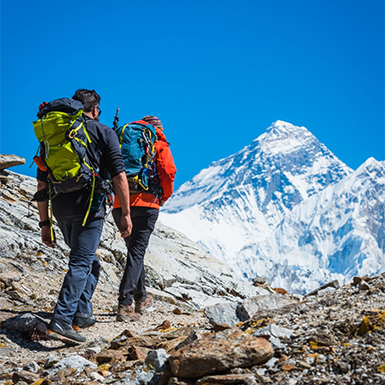
The extraordinary adventure of trekking to Everest Base Camp draws people from all over the globe. A reliable Everest Base Camp Map is indispensable to navigate this awe-inspiring trek. A well-detailed map empowers trekkers to plan their route, anticipate challenges, and ensure a safe and enjoyable experience amidst the breathtaking Himalayan landscape.
A comprehensive Everest Base Camp map is a trusted companion, providing vital information for trekkers of all levels. It outlines the primary trekking routes, highlights key landmarks and settlements, and indicates altitude variations along the way. A clear mental image of the trail and surroundings aids trekkers in planning a successful itinerary.
- Routes: The map showcases the main trekking paths, typically including the famous South Base Camp route from Lukla and the less-traveled Gokyo Lakes route.
- Landmarks: Trekkers can identify significant landmarks like Namche Bazaar, Tengboche Monastery, and Dingboche, enabling them to anticipate points of interest and plan rest stops.
- Altitudes: Altitude information is crucial for acclimatization and managing potential altitude sickness. The map typically displays elevation profiles and indicates high-altitude zones.
- Additional Features: Some maps may include additional features like campsites, water sources, medical facilities, and communication points, further enhancing their practicality for trekkers.

Mapping Your Everest Base Camp Adventure: Choosing the Right Trail
The Everest Base Camp trek is a mosaic of trails with distinct characters and obstacles. Whether you seek a classic experience or a path less traveled, there’s a route perfectly suited to your aspirations. An Everest Base Camp Map is your compass, guiding you through this remarkable trek.
The Classic South Base Camp Route
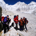
The most popular path to Everest Base Camp begins in Lukla, a charming village accessible by a scenic flight from Kathmandu. This well-established trail winds through vibrant Sherpa communities, verdant forests, and across exhilarating suspension bridges, revealing breathtaking Himalayan vistas at every turn. The South Base Camp trek typically takes 12-14 days, allowing ample time for acclimatization. An Everest Base Camp trekking map will detail this classic route, pinpointing key landmarks and villages.
- Must-See Stops: Namche Bazaar, Tengboche Monastery, Dingboche, Lobuche
- Challenge Level: Moderate to challenging
- Perfect For First-time trekkers and those seeking an iconic Everest experience
The Gokyo Lakes Route
The Gokyo Lakes route beckons if you prefer a less crowded, equally rewarding path. This trail branches off from the main route at Namche Bazaar, leading to the serene Gokyo Lakes, renowned for their turquoise waters and awe-inspiring mountain reflections. The Gokyo Lakes trek typically lasts 14-16 days and includes a challenging climb to Gokyo Ri, rewarding you with panoramic views of Everest and the surrounding peaks. An Everest Base Camp route map will help you effectively plan and navigate this scenic trek, maximizing your trekking experience.
- Must-See Stops: Gokyo Lakes, Gokyo Ri, Cho La Pass
- Challenge Level: Demanding
- Perfect For Experienced trekkers seeking solitude and breathtaking scenery
The Three Passes Trek
For adventurous spirits seeking a genuinely demanding challenge, the Three Passes trek awaits. This epic trek conquers three high-altitude passes, Kongma La, Cho La, and Renjo La, offering unparalleled vistas and an immense sense of accomplishment. The Three Passes trek typically takes 18-21 days and requires peak physical fitness and careful acclimatization. An Everest Base Camp map with altitude is essential for this challenging trek, allowing you to anticipate elevation changes and plan accordingly.
- Must-See Stops: Kongma La Pass, Cho La Pass, Renjo La Pass, Gokyo Lakes, Everest Base Camp
- Challenge Level: Strenuous
- Perfect For Highly experienced trekkers craving a challenging and rewarding adventure.
Landmarks that Shape Your Everest Base Camp Trek: A Map’s Perspective
The Everest Base Camp trek feels like stepping into a living postcard. Iconic landmarks pepper the trek, adding visual splendor and serving as crucial waypoints on your adventure. Your Everest Base Camp map will be your trusted guide, showcasing these remarkable sites.
Namche Bazaar (3,440m/11,286ft)
Often referred to as the “Gateway to Everest,” Namche Bazaar is a bustling Sherpa village nestled amidst the mountains. This vibrant hub offers trekkers a chance to acclimatize, stock up on supplies, and immerse themselves in the local culture. An Everest Base Camp trekking map will pinpoint Namche Bazaar as a significant stop, allowing you to plan your rest and exploration accordingly.
- Significance: A crucial acclimatization point and a cultural immersion opportunity.
- Altitude: Namche Bazaar’s altitude is a gentle introduction to the higher elevations ahead, aiding in acclimatization.
Tengboche Monastery (3,867m/12,687ft)
Tengboche Monastery, a spiritual sanctuary and must-visit landmark, sits majestically on a hilltop, offering panoramic views of Everest and Ama Dablam. This active Buddhist monastery offers a glimpse into Sherpa religious traditions and provides a serene setting for contemplation. An Everest Base Camp route map will highlight Tengboche Monastery, allowing you to anticipate this awe-inspiring stop.
- Significance: A spiritual and cultural landmark offering breathtaking views.
- Altitude: Located at a higher altitude, Tengboche Monastery emphasizes the importance of gradual acclimatization.

Dingboche (4,410m/14,469ft)
Dingboche, a picturesque village surrounded by towering peaks, is another vital acclimatization stop. Dingboche provides a welcome respite for trekkers to acclimatize to the increasing altitude and explore the surrounding trails, often prompting an extra day’s stay. An Everest Base Camp map with altitude will emphasize the significance of Dingboche, allowing you to plan for this crucial acclimatization phase.
- Significance: An essential acclimatization point with opportunities for day hikes.
- Altitude: The higher altitude of Dingboche underscores the need for careful acclimatization to prevent altitude sickness.
Lobuche (4,940m/16,207ft)
Lobuche, a high-altitude settlement with stunning views of the Khumbu Glacier, marks the final stop before Everest Base Camp. Here, trekkers prepare for the final push to their ultimate destination. An Everest Base Camp map overview will showcase Lobuche as a key waypoint, allowing you to visualize the final stretch of your trek.
- Significance: The last stop before Everest Base Camp offers a sense of anticipation and excitement.
- Altitude: Lobuche’s high altitude emphasizes the importance of proper acclimatization and physical preparedness.

Conquering Altitude: Your Everest Base Camp Trek and the Importance of Acclimatization
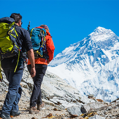
Altitude is a defining feature of the Everest Base Camp trek. It shapes the dramatic landscapes, influences the unpredictable weather, and, most importantly, tests your body’s limits. A well-crafted Everest Base Camp map charts your course and becomes crucial for managing altitude and ensuring a safe and fulfilling trek.
Altitude Profile: Key Points on Your Everest Base Camp Trek
- Lukla (2,860m/9,383ft): Your trek begins in Lukla, where you’ll experience the subtle effects of altitude.
- Namche Bazaar (3,440m/11,286ft) is a popular acclimatization stop offering breathtaking vistas and a glimpse into Sherpa culture.
- Tengboche (3,867m/12,687ft): Home to the revered Tengboche Monastery, this village provides further opportunities to acclimatize.
- Dingboche (4,410m/14,469ft): Dingboche is a crucial checkpoint where trekkers can gradually adjust to the thinner air at higher altitudes.
- Lobuche (4,940m/16,207ft): The final village, before reaching Everest Base Camp, Lobuche, starkly reminds us of the challenges ahead as the air thins noticeably and the trek intensifies.
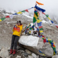
- Everest Base Camp (5,364m/17,598ft): Everest Base Camp, your ultimate destination, awaits at a formidable altitude, demanding respect for the mountain and meticulous preparation for the challenges ahead.

Acclimatization: Your Key to a Safe and Successful Trek
Acclimatization is your body’s process of adapting to the thinner air at higher elevations. It’s paramount for preventing altitude sickness and ensuring a safe and enjoyable experience. An Everest Base Camp map with altitude vividly illustrates the elevation changes you’ll encounter, empowering you to plan your acclimatization strategy effectively.
Your Map: An Essential Acclimatization Tool
- Visualize Altitude Gain: Your map showcases the elevation changes between various points on the trek, helping you set a comfortable pace and avoid ascending too rapidly.
- Pinpoint Acclimatization Stops: The map highlights key acclimatization stops, such as Namche Bazaar and Dingboche, reminding you to schedule rest days at these crucial points.
- Strategically Plan Rest Days: Use your map to incorporate rest days into your itinerary, particularly at higher altitudes. It will give your body the time it needs to adjust.
- Explore Alternate Routes: If altitude poses a challenge, your map can reveal alternate routes with less dramatic elevation gain, allowing you to adapt your trek while still enjoying the experience.
Wayfinding in the Himalayas: Mastering Your Everest Base Camp Map
Even with the convenience of GPS, a tangible Everest Base Camp Map remains an indispensable companion for every trekker. Tactile terrain exploration enhances your ability to make sound judgments and confidently traverse the trails. Let’s explore some practical tips for harnessing the power of your map and confidently traversing the awe-inspiring landscapes of the Everest region.
Unlocking the Secrets of Your Everest Base Camp Map
Before you begin on your trek, familiarize yourself with the wealth of information your map offers. An Everest Base Camp trekking map or an Everest Base Camp route map typically includes:
- Scale: This reveals the relationship between distances on the map and the actual distances you’ll cover. It’s critical for estimating travel times and crafting your daily itinerary.
- Legend: The legend deciphers the symbols and colors used on the map, representing trails, rivers, settlements, and landmarks. Understanding these symbols empowers you to interpret the map accurately.
- Contour Lines: Contour lines illustrate the shape and elevation of the terrain. Tightly packed lines signify steep slopes, while broader spacing denotes gentler terrain. An Everest Base Camp map with altitude incorporates contour lines and elevation markers, which are essential for grasping the challenges ahead.
- North Arrow: Always align your map with the north arrow pointing true north. Synchronizing your map with the actual terrain prevents disorientation.
Trail Markings and Navigation Techniques
As you trek, remain vigilant for trail markings, including cairns (stacked stones), painted rocks, or fluttering prayer flags. These markers are your silent guides, helping you stay on course and avoid getting lost. However, it’s crucial to cross-check these markings with your Everest Base Camp map to ensure you’re on the right path.
- Estimating Travel Times: Leverage the map’s scale and terrain information to gauge travel times between destinations. Remember that altitude, weather conditions, and your physical state can influence your pace.
- Identifying Safe Havens for Rest: Seek out designated campsites or teahouses indicated on your map. These offer secure and comfortable places to rest and rejuvenate.
- Navigating with a Compass: A compass becomes your trusted ally in areas with limited visibility or unclear trail markings. Master using a compass with your map to stay on track.
Bonus Navigation Tips
- Backup Map: For added peace of mind, ensure you have a backup map, whether a physical copy or a digital version, conveniently stored on your phone. Consider downloading an Everest Base Camp map PDF for offline access.
- Local Knowledge: Engage with Sherpa guides and local villagers. They possess invaluable insights into trail conditions and alternative routes.
- Teahouse Check-Ins: Register at teahouses along your route. Sharing your progress helps others track you and ensures someone knows your whereabouts.
Digital or Physical? Choosing the Best Everest Base Camp Map for Your Trek
Trekkers can choose between traditional paper maps and modern digital solutions in today’s digital age. Both options have merits and drawbacks; the ideal choice depends on your preferences and trekking style.
Weighing the Options: Digital vs. Physical Everest Base Camp Maps
Physical Maps
Advantages:
- Reliability: Not reliant on batteries or network connectivity.
- Tangible Overview: Provides a comprehensive view of the entire trekking region.
- Durability: Can withstand harsh weather conditions.
- Nostalgia: Offers a classic trekking experience.
Disadvantages:
- Bulk and Weight: This can be cumbersome to carry.
- Limited Detail: This may offer a different level of zoom and detail than digital maps.
- No Real-Time Updates: Doesn’t account for trail closures or changes.
Digital Maps & Apps
Advantages:
- Convenience: Lightweight and easily accessible on your smartphone or GPS device
- Interactive Features: Offers zoom, GPS tracking, and real-time location updates
- Additional Information: Can include points of interest, photos, and user reviews
- Offline Functionality: Many apps allow you to download maps for offline use
Disadvantages:
- Battery Dependency: Requires a reliable power source.
- Fragile: Electronic devices can be damaged in harsh conditions.
- Potential for Technical Issues: Apps can crash or experience glitches.
Recommended Trekking Apps with Everest Base Camp Routes
- me: A popular offline map app with detailed trails and points of interest.
- AllTrails: Offers a variety of trekking routes with user reviews and photos.
- Gaia GPS: A comprehensive navigation app with advanced features for experienced trekkers.
Finding Your Everest Base Camp Map
Whether you prefer a classic Everest Base Camp trekking map or a modern digital solution, there are several ways to acquire a reliable map.
- Online Retailers: Purchase a physical map or download a digital version from reputable online stores.
- Trekking Agencies: Many trekking agencies in Kathmandu and Lukla provide maps as part of their trekking packages.
- Local Shops: Bookstores and outdoor gear shops in Kathmandu and Lukla offer a variety of maps and guidebooks.
Your Everest Base Camp Map: More Than Just a Guide
An Everest Base Camp map becomes more than a simple navigation tool in the awe-inspiring Himalayan realm. It transforms into a trusted companion, a silent guide whispering directions, and a key that unlocks the secrets of this extraordinary trek.
Whether you choose a traditional Everest Base Camp trekking map, a detailed Everest Base Camp route map, or a modern digital solution with live updates, your map empowers you to:
- Visualize Your Adventure: Picture the trails, landmarks, and elevation changes that await you.
- Craft Your Perfect Itinerary: Estimate travel times, pinpoint crucial acclimatization stops, and strategically plan your rest days.
- Navigate with Confidence: Stay on track even when the going gets tough, ensuring you never lose your way.
- Make Informed Choices: Evaluate trail conditions, explore alternate routes if necessary, and guarantee a safe and enjoyable experience.