


The three main Mount Kenya routes to Point Lenana (4,985 m) on Mount Kenya are Sirimon, Chogoria, and Naro Moru. Sirimon is the best for acclimatization with a gradual dry-side ascent. Chogoria is the most scenic with waterfalls, gorges, and alpine lakes. Naro Moru is the shortest and steepest, famous for the punishing Vertical Bog section. Mount Kenya National Park protects the mountain’s high-altitude landscapes and forests. Check the official information for Mount Kenya National Park before planning your trek.
Mount Kenya rises to 5,199 meters at Batian, its technical rock summit. Point Lenana, at 4,985 meters, is the trekking summit and the highest Point most visitors reach without ropes or technical climbing skills. UNESCO inscribed Mount Kenya National Park as a World Heritage Site in 1997. UNESCO inscribed Mount Kenya National Park as a World Heritage Site in 1997.
Route choice affects everything on the mountain. Your acclimatization curve, summit success rate, scenery, and knee condition on descent all trace back to it. The Sirimon–Chogoria traverse (up Sirimon, down Chogoria) is the most highly recommended combination for a first Mount Kenya climb.
Quick Comparison Table: Sirimon vs. Chogoria vs. Naro Moru
| Feature | Sirimon | Chogoria | Naro Moru |
|---|---|---|---|
| Location | Northwest side | Southeast side | West side |
| Recommended days | 4 to 5 | 4 to 6 | 3 to 4 |
| Round trip distance | 35 km | 40 km | 29 km |
| Difficulty | Moderate | Moderate to demanding | Demanding |
| Scenery rating | Good | Best | Fair |
| Acclimatization | Best | Good | Poor |
| Summit success rate | Over 90% at 5 days | Over 90% at 5 days | 65-75% at 4 days |
| Signature feature | Gradual dry ascent | Lake Michaelson, waterfalls | Vertical Bog, Devil’s Staircase |
| Best used for | Ascent | Descent | Fast fitness climb |
| Accommodation | Old Moses, Shipton’s | Chogoria Bandas, Mintos | Met Station, Mackinder’s |
For a detailed breakdown of park fees, guide and porter charges, accommodation, and other expenses, read our guide to Mount Kenya trekking costs.
The Sirimon Route: Best for Acclimatization
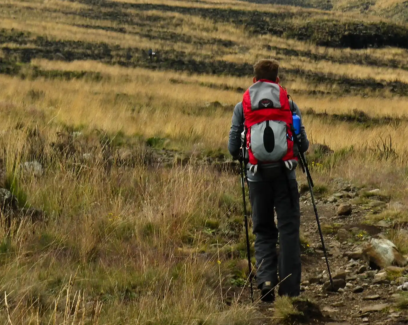
The Sirimon Route climbs Mount Kenya from the northwest and is the most highly recommended route for a first ascent because of its gradual profile. The trail starts at Sirimon Gate on the Nanyuki–Meru road. Day one climbs to Old Moses Camp at 3,387 meters. Day two progresses to Shipton’s Camp at 4,255 meters. The dry northern climate reduces the chance of trail-wide rain.
What the Sirimon Trail Is Like
Day one covers 9 km from Sirimon Gate through montane forest and moorland to Old Moses Camp. The gain is steady and unremarkable — the day exists to start your body’s altitude adaptation. Cedar and yellowwood trees line the lower section. You may see buffalo, elephants, or bushbuck in the forest belt.
Day two covers 14 km from Old Moses to Shipton’s Camp through the Mackinder Valley. The valley floor is open moorland dotted with giant lobelias and giant groundsels — plants that grow only above 3,500 meters in East Africa. The trail passes through Liki North Hut (a rest lunch stop) before the final push to Shipton’s.
Shipton’s Camp sits at 4,255 meters in the basin below the north face of Batian. Point Lenana is visible from Camp. Summit day starts at 02:30. A 4-hour climb via the ridge reaches Point Lenana for sunrise. Descent returns to Shipton’s for breakfast, then continues either back down Sirimon or across the top to link with Chogoria.
Why Sirimon Is Recommended for Ascent
Sirimon’s altitude profile is the most gradual of the three routes. Each successive night’s sleeping altitude is 500 to 800 meters higher than the previous night. The standard altitude rule limits sleeping-altitude gain to 800 meters per day above 3,000 meters. The northwest side of the mountain also sits in the rain shadow, so trails stay drier than on Chogoria or Naro Moru.
Success rates for well-supported 5-day Sirimon-only itineraries consistently exceed 90 percent for reasonably fit trekkers.
The Chogoria Route: The Most Scenic on Mount Kenya
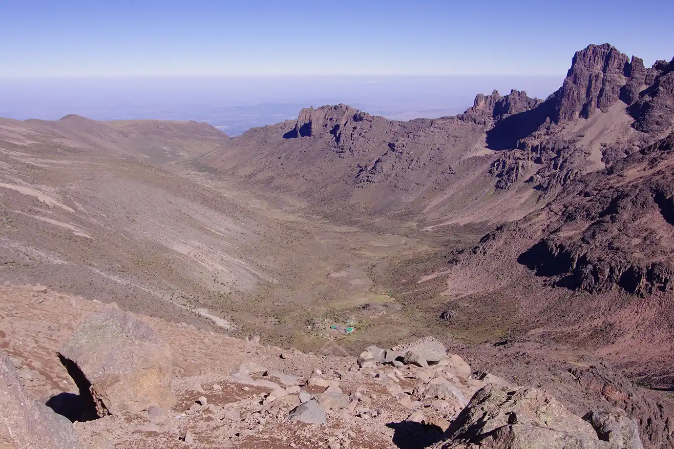
The Chogoria Route climbs Mount Kenya from the southeast and is widely considered the most beautiful trail on the mountain. The route passes Lake Ellis at 3,455 meters and drops into the Gorges Valley. Waterfalls and sheer basalt cliffs define the valley. Lake Michaelson sits below towering red-black rock walls.
What the Chogoria Trail Is Like
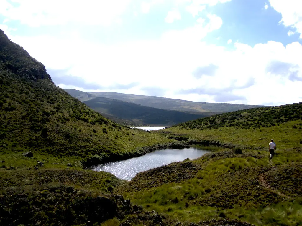
The trail starts at Chogoria Gate at 2,950 meters on the eastern slopes. Chogoria Bandas (park cabins) sit near the gate for overnight arrivals. Day one climbs through montane forest and bamboo zone to Lake Ellis at 3,455 meters — a shallow alpine lake surrounded by giant heather.
Day two crosses moorland to Mintos Hut/Camp at 4,297 meters, passing above the Gorges Valley. The valley below is one of the most dramatic pieces of terrain in East Africa. It is a deep basalt canyon with waterfalls dropping hundreds of meters from the plateau above. Lake Michaelson sits in a hanging cirque you can descend to for a side trip.
Summit day from Mintos to Point Lenana is a 4- to 5-hour climb, best started before 03:00 for a sunrise summit. The final push climbs a scree slope to the summit ridge.
Why Chogoria Is Best Used for Descent
Chogoria’s high entry altitude (2,950 m at the gate) and steeper day-one gains make it less ideal for a first-time ascent. Trekkers coming up Chogoria on tight timelines often struggle with altitude at Mintos. Coming down Chogoria after ascending Sirimon delivers all the scenery while your body is already acclimatized. The descent through the Gorges Valley to Lake Ellis and out the Chogoria forest is the best-photographed stretch of any Mount Kenya route.
The Naro Moru Route: Shortest, Steepest, Most Punishing
The Naro Moru Route climbs Mount Kenya from the west and is the shortest and most direct trail to Point Lenana. The route is the traditional fast-ascent option, taking 3 to 4 days from the gate to the summit and back. Success rates are the lowest of the three main routes. Rapid altitude gain and the notorious Vertical Bog section between Met Station and Mackinder’s Camp are the reasons why. For current gate locations, access details, and visitor guidance, consult the official park gates and access information.
The Vertical Bog and Devil’s Staircase
Day one on Naro Moru covers 10 km from Naro Moru Gate through forest to Met Station at 3,050 meters. The section is straightforward and passes through prime elephant and buffalo habitat.
Day two is where Naro Moru earns its reputation. The Vertical Bog is a 5,500-meter vertical stretch of waterlogged moorland with no easy footing. In dry season, expect ankle-deep mud in places. In wet season, expect knee-deep bog for extended sections.
Above the bog, the Devil’s Staircase — a grinding, uneven scree ascent — climbs to Mackinder’s Camp at 4,200 meters. Summit day from Mackinder’s to Point Lenana involves 800 meters of vertical scree climbing to Austrian Hut. The final push follows to the summit ridge. Descent retraces the route.
Is Naro Moru Worth Choosing?
Naro Moru is a valid choice only for very fit trekkers on tight time budgets who understand the tradeoff. On a 3-day itinerary, summit success rates range from 40 to 60 percent.
On a 5-day itinerary with an extra acclimatization night, success improves to 80 percent or more. But that gain removes Naro Moru’s core advantage of speed. Most Mount Kenya operators recommend Sirimon over Naro Moru for any trekker with 5 days available.
The Sirimon–Chogoria Traverse: The Recommended Combination
The Sirimon–Chogoria traverse ascends via Sirimon and descends via Chogoria — the most highly recommended way to climb Mount Kenya. The traverse combines Sirimon’s gradual acclimatization profile with Chogoria’s superior scenery on the descent. Your body is fully adapted to altitude by then, so you can take in the surroundings without struggle.
How the Traverse Works
The standard 5-day Sirimon–Chogoria itinerary runs like this:
- Day 1: Sirimon Gate to Old Moses Camp (3,387 m) — 9 km
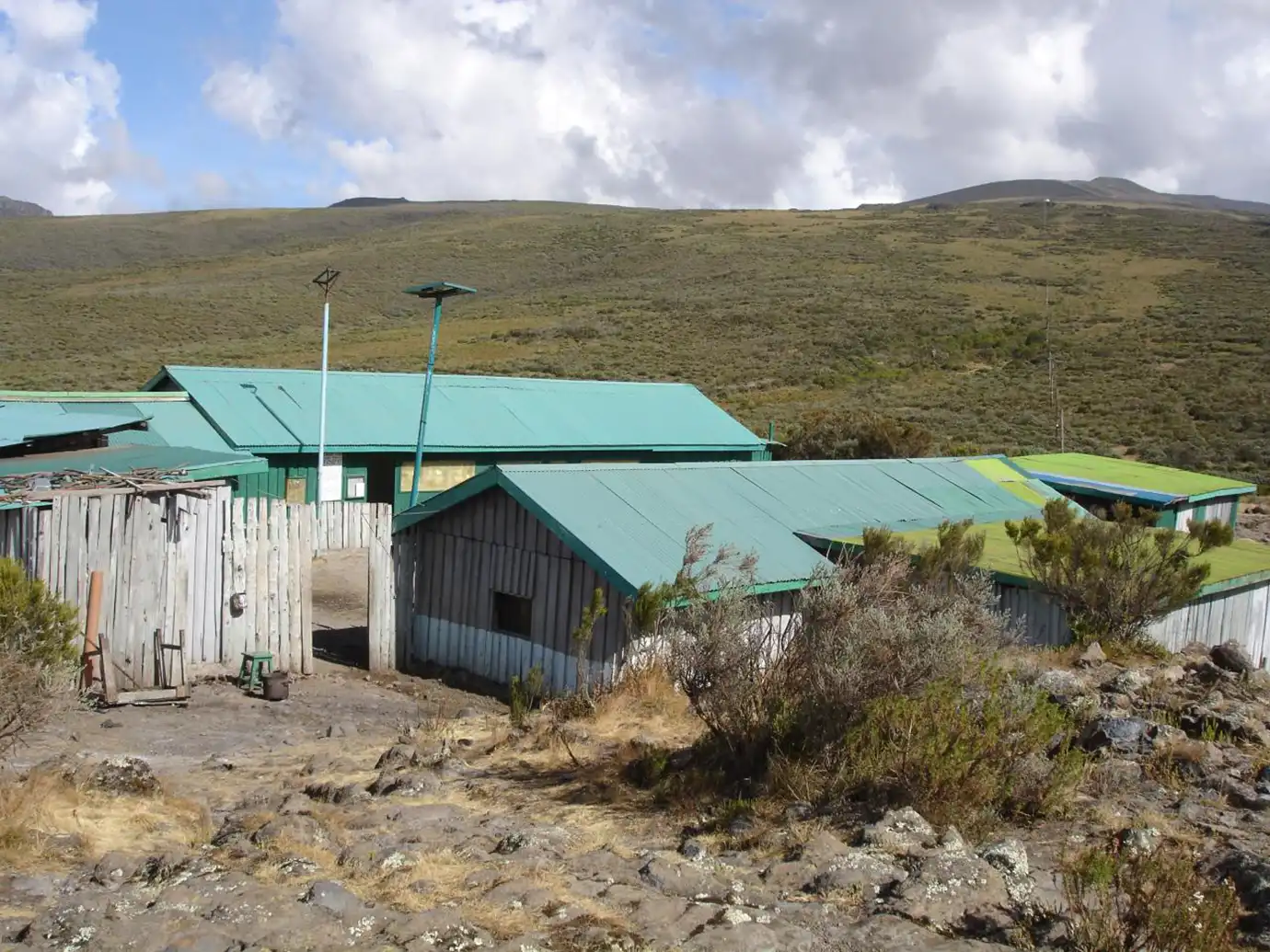
- Day 2: Old Moses to Shipton’s Camp (4,255 m) — 14 km
- Day 3: Summit Point Lenana (4,985 m) at sunrise, descend to Mintos Camp (4,297 m) via top col — 6 to 8 hours
- Day 4: Mintos to Chogoria Bandas via Lake Ellis and Gorges Valley — 18 km
- Day 5: Chogoria Bandas to Chogoria Gate, road transfer to Nairobi — 10 km
A 6-day variation adds an acclimatization day at Shipton’s, which pushes summit success to over 95 percent.
Why the Traverse Beats Any Single-Route Option
You see everything the mountain offers. Sirimon delivers the acclimatization curve, moorland, and Mackinder Valley approach. The summit day offers you Point Lenana at sunrise, with views of Kilimanjaro on a clear morning. The Chogoria descent takes you through Lake Ellis, the Gorges Valley, Lake Michaelson (optional detour), and out through the bamboo forest.
You avoid backtracking. Same-route ascent and descent means retracing the same terrain. The traverse gives you a full loop across the mountain’s two most distinct sides.
You use both park gates. The traverse requires logistical planning (arranging vehicles at both ends), but every reputable Mount Kenya operator handles this as part of a standard package.
When Is the Best Time to Climb Mount Kenya?
The two prime windows for Mount Kenya are January to February and July to October. Both windows fall inside the dry seasons and offer the best combination of clear weather, low precipitation, and stable summit conditions. January and February are the warmest and driest months on the mountain. July through October is the second dry season — slightly cooler but with equally reliable weather.
Trails are firm in January and February. The Vertical Bog on Naro Moru is at its most manageable. Summit temperatures are relatively mild.
Avoid March through May (long rains) and November (short rains). Trails turn to deep mud, visibility drops in cloud, and technical routes become genuinely dangerous.
What to Pack for a Mount Kenya Trek
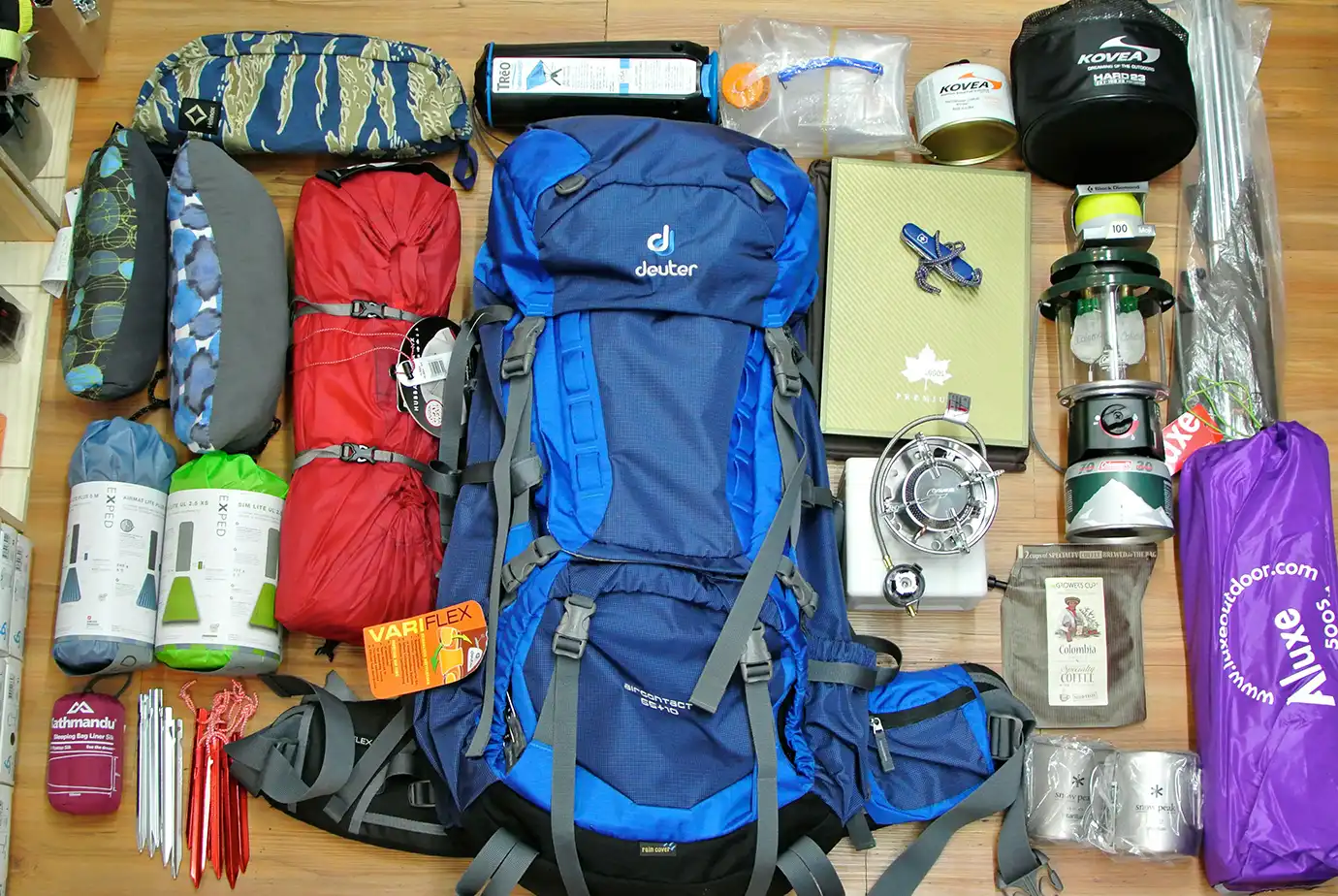
- Waterproof hiking boots broken in over at least 50 km of prior use
- Gaiters (essential for Naro Moru, useful on all routes)
- Trekking poles (both, not just one — descent is punishing on knees)
- 4-season sleeping bag rated to -10°C
- Insulated jacket (down or synthetic, minimum 700-fill or equivalent)
- Thermal base layers, midlayer fleece, waterproof shell
- Insulated gloves plus lightweight liner gloves
- Warm beanie plus wide-brim sun hat
- Headlamp with spare batteries (summit day starts pre-dawn)
- 3-liter water capacity minimum (bladder plus bottle)
- Sunglasses with UV protection (essential at altitude)
- High-SPF sunscreen and lip balm
- Personal first aid kit including altitude medication (Diamox) if prescribed
- Cash in Kenyan Shillings for tips at the end of the trek
Frequently Asked Questions
Which Mount Kenya route is easiest?
Sirimon is the easiest of the three main Mount Kenya routes for a well-acclimatized trekker. It has the most gradual ascent profile, drier trail conditions, and the highest summit success rate on standard 5-day itineraries. Naro Moru is shorter but significantly harder because of the rapid altitude gain and the Vertical Bog section. Chogoria is beautiful but has a steeper day-one profile from the gate.
How high is Mount Kenya’s trekking summit?
Point Lenana, Mount Kenya’s trekking summit, stands at 4,985 meters (16,355 feet). It is the third-highest peak of Mount Kenya after Batian (5,199 m) and Nelion (5,188 m). Both higher peaks require technical rock climbing to summit. Point Lenana is a standard hiking summit that can be reached without ropes, though the final ridge involves easy scrambling. Most trekkers reach Point Lenana at sunrise on their summit day.
How many days do you need for Mount Kenya?
Plan at least 4 days on Mount Kenya, though 5 days yields a significantly higher summit success rate. The recommended Sirimon–Chogoria traverse runs 5 days and combines gradual acclimatization with the mountain’s best scenery. A 6-day itinerary with an extra acclimatization night at Shipton’s Camp pushes summit success rates above 95 percent. Naro Moru attempts in 3 days have summit success rates well below 60 percent for most trekkers.
Is Mount Kenya harder than Kilimanjaro?
Mount Kenya’s Point Lenana is lower than Kilimanjaro’s Uhuru Peak (4,985 m vs. 5,895 m). But the routes to Lenana involve more scrambling and steeper terrain in places. Kilimanjaro is a straightforward high-altitude walk with no scrambling. Mount Kenya has more technical trail sections, particularly on Naro Moru’s Vertical Bog and the summit ridge to Point Lenana. Success rates on Mount Kenya’s Sirimon–Chogoria traverse are generally higher than on Kilimanjaro’s shorter routes.
Do you need a guide for Mount Kenya?
Yes. Kenya Wildlife Service regulations require all Mount Kenya trekkers to be accompanied by a licensed mountain guide registered with the park. Independent climbing above the park gates is not permitted. A porter team and guide are standard for all commercial trips. Mountain hut bookings, park fees, and evacuation coordination all require professional operator involvement. Solo unguided attempts are refused at the park gates.
| Plan Your Mount Kenya Trek With Peregrine
Email: sales@peregrinetreks.com WhatsApp: +977 985 105 2413 Web: peregrinetreks.com |