
When to Trek Manaslu Circuit: Unveiling the Optimal time for Your Expedition
Manaslu Trek in Autumn Months: Best Time for Manaslu Circuit Trek Manaslu Trek in September September commences the […]

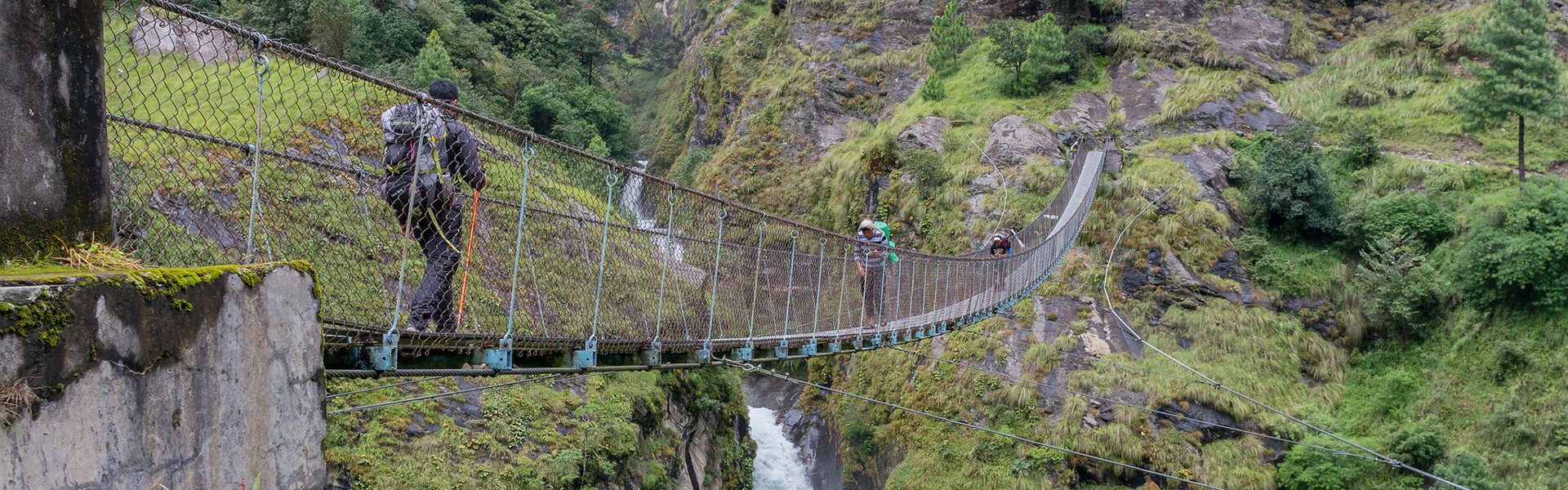
A Complete Guide to Manaslu Circuit Trek
Itinerary – A Complete Guide to Manaslu Circuit Trek Day 1 Arrival at Tribhuvan International Airport Kathmandu Day […]

Difficulty Level of the Annapurna Circuit Trek: A Comprehensive Guide
Tips to Avoid Annapurna Circuit Trek Difficulty 1. Prepare yourself with proper training If you are not used […]

Annapurna Circuit Trek Cost: A Guide to Budgeting Your Adventure in Nepal
Major Annapurna Circuit Trek Cost Factors 1. Visa Cost for Annapurna Circuit Trek After you land at the […]

Nepal Trekking Equipment and Gear List
Here is a Nepal trekking equipment and gear list that is essential during trekking for the trekker’s safety […]

When is the Best Time for Annapurna Circuit Trek?
2. Spring – Second Best Time For Annapurna Circuit Trek Spring is the second-best season to do Annapurna […]

Everest Base Camp Trek Difficulty – How Hard Is It Really?
[contact-form-7 id=”6913″ title=”Inquiry From – Blog”] How to Make the Trek Easier If you’re worried about the Everest […]
On Arrival Visa ban in Nepal
Nepal has decided to ban arrival visas for six different countries. Citizens who want to come to Nepal […]
COVID -19: Is Nepal is safe from Novel Coronavirus?
As the world is aware of the 2019 Novel Coronavirus (COVID-19), here is one question: Is Nepal safe […]